Estimated Value: $1,764,510 - $4,466,000
20
Beds
1
Bath
27,758
Sq Ft
$112/Sq Ft
Est. Value
About This Home
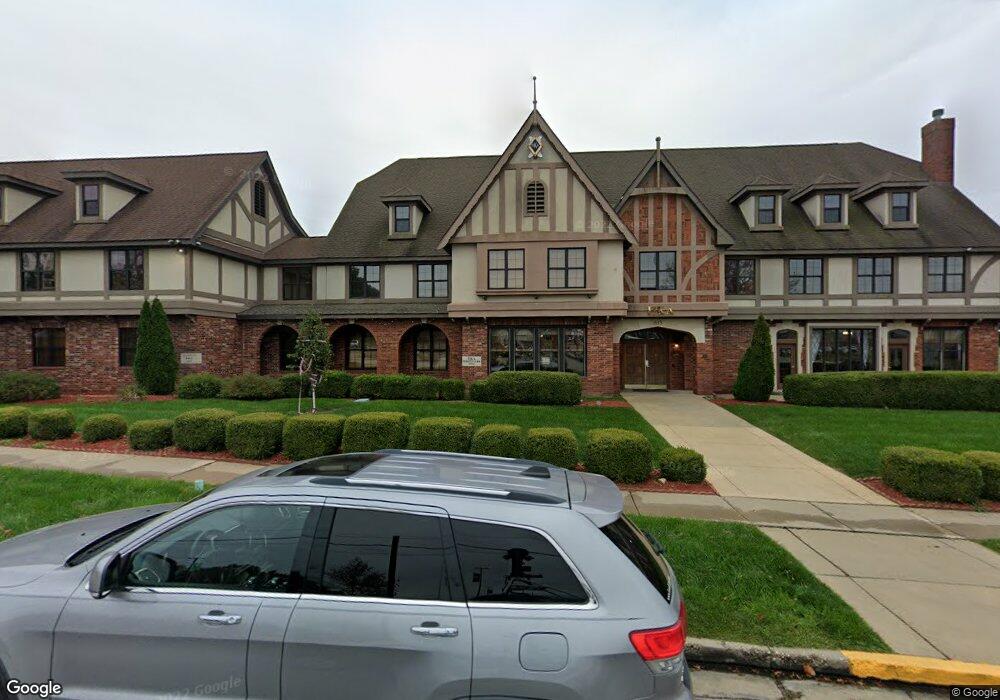
This home is located at 613 W 9th St, Rolla, MO 65401 and is currently estimated at $3,115,255, approximately $112 per square foot. 613 W 9th St is a home with nearby schools including Rolla Junior High School, Rolla Senior High School, and Immanuel Lutheran School.
Ownership History
Date
Name
Owned For
Owner Type
Purchase Details
Closed on
Aug 22, 2006
Current Estimated Value
Purchase Details
Closed on
Mar 8, 2006
Purchase Details
Closed on
Dec 20, 2000
Purchase Details
Closed on
Nov 30, 1987
Purchase Details
Closed on
Jun 19, 1979
Purchase Details
Closed on
Oct 18, 1977
Purchase Details
Closed on
Mar 14, 1970
Purchase Details
Closed on
Apr 25, 1969
Create a Home Valuation Report for This Property
The Home Valuation Report is an in-depth analysis detailing your home's value as well as a comparison with similar homes in the area
Home Values in the Area
Average Home Value in this Area
Purchase History
| Date | Buyer | Sale Price | Title Company |
|---|---|---|---|
| -- | -- | -- | |
| -- | -- | -- | |
| -- | -- | -- | |
| -- | -- | -- | |
| -- | -- | -- | |
| -- | -- | -- | |
| -- | -- | -- | |
| -- | -- | -- |
Source: Public Records
Tax History
| Year | Tax Paid | Tax Assessment Tax Assessment Total Assessment is a certain percentage of the fair market value that is determined by local assessors to be the total taxable value of land and additions on the property. | Land | Improvement |
|---|---|---|---|---|
| 2025 | -- | $420,350 | $18,220 | $402,130 |
| 2024 | -- | $377,350 | $11,780 | $365,570 |
| 2023 | $20,414 | $377,350 | $11,780 | $365,570 |
| 2022 | $17,338 | $377,350 | $11,780 | $365,570 |
| 2021 | $17,456 | $377,350 | $11,780 | $365,570 |
| 2020 | $15,629 | $329,670 | $11,780 | $317,890 |
| 2019 | $15,542 | $329,670 | $11,780 | $317,890 |
| 2018 | $15,404 | $329,670 | $11,780 | $317,890 |
| 2017 | $15,376 | $329,670 | $11,780 | $317,890 |
| 2016 | $14,874 | $329,670 | $11,780 | $317,890 |
| 2015 | -- | $329,670 | $11,780 | $317,890 |
| 2014 | -- | $329,670 | $11,780 | $317,890 |
| 2013 | -- | $329,670 | $0 | $0 |
Source: Public Records
Map
Nearby Homes
- 1000 N Pine St
- 400 N Oak St
- 104 E 3rd St
- 303 E 7th St
- 17400 Highway 63
- 0.25 +/- ac N Olive St
- 100 N Walnut St
- 507 E 13th St
- 403 S Adrian Ave
- 5 Rolla Gardens Dr
- TBD Bluebird Ln
- 401 Fort Wyman Rd
- 711 E 10th St
- 403 Fort Wyman Rd
- 600 S Rolla St
- 305 Mossman Ln
- 35 Green Acres Dr
- 63 Rose Ct
- 1400 Nagogami Rd
- 922 Oak Lane Dr Unit 926
- 609 W 9th St
- 607 W 9th St
- 608 W 8th St
- 704 N Bishop Ave
- 611 W 8th St
- 606 W 8th St
- 157 Hc 33 Box 157
- 807 N State St
- 702 N Bishop Ave
- 604 W 7th St
- 604 W 7th St
- 702 N Bishop & 604 W 7th St
- 801 N State St
- 707 N State St
- 600 W 7th St
- 701 N State St
- 602 N Bishop Ave
- 605 W 11th St
- 5242PD Us Highway 63
- 604 W 6th St
Your Personal Tour Guide
Ask me questions while you tour the home.