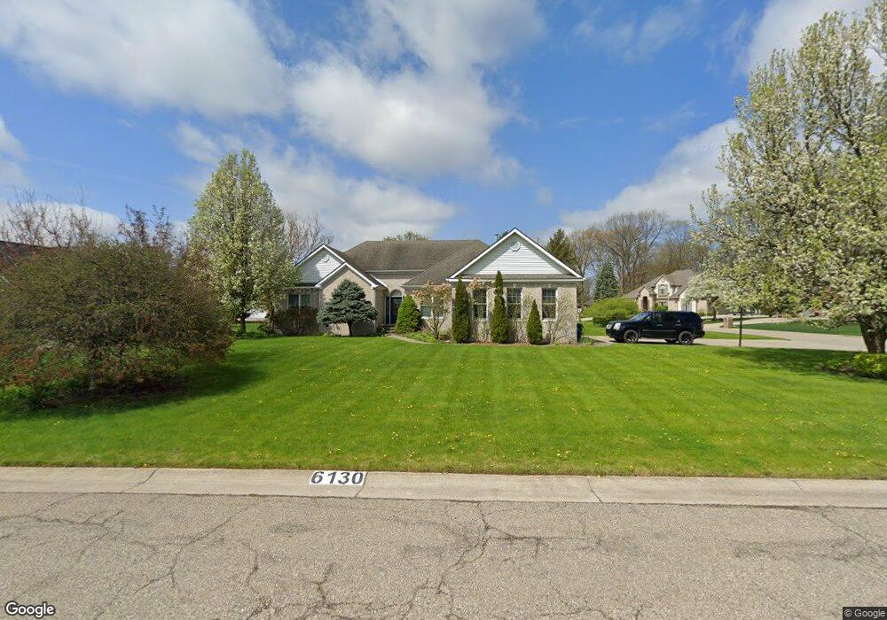
6130 Foxtrail Path Swartz Creek, MI 48473
Estimated Value: $350,000 - $385,479
--
Bed
--
Bath
1,902
Sq Ft
$196/Sq Ft
Est. Value
About This Home
This home is located at 6130 Foxtrail Path, Swartz Creek, MI 48473 and is currently estimated at $372,370, approximately $195 per square foot. 6130 Foxtrail Path is a home located in Genesee County with nearby schools including Elms Road Elementary School, Syring Elementary School, and Morrish Elementary School.
Ownership History
Date
Name
Owned For
Owner Type
Purchase Details
Closed on
Aug 1, 2018
Sold by
Varner Michael Joe and Varner Kali Jean
Bought by
Lucia Layne
Current Estimated Value
Purchase Details
Closed on
Feb 23, 2002
Sold by
Ackerman Dwain and Ackerman Darlene
Bought by
Varner Michael Joe
Home Financials for this Owner
Home Financials are based on the most recent Mortgage that was taken out on this home.
Original Mortgage
$228,000
Interest Rate
6%
Create a Home Valuation Report for This Property
The Home Valuation Report is an in-depth analysis detailing your home's value as well as a comparison with similar homes in the area
Home Values in the Area
Average Home Value in this Area
Purchase History
| Date | Buyer | Sale Price | Title Company |
|---|---|---|---|
| Lucia Layne | $240,000 | Sargents Title Cox | |
| Varner Michael Joe | $240,000 | Chicago Title Insurance Co |
Source: Public Records
Mortgage History
| Date | Status | Borrower | Loan Amount |
|---|---|---|---|
| Previous Owner | Varner Michael Joe | $228,000 |
Source: Public Records
Tax History Compared to Growth
Tax History
| Year | Tax Paid | Tax Assessment Tax Assessment Total Assessment is a certain percentage of the fair market value that is determined by local assessors to be the total taxable value of land and additions on the property. | Land | Improvement |
|---|---|---|---|---|
| 2025 | $5,806 | $175,300 | $0 | $0 |
| 2024 | $3,604 | $175,500 | $0 | $0 |
| 2023 | $3,438 | $166,100 | $0 | $0 |
| 2022 | $5,185 | $150,300 | $0 | $0 |
| 2021 | $5,100 | $142,400 | $0 | $0 |
| 2020 | $3,172 | $135,500 | $0 | $0 |
| 2019 | $3,125 | $130,200 | $0 | $0 |
| 2018 | $3,132 | $119,400 | $0 | $0 |
| 2017 | $2,966 | $117,600 | $0 | $0 |
| 2016 | $2,934 | $109,400 | $0 | $0 |
| 2015 | $2,718 | $103,100 | $0 | $0 |
| 2014 | $1,742 | $93,000 | $0 | $0 |
| 2012 | -- | $85,100 | $85,100 | $0 |
Source: Public Records
Map
Nearby Homes
- 5130 Highpoint Dr
- 5220 Wyndemere Cir
- 5280 O Connor Pass
- 6031 Oak Creek Dr
- 6309 Victoria Ln
- 6011 Oak Creek Dr
- 6285 Victoria Ln
- 6019 Cousins Dr
- 6043 Cousins Dr
- 6050 Coventry Dr
- 0 Reid Rd Unit 50168280
- 5379 Linden Rd
- 6123 King Arthur Dr
- 6095 Weyerbacher Dr
- 4368 Regency Rd
- 5141 Maple Ave
- 5252 Maple Ave
- 5292 Maple Ave
- 7452 Skylar Ct
- 7465 Skylar Ct
- 6140 Foxtrail Path
- 5180 Highpoint Dr
- 6150 Foxtrail Path
- 5188 Highpoint Dr
- 5161 Highpoint Dr
- 6150 Fox Trail Path
- 5196 Highpoint Dr
- 5170 Highpoint Dr
- 5202 Highpoint Dr
- 6141 Foxtrail Path
- 5210 Highpoint Dr
- 6151 Fox Trail Path
- 5160 Highpoint Dr
- 6151 Foxtrail Path
- 5151 Highpoint Dr
- 5345 Wyndemere Square
- 5333 Wyndemere Square
- 5189 Wyndemere Square
- 5179 Wyndemere Square
- 5323 Wyndemere Square