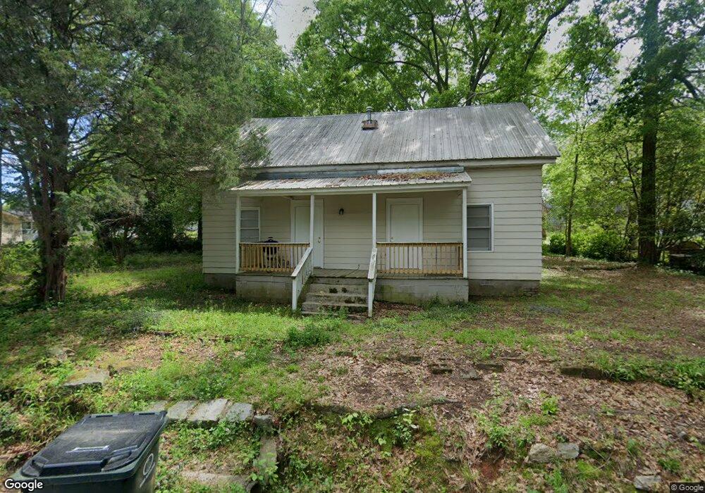
6130 Sorrell St NE Covington, GA 30014
Estimated Value: $137,000 - $224,000
2
Beds
1
Bath
1,182
Sq Ft
$149/Sq Ft
Est. Value
About This Home
This home is located at 6130 Sorrell St NE, Covington, GA 30014 and is currently estimated at $176,542, approximately $149 per square foot. 6130 Sorrell St NE is a home located in Newton County with nearby schools including Flint Hill Elementary School, Cousins Middle School, and Eastside High School.
Ownership History
Date
Name
Owned For
Owner Type
Purchase Details
Closed on
Dec 4, 2018
Sold by
Lunt Jacob
Bought by
Bruno Properties Management Llc
Current Estimated Value
Purchase Details
Closed on
Oct 6, 2009
Sold by
Wells Fargo Bk Na
Bought by
Federal Home Loan Mortgage Corporation
Purchase Details
Closed on
Jun 23, 2006
Sold by
Household Rlty
Bought by
Lunt Jacob
Home Financials for this Owner
Home Financials are based on the most recent Mortgage that was taken out on this home.
Original Mortgage
$58,160
Interest Rate
6.55%
Create a Home Valuation Report for This Property
The Home Valuation Report is an in-depth analysis detailing your home's value as well as a comparison with similar homes in the area
Home Values in the Area
Average Home Value in this Area
Purchase History
| Date | Buyer | Sale Price | Title Company |
|---|---|---|---|
| Bruno Properties Management Llc | $9,500 | -- | |
| Federal Home Loan Mortgage Corporation | -- | -- | |
| Wells Fargo Bk Na | $75,214 | -- | |
| Lunt Jacob | $54,000 | -- |
Source: Public Records
Mortgage History
| Date | Status | Borrower | Loan Amount |
|---|---|---|---|
| Previous Owner | Lunt Jacob | $58,160 |
Source: Public Records
Tax History Compared to Growth
Tax History
| Year | Tax Paid | Tax Assessment Tax Assessment Total Assessment is a certain percentage of the fair market value that is determined by local assessors to be the total taxable value of land and additions on the property. | Land | Improvement |
|---|---|---|---|---|
| 2024 | $1,097 | $36,320 | $14,000 | $22,320 |
| 2023 | $818 | $25,160 | $4,000 | $21,160 |
| 2022 | $732 | $22,520 | $4,000 | $18,520 |
| 2021 | $641 | $17,640 | $4,000 | $13,640 |
| 2020 | $723 | $18,120 | $4,000 | $14,120 |
| 2019 | $762 | $18,760 | $4,000 | $14,760 |
| 2018 | $538 | $13,080 | $4,000 | $9,080 |
| 2017 | $419 | $10,200 | $2,000 | $8,200 |
| 2016 | $439 | $10,680 | $2,800 | $7,880 |
| 2015 | $395 | $9,600 | $2,000 | $7,600 |
| 2014 | $337 | $9,600 | $0 | $0 |
Source: Public Records
Map
Nearby Homes
- 6192 Collins St NE
- 6193 Collins St NE
- 5150 Wheat St NE
- 0 Highway 278 NE Unit 10595588
- 5130 N Dearing St NE
- 4105 Rose Ln NE
- 4217 Elizabeth St NE
- 6127 Floyd St NE
- 5139 West Dr NE
- 6104 Floyd St NE
- 4128 Elizabeth St NE
- 9202 Settlers Grove Rd NE
- 4181 A&B Floyd St NE
- 5118 Floyd St NE
- 2173 Anderson Ave SE
- 10630 Highway 278 NE
- 3127 Mill St SE
- 3112 Floyd St NE
- 3149 Thompson Ave SE
- 10167 Waterford Rd NE
- 6120 Sorrell St NE
- 6142 Sorrell St NE
- 0 Hopkins St NE Unit 8674633
- 0 Collins St NE Unit 8754803
- 0 Collins St NE Unit 8714006
- 0 Collins St NE Unit 8012705
- 0 Collins St NE Unit 8731350
- 0 Collins St NE
- 0 Sorrell St NE Unit 7123759
- 0 Sorrell St NE
- 6129 Sorrell St NE
- 6114 Hopkins St NE
- 6126 Hopkins St NE
- 6110 Sorrell St NE
- 6143 Sorrell St NE
- 6114 Blair St NE
- 6136 Hopkins St NE Unit 109
- 6136 Hopkins St NE
- 6136 Hopkins St NE
- 0 Blair St NE Unit 8554946