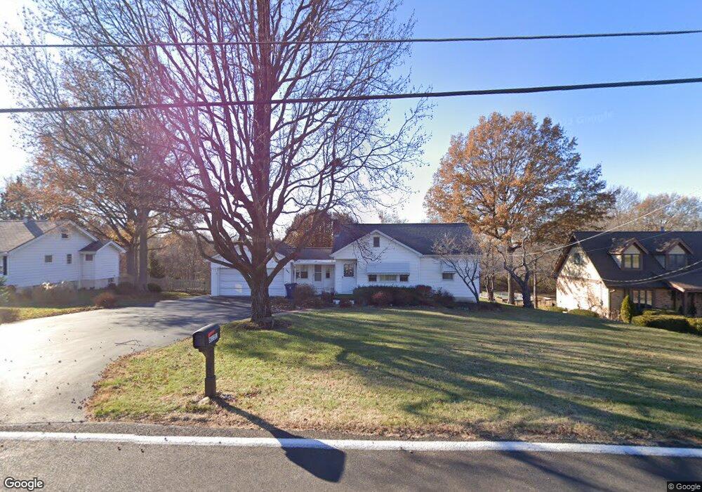
6131 Erb Rd Saint Louis, MO 63129
Estimated Value: $244,000 - $277,786
3
Beds
2
Baths
1,199
Sq Ft
$214/Sq Ft
Est. Value
About This Home
This home is located at 6131 Erb Rd, Saint Louis, MO 63129 and is currently estimated at $256,697, approximately $214 per square foot. 6131 Erb Rd is a home located in St. Louis County with nearby schools including Point Elementary School, Oakville Middle School, and Oakville Senior High School.
Ownership History
Date
Name
Owned For
Owner Type
Purchase Details
Closed on
Aug 21, 2003
Sold by
Wilson Robert E
Bought by
Davenport Bettie L and Davenport Wilson Bettie
Current Estimated Value
Create a Home Valuation Report for This Property
The Home Valuation Report is an in-depth analysis detailing your home's value as well as a comparison with similar homes in the area
Home Values in the Area
Average Home Value in this Area
Purchase History
| Date | Buyer | Sale Price | Title Company |
|---|---|---|---|
| Davenport Bettie L | -- | -- |
Source: Public Records
Tax History Compared to Growth
Tax History
| Year | Tax Paid | Tax Assessment Tax Assessment Total Assessment is a certain percentage of the fair market value that is determined by local assessors to be the total taxable value of land and additions on the property. | Land | Improvement |
|---|---|---|---|---|
| 2025 | $2,676 | $40,700 | $20,350 | $20,350 |
| 2024 | $2,676 | $39,710 | $13,550 | $26,160 |
| 2023 | $2,642 | $39,710 | $13,550 | $26,160 |
| 2022 | $1,879 | $28,280 | $13,550 | $14,730 |
| 2021 | $1,819 | $28,280 | $13,550 | $14,730 |
| 2020 | $1,828 | $27,040 | $11,800 | $15,240 |
| 2019 | $1,823 | $27,040 | $11,800 | $15,240 |
| 2018 | $1,654 | $22,120 | $9,710 | $12,410 |
| 2017 | $1,652 | $22,120 | $9,710 | $12,410 |
| 2016 | $1,986 | $25,590 | $8,850 | $16,740 |
| 2015 | $1,824 | $25,590 | $8,850 | $16,740 |
| 2014 | $1,617 | $22,420 | $13,850 | $8,570 |
Source: Public Records
Map
Nearby Homes
- 6018 Gatling Dr
- 2771 Cliffwood Trail
- 6116 Arbor Green Dr
- 2634 Brantley Ct
- 2512 Janel Ct
- 5908 Oakville Woods Place
- 6221 Water Tower Place Dr
- 2708 Blackforest Dr
- 5842 Rabbit Run Dr
- 156 Tori Pines Dr Unit 55
- 5810 Flaming Leaf Ct
- 5788 Westphalia Ln Unit 5788
- 6568 Devonhurst Dr
- 5766 Westphalia Ln Unit C
- 2804 Blackforest Dr Unit A
- 2745 Westphalia Ct Unit F
- 2741 Westphalia Ct Unit F
- 2777 Blackforest Dr Unit C
- 2793 Blackforest Dr Unit B
- 2781 Blackforest Dr Unit C