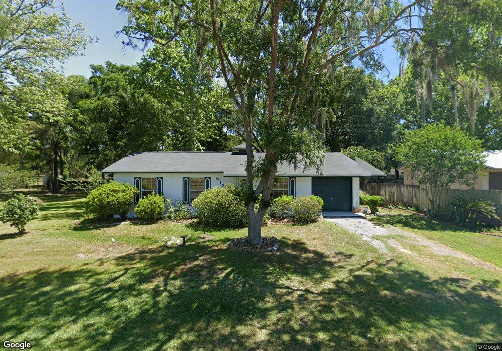
6131 NW Highway 225a Ocala, FL 34482
Fellowship NeighborhoodEstimated Value: $183,000 - $818,000
3
Beds
2
Baths
1,014
Sq Ft
$354/Sq Ft
Est. Value
About This Home
This home is located at 6131 NW Highway 225a, Ocala, FL 34482 and is currently estimated at $358,655, approximately $353 per square foot. 6131 NW Highway 225a is a home located in Marion County with nearby schools including Fessenden Elementary School, North Marion Middle School, and North Marion High School.
Ownership History
Date
Name
Owned For
Owner Type
Purchase Details
Closed on
Sep 3, 2024
Sold by
Strynkowski Michael John
Bought by
Strynkowski Theresa F
Current Estimated Value
Purchase Details
Closed on
May 8, 2023
Sold by
Strynkowski Theresa F Le
Bought by
Strynkowski Michael John
Purchase Details
Closed on
Jul 3, 2016
Sold by
Nosbisch Ronald W and Nosbisch Ane Margkt
Bought by
Strynkowski Theresa
Purchase Details
Closed on
May 28, 2016
Sold by
Nosbisch Ronald and Nosbisch Margaret
Bought by
Strynkowski Theresa
Create a Home Valuation Report for This Property
The Home Valuation Report is an in-depth analysis detailing your home's value as well as a comparison with similar homes in the area
Home Values in the Area
Average Home Value in this Area
Purchase History
| Date | Buyer | Sale Price | Title Company |
|---|---|---|---|
| Strynkowski Theresa F | $100 | None Listed On Document | |
| Strynkowski Michael John | $100 | None Listed On Document | |
| Strynkowski Theresa | -- | None Available | |
| Strynkowski Theresa | $6,000 | None Available |
Source: Public Records
Tax History Compared to Growth
Tax History
| Year | Tax Paid | Tax Assessment Tax Assessment Total Assessment is a certain percentage of the fair market value that is determined by local assessors to be the total taxable value of land and additions on the property. | Land | Improvement |
|---|---|---|---|---|
| 2024 | $584 | $43,023 | -- | -- |
| 2023 | $566 | $41,770 | $0 | $0 |
| 2022 | $548 | $40,553 | $0 | $0 |
| 2021 | $538 | $39,372 | $0 | $0 |
| 2020 | $531 | $38,828 | $0 | $0 |
| 2019 | $518 | $37,955 | $0 | $0 |
| 2018 | $493 | $37,247 | $0 | $0 |
| 2017 | $482 | $36,481 | $0 | $0 |
| 2016 | $394 | $32,303 | $0 | $0 |
| 2015 | $386 | $32,078 | $0 | $0 |
| 2014 | $376 | $31,823 | $0 | $0 |
Source: Public Records
Map
Nearby Homes
- 6889 NW 60th St
- 6848 NW 60th St
- TBD NW 54 Loop
- 6609 NW 60th St
- 6610 NW 61st St
- 6925 NW Highway 225a
- 6441 NW 65th Ave
- 0 NW 61 Ln
- 4738 NW 51st Ct
- 5472 NW 46th Lane Rd
- 5383 NW 48th Place
- 5365 NW 46th Lane Rd
- 5450 NW 46th Lane Rd
- 6262 NW 61st St
- 6110 NW 62nd Ave
- 0 NW 61st St Unit R11106082
- 7699 NW 56th Place
- 5391 NW 76th Ct
- 6667 NW 61st Ct
- 6681 NW 61st Ct
- 6111 NW Highway 225a
- 6130 NW 69th Ct
- 6081 NW Highway 225a
- 6171 NW Highway 225a
- 6080 NW 69th Ct
- 6080 NW 69 Ct
- 0 NW 69th Ct
- 6060 NW 69th Ct
- 6040 NW 69th Ct
- 6175 NW 69th Ct
- 6915 NW 60th Street Rd
- 6960 NW 62nd Place
- 6055 NW 69th Ct
- 6055 NW 69 Ct
- 6195 NW 69th Ct
- 6002 NW 69th Ct
- 6995 NW 60th St
- 6019 NW Highway 225a
- 6184 NW 67th Ave
- 6215 NW 69th Ct