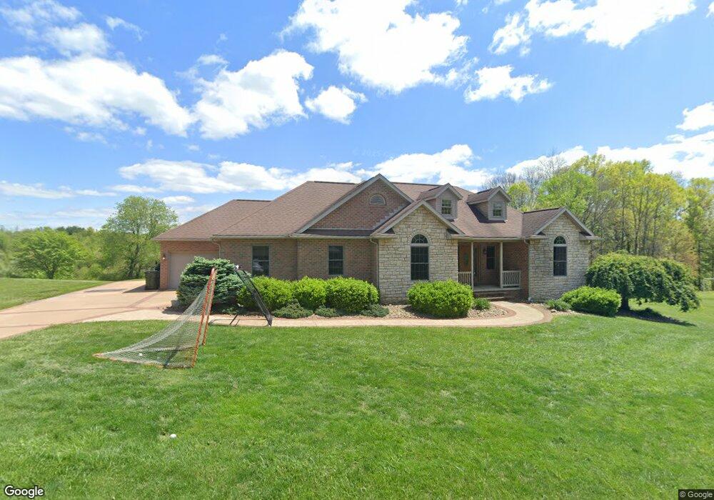
61320 Heritage Ct Cambridge, OH 43725
Estimated Value: $259,000 - $549,000
Studio
1
Bath
1,885
Sq Ft
$210/Sq Ft
Est. Value
About This Home
This home is located at 61320 Heritage Ct, Cambridge, OH 43725 and is currently estimated at $395,327, approximately $209 per square foot. 61320 Heritage Ct is a home with nearby schools including New Concord Elementary School, Larry Miller Intermediate Elementary School, and East Muskingum Middle School.
Ownership History
Date
Name
Owned For
Owner Type
Purchase Details
Closed on
Jun 11, 2007
Sold by
Grywalski Terence and Grywalski Traci
Bought by
Atkinson Mark C and Atkinson Megan J
Current Estimated Value
Create a Home Valuation Report for This Property
The Home Valuation Report is an in-depth analysis detailing your home's value as well as a comparison with similar homes in the area
Purchase History
| Date | Buyer | Sale Price | Title Company |
|---|---|---|---|
| Atkinson Mark C | $38,000 | -- |
Source: Public Records
Tax History
| Year | Tax Paid | Tax Assessment Tax Assessment Total Assessment is a certain percentage of the fair market value that is determined by local assessors to be the total taxable value of land and additions on the property. | Land | Improvement |
|---|---|---|---|---|
| 2024 | $5,218 | $126,388 | $26,960 | $99,428 |
| 2023 | $5,050 | $96,481 | $20,580 | $75,901 |
| 2022 | $4,218 | $96,480 | $20,580 | $75,900 |
| 2021 | $4,079 | $96,480 | $20,580 | $75,900 |
| 2020 | $3,742 | $88,800 | $16,910 | $71,890 |
| 2019 | $6 | $88,800 | $16,910 | $71,890 |
| 2018 | $3,450 | $88,800 | $16,910 | $71,890 |
| 2017 | $3,437 | $76,970 | $14,700 | $62,270 |
| 2016 | $3,117 | $76,970 | $14,700 | $62,270 |
| 2015 | $3,117 | $76,970 | $14,700 | $62,270 |
| 2014 | -- | $68,960 | $12,350 | $56,610 |
| 2013 | $2,823 | $68,960 | $12,350 | $56,610 |
Source: Public Records
Map
Nearby Homes
- 61220 Kadon Dr
- 60999 Greenbriar Dr
- 3029 Best Rd
- 1420 Glenn Hwy
- 62132 Beech Circle Rd
- 60040 Bliss Rd
- 110 Cherry Ln
- 67 E Main St
- 160 N Liberty St
- 0 Maple Ln
- 112 Thompson Ave
- 170 Thompson Ave
- 3278 Rough & Ready Rd
- 0 Rix Mills Rd
- 4896 High Hill Rd
- 0 Homestead Dr Unit 11611647
- 0 Homestead Dr Unit 5174212
- 0 Haught Rd Unit 5180764
- 0 Haught Rd Unit 5181769
- 63041 Ridgewood Dr
- 61315 Heritage Ct
- 61290 Heritage Ct
- 61295 Heritage Ct
- 61355 Heritage Ct
- 61310 Kadon Dr
- 61316 Kadon Dr
- 61294 Kadon Dr
- 61280 Kadon Dr
- 61350 Kadon Dr
- 61317 Kadon Dr
- 61266 Kadon Dr
- 61329 Kadon Dr
- 61374 Kadon Dr
- 61313 Kadon Dr
- 61357 Kadon Dr
- 61200 Heritage Ct
- 61299 Kadon Dr
- 61250 Kadon Dr
- 61388 Kadon Dr
- 61275 Kadon Dr
Your Personal Tour Guide
Ask me questions while you tour the home.