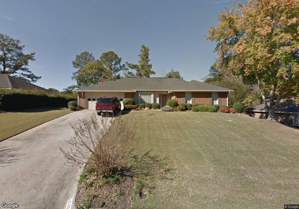
6133 Cape Cod Dr Columbus, GA 31904
North Columbus NeighborhoodEstimated Value: $354,971 - $418,000
3
Beds
3
Baths
2,369
Sq Ft
$161/Sq Ft
Est. Value
About This Home
This home is located at 6133 Cape Cod Dr, Columbus, GA 31904 and is currently estimated at $382,243, approximately $161 per square foot. 6133 Cape Cod Dr is a home located in Muscogee County with nearby schools including River Road Elementary School, Double Churches Middle School, and Northside High School.
Ownership History
Date
Name
Owned For
Owner Type
Purchase Details
Closed on
May 26, 2022
Sold by
Godfrey Margaret P
Bought by
Jenkins Jane Lindsey and Jenkins Robert T
Current Estimated Value
Home Financials for this Owner
Home Financials are based on the most recent Mortgage that was taken out on this home.
Original Mortgage
$256,000
Outstanding Balance
$239,649
Interest Rate
4.25%
Mortgage Type
Balloon
Estimated Equity
$142,594
Purchase Details
Closed on
May 12, 2020
Sold by
Sandahl Trent J
Bought by
Godfrey Margaret P
Home Financials for this Owner
Home Financials are based on the most recent Mortgage that was taken out on this home.
Original Mortgage
$212,000
Interest Rate
3.3%
Purchase Details
Closed on
Sep 12, 2019
Sold by
Scoggins James D
Bought by
Sandahl Trent J and Sandahl Anna K
Home Financials for this Owner
Home Financials are based on the most recent Mortgage that was taken out on this home.
Original Mortgage
$200,000
Interest Rate
3.6%
Mortgage Type
New Conventional
Create a Home Valuation Report for This Property
The Home Valuation Report is an in-depth analysis detailing your home's value as well as a comparison with similar homes in the area
Home Values in the Area
Average Home Value in this Area
Purchase History
| Date | Buyer | Sale Price | Title Company |
|---|---|---|---|
| Jenkins Jane Lindsey | $320,000 | Page Scrantom Sprouse Tucker & | |
| Godfrey Margaret P | $265,000 | -- | |
| Sandahl Trent J | $250,000 | -- |
Source: Public Records
Mortgage History
| Date | Status | Borrower | Loan Amount |
|---|---|---|---|
| Open | Jenkins Jane Lindsey | $256,000 | |
| Previous Owner | Godfrey Margaret P | $212,000 | |
| Previous Owner | Sandahl Trent J | $200,000 |
Source: Public Records
Tax History
| Year | Tax Paid | Tax Assessment Tax Assessment Total Assessment is a certain percentage of the fair market value that is determined by local assessors to be the total taxable value of land and additions on the property. | Land | Improvement |
|---|---|---|---|---|
| 2025 | $4,169 | $128,000 | $16,920 | $111,080 |
| 2024 | $4,169 | $128,000 | $16,920 | $111,080 |
| 2023 | $2,676 | $128,000 | $16,920 | $111,080 |
| 2022 | $4,371 | $107,048 | $21,376 | $85,672 |
| 2021 | $4,283 | $104,892 | $21,376 | $83,516 |
| 2020 | $4,084 | $100,000 | $21,080 | $78,920 |
| 2019 | $2,716 | $99,232 | $21,376 | $77,856 |
| 2018 | $2,716 | $99,232 | $21,376 | $77,856 |
| 2017 | $2,726 | $99,232 | $21,376 | $77,856 |
| 2016 | $2,737 | $93,679 | $8,920 | $84,759 |
| 2015 | $2,742 | $93,679 | $8,920 | $84,759 |
| 2014 | $2,746 | $93,679 | $8,920 | $84,759 |
| 2013 | -- | $93,679 | $8,920 | $84,759 |
Source: Public Records
Map
Nearby Homes
- 6333 Cape Cod Dr
- 6390 Cape Cod Dr
- 6101 River Rd Unit 14
- 6101 River Rd Unit 13
- 6101 River Rd Unit 2
- 6101 River Rd Unit 5
- 16 Kylemore Ct
- 7281 Mobley Walk Dr
- 6400 Green Island Dr Unit 42
- 6400 Green Island Dr Unit 11
- 6400 Green Island Dr Unit 43
- 5602 Morris Ave
- 831 53rd St
- 5472 Roaring Branch Rd
- 222 Cascade Rd
- 254 Cascade Rd
- 1021 53rd St
- 1325 Autumnridge Dr
- 5431 Roaring Branch Rd
- 1037 53rd St
- 6141 Cape Cod Dr
- 6115 Cape Cod Dr
- 6114 Bristol Blvd
- 6122 Bristol Blvd
- 6132 Cape Cod Dr
- 6100 Bristol Blvd
- 6151 Cape Cod Dr
- 6140 Cape Cod Dr
- 6124 Cape Cod Dr
- 6150 Cape Cod Dr
- 6120 Cape Cod Dr
- 6112 Cape Cod Dr
- 6138 Bristol Blvd
- 6119 Bristol Blvd
- 6201 Cape Cod Dr
- 6111 Bristol Blvd
- 6034 Bristol Blvd
- 6127 Bristol Blvd
- 6119 Marlowe Dr
- 6129 Marlowe Dr
Your Personal Tour Guide
Ask me questions while you tour the home.