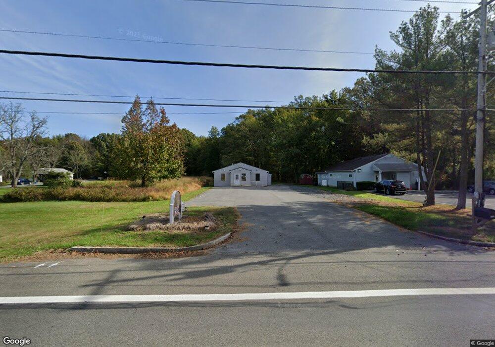
6133 Shady Side Rd Shady Side, MD 20764
Estimated Value: $289,894
--
Bed
--
Bath
1,340
Sq Ft
$216/Sq Ft
Est. Value
About This Home
This home is located at 6133 Shady Side Rd, Shady Side, MD 20764 and is currently estimated at $289,894, approximately $216 per square foot. 6133 Shady Side Rd is a home located in Anne Arundel County with nearby schools including Shady Side Elementary School, Southern Middle School, and Southern High School.
Ownership History
Date
Name
Owned For
Owner Type
Purchase Details
Closed on
Jul 19, 2023
Sold by
Ditraglia Francis J
Bought by
Direct Urgent Care Center Properties Llc
Current Estimated Value
Purchase Details
Closed on
Mar 10, 2020
Sold by
Carbone John A and Carbone Victor R
Bought by
Ditraglia Frank
Purchase Details
Closed on
Jan 31, 2017
Sold by
Creekmore Rufus C and Creekmore Tina H
Bought by
Carbone John A and Carbone Victor R
Home Financials for this Owner
Home Financials are based on the most recent Mortgage that was taken out on this home.
Original Mortgage
$182,000
Interest Rate
4.2%
Mortgage Type
Commercial
Purchase Details
Closed on
Dec 1, 1987
Bought by
Creekmore Rufus C and Creekmore Tina H
Home Financials for this Owner
Home Financials are based on the most recent Mortgage that was taken out on this home.
Original Mortgage
$23,000
Interest Rate
10.55%
Create a Home Valuation Report for This Property
The Home Valuation Report is an in-depth analysis detailing your home's value as well as a comparison with similar homes in the area
Home Values in the Area
Average Home Value in this Area
Purchase History
| Date | Buyer | Sale Price | Title Company |
|---|---|---|---|
| Direct Urgent Care Center Properties Llc | -- | None Listed On Document | |
| Ditraglia Frank | $210,000 | Eagle Title Llc | |
| Carbone John A | $182,000 | Rgs Title Llc | |
| Creekmore Rufus C | $25,000 | -- |
Source: Public Records
Mortgage History
| Date | Status | Borrower | Loan Amount |
|---|---|---|---|
| Previous Owner | Carbone John A | $182,000 | |
| Previous Owner | Creekmore Rufus C | $23,000 |
Source: Public Records
Tax History Compared to Growth
Tax History
| Year | Tax Paid | Tax Assessment Tax Assessment Total Assessment is a certain percentage of the fair market value that is determined by local assessors to be the total taxable value of land and additions on the property. | Land | Improvement |
|---|---|---|---|---|
| 2025 | $2,629 | $214,500 | $209,100 | $5,400 |
| 2024 | $2,629 | $214,500 | $209,100 | $5,400 |
| 2023 | $2,580 | $215,600 | $209,100 | $6,500 |
| 2022 | $2,341 | $203,500 | $0 | $0 |
| 2021 | $2,092 | $191,400 | $0 | $0 |
| 2020 | $2,092 | $179,300 | $162,000 | $17,300 |
| 2019 | $4,140 | $179,300 | $162,000 | $17,300 |
| 2018 | $1,818 | $179,300 | $162,000 | $17,300 |
| 2017 | $3,460 | $323,900 | $0 | $0 |
| 2016 | -- | $315,400 | $0 | $0 |
| 2015 | -- | $306,900 | $0 | $0 |
| 2014 | -- | $298,400 | $0 | $0 |
Source: Public Records
Map
Nearby Homes
- 0 Shady Side Rd Unit MDAA2113156
- 0 Shady Side Rd Unit MDAA2113166
- 6152 Shady Side Rd
- 6118 Shady Side Rd
- 1428 Haile Pkwy
- 1408 & 1410 Haile Pkwy
- 6070 Shady Side Rd
- 1436 Haile Pkwy
- 1445 & 1447 Haile Pkwy
- 0 Haile Pkwy Unit MDAA2127474
- 1461 Cedarhurst Rd
- 1419 Shady Rest Rd
- 1302 Spruce St
- 4913 Chestnut St
- 4912 Beech St
- 1208 Oak Ave
- 4992 Lerch Dr
- 1213 Oak Ave
- 1220 Grove Ave
- 4908 Aspen St
- 6131 Shady Side Rd
- 6147 Shady Side Rd
- 1406 Cedarhurst Rd
- 6140 Shady Side Rd
- 6127 Shady Side Rd
- 1410 Cedarhurst Rd
- 6136 Shady Side Rd
- 0 Shady Side Rd Unit AA7930311
- 0 Shady Side Rd Unit AA7934186
- 0 Shady Side Rd Unit 1004327243
- 0 Shady Side Rd Unit 1009693328
- 0 Shady Side Rd Unit 1009689402
- 6132 Shady Side Rd
- 6146 Shady Side Rd
- 1416 Cedarhurst Rd
- 6126 Shady Side Rd
- 6121 Shady Side Rd
- 1422 Cedarhurst Rd
- 1409 Cedarhurst Rd
- 6160 Shady Side Rd