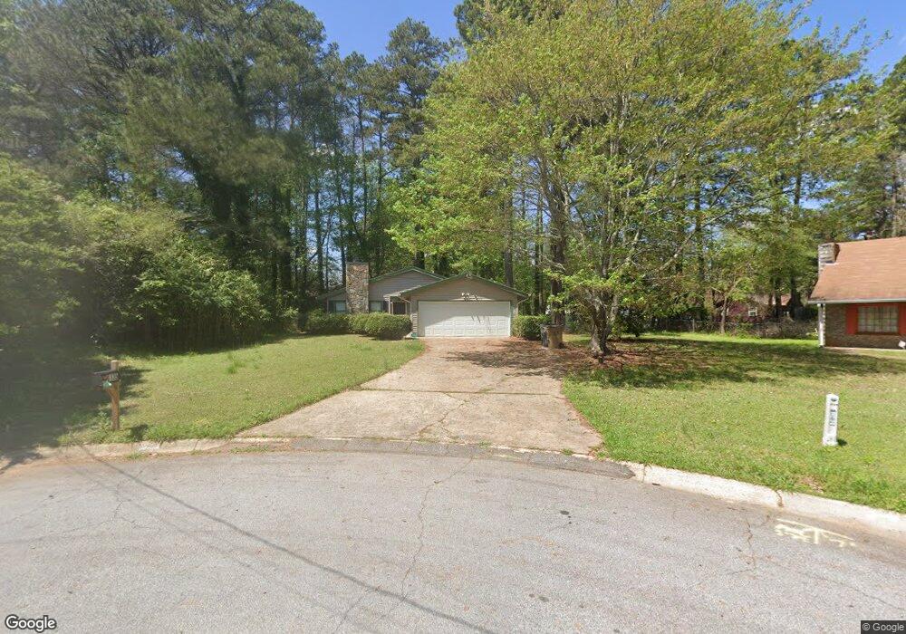
6135 Castlegate Ct Riverdale, GA 30296
Estimated Value: $197,000 - $242,000
3
Beds
2
Baths
1,338
Sq Ft
$169/Sq Ft
Est. Value
About This Home
This home is located at 6135 Castlegate Ct, Riverdale, GA 30296 and is currently estimated at $225,694, approximately $168 per square foot. 6135 Castlegate Ct is a home located in Clayton County with nearby schools including Oliver Elementary School, North Clayton Middle School, and North Clayton High School.
Ownership History
Date
Name
Owned For
Owner Type
Purchase Details
Closed on
May 3, 2022
Sold by
Ellison James B
Bought by
Resicap Georgia Owner Ii Llc
Current Estimated Value
Purchase Details
Closed on
Jul 13, 2001
Sold by
Ellison James B and Ellison Debra S
Bought by
Ellison James B
Home Financials for this Owner
Home Financials are based on the most recent Mortgage that was taken out on this home.
Original Mortgage
$89,600
Interest Rate
7.08%
Mortgage Type
New Conventional
Create a Home Valuation Report for This Property
The Home Valuation Report is an in-depth analysis detailing your home's value as well as a comparison with similar homes in the area
Home Values in the Area
Average Home Value in this Area
Purchase History
| Date | Buyer | Sale Price | Title Company |
|---|---|---|---|
| Resicap Georgia Owner Ii Llc | $163,000 | -- | |
| Ellison James B | -- | -- |
Source: Public Records
Mortgage History
| Date | Status | Borrower | Loan Amount |
|---|---|---|---|
| Previous Owner | Ellison James B | $89,600 |
Source: Public Records
Tax History Compared to Growth
Tax History
| Year | Tax Paid | Tax Assessment Tax Assessment Total Assessment is a certain percentage of the fair market value that is determined by local assessors to be the total taxable value of land and additions on the property. | Land | Improvement |
|---|---|---|---|---|
| 2024 | $2,774 | $70,200 | $7,200 | $63,000 |
| 2023 | $2,354 | $65,200 | $6,560 | $58,640 |
| 2022 | $2,173 | $54,480 | $7,200 | $47,280 |
| 2021 | $1,594 | $39,480 | $7,200 | $32,280 |
| 2020 | $1,472 | $35,934 | $7,200 | $28,734 |
| 2019 | $1,543 | $37,158 | $5,600 | $31,558 |
| 2018 | $1,419 | $34,103 | $5,600 | $28,503 |
| 2017 | $1,041 | $24,723 | $5,600 | $19,123 |
| 2016 | $1,246 | $29,762 | $5,600 | $24,162 |
| 2015 | $1,239 | $0 | $0 | $0 |
| 2014 | $960 | $23,246 | $5,600 | $17,646 |
Source: Public Records
Map
Nearby Homes
- 1991 Flat Shoals Rd
- 6180 Beethoven Cir
- 6220 Polar Fox Ct
- 6255 Mozart Dr
- 1969 Banks Way
- 2069 Swan Ct
- 6159 Sable Fox Dr
- 1959 Conkle Rd
- 6278 Thornhedge Dr
- 5950 Milligan Ct
- 6350 Mozart Dr
- 6307 Thornhedge Dr
- 1857 Rockford Ct
- 6285 Polar Fox Ct
- 1836 Whitworth Dr
- 6297 Polar Fox Ct
- 6105 Camden Forrest Ct
- 1125 Knight Ct
- 2164 Crossrail Dr
- 6143 Castlegate Ct
- 6134 Castlegate Ct
- 6136 Radford Dr
- 6126 Radford Dr
- 2050 Radford Ct
- 2058 Radford Ct
- 6144 Radford Dr
- 2040 Radford Ct
- 6138 Castlegate Ct
- 6184 Castlegate Ct
- 2070 Radford Ct
- 2030 Radford Ct
- 6192 Castlegate Ct
- 6154 Radford Dr
- 6131 Radford Dr
- 2022 Radford Ct
- 6121 Radford Dr
- 6141 Radford Dr
- 2069 Radford Ct
- 2045 Radford Ct