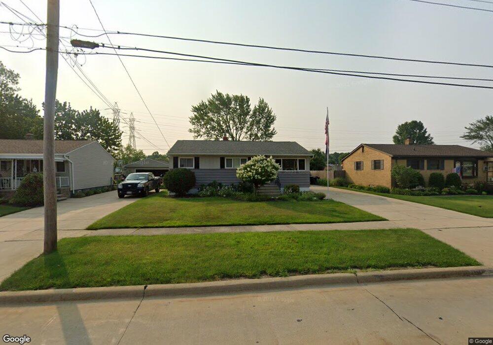
6135 Michael Dr Brookpark, OH 44142
Estimated Value: $181,000 - $219,000
3
Beds
1
Bath
936
Sq Ft
$208/Sq Ft
Est. Value
About This Home
This home is located at 6135 Michael Dr, Brookpark, OH 44142 and is currently estimated at $194,616, approximately $207 per square foot. 6135 Michael Dr is a home located in Cuyahoga County with nearby schools including Berea-Midpark Middle School, Berea-Midpark High School, and Huber Heights Preparatory Academy Parma Academy.
Ownership History
Date
Name
Owned For
Owner Type
Purchase Details
Closed on
Jan 19, 2006
Sold by
Priefer Patrick M and Priefer Diane M
Bought by
Hrabak Jason A and Ramser Kristen L
Current Estimated Value
Home Financials for this Owner
Home Financials are based on the most recent Mortgage that was taken out on this home.
Original Mortgage
$119,000
Outstanding Balance
$65,534
Interest Rate
6.42%
Mortgage Type
Fannie Mae Freddie Mac
Estimated Equity
$129,082
Purchase Details
Closed on
Sep 12, 1989
Sold by
Kristof Ladimer Albert
Bought by
Priefer Patrick M
Purchase Details
Closed on
Mar 27, 1980
Sold by
Dolores M
Bought by
Kristof Ladimer Albert
Purchase Details
Closed on
Jan 1, 1975
Bought by
Dolores M
Create a Home Valuation Report for This Property
The Home Valuation Report is an in-depth analysis detailing your home's value as well as a comparison with similar homes in the area
Home Values in the Area
Average Home Value in this Area
Purchase History
| Date | Buyer | Sale Price | Title Company |
|---|---|---|---|
| Hrabak Jason A | $119,000 | First American Title Ins Co | |
| Priefer Patrick M | $65,000 | -- | |
| Kristof Ladimer Albert | -- | -- | |
| Dolores M | -- | -- |
Source: Public Records
Mortgage History
| Date | Status | Borrower | Loan Amount |
|---|---|---|---|
| Open | Hrabak Jason A | $119,000 |
Source: Public Records
Tax History
| Year | Tax Paid | Tax Assessment Tax Assessment Total Assessment is a certain percentage of the fair market value that is determined by local assessors to be the total taxable value of land and additions on the property. | Land | Improvement |
|---|---|---|---|---|
| 2025 | $2,688 | $53,620 | $11,970 | $41,650 |
| 2024 | $2,704 | $53,620 | $11,970 | $41,650 |
| 2023 | $3,070 | $50,400 | $10,220 | $40,180 |
| 2022 | $3,048 | $50,400 | $10,220 | $40,180 |
| 2021 | $3,030 | $50,400 | $10,220 | $40,180 |
| 2020 | $2,733 | $40,010 | $8,120 | $31,890 |
| 2019 | $2,652 | $114,300 | $23,200 | $91,100 |
| 2018 | $2,496 | $40,010 | $8,120 | $31,890 |
| 2017 | $2,559 | $35,810 | $7,600 | $28,210 |
| 2016 | $2,526 | $35,640 | $7,600 | $28,040 |
| 2015 | $2,370 | $35,640 | $7,600 | $28,040 |
| 2014 | $2,370 | $35,640 | $7,600 | $28,040 |
Source: Public Records
Map
Nearby Homes
- 6103 Westbrook Dr
- 14242 Holland Rd
- 6095 Stark Dr
- 14761 Larkfield Dr
- 14801 Larkfield Dr
- 14024 Donald Dr
- 6024 Brook Ct
- 6014 Westbrook Dr
- 6065 Mercer Dr
- 14396 Park Dr
- 13602 Holland Rd
- 13442 Havendale Dr
- 13670 Middlebrook Blvd
- 6330 Sandfield Dr
- 6386 Sandfield Dr
- 6377 Ledgebrook Dr
- 6330 Ledgebrook Dr
- 6453 Terre Dr
- 15995 Paulding Blvd
- 5952 Delores Blvd
- 6129 Michael Dr
- 6145 Michael Dr
- 6127 Michael Dr
- 6155 Michael Dr
- 6125 Michael Dr
- 6161 Michael Dr
- 6130 Michael Dr
- 6140 Michael Dr
- 6165 Michael Dr
- 6123 Michael Dr
- 6150 Michael Dr
- 6118 Michael Dr
- 6068 Middlebrook Blvd
- 6175 Michael Dr
- 14545 Sylvia Dr
- 6116 Michael Dr
- 14570 Greystone Dr
- 6170 Michael Dr
- 6185 Michael Dr
- 6064 Middlebrook Blvd
Your Personal Tour Guide
Ask me questions while you tour the home.