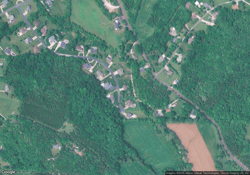
6136 Brookparc Dr Imperial, MO 63052
Estimated Value: $419,000 - $525,000
Studio
1
Bath
1,502
Sq Ft
$310/Sq Ft
Est. Value
About This Home
This home is located at 6136 Brookparc Dr, Imperial, MO 63052 and is currently estimated at $465,606, approximately $309 per square foot. 6136 Brookparc Dr is a home located in Jefferson County with nearby schools including Antonia Elementary School, Antonia Middle School, and Seckman Senior High School.
Ownership History
Date
Name
Owned For
Owner Type
Purchase Details
Closed on
Apr 14, 1999
Sold by
Homeier Gerald J and Homeier Barbara J
Bought by
Homeier Gerald J and Lewis Homeier Barbara J
Current Estimated Value
Home Financials for this Owner
Home Financials are based on the most recent Mortgage that was taken out on this home.
Original Mortgage
$161,550
Interest Rate
7.06%
Create a Home Valuation Report for This Property
The Home Valuation Report is an in-depth analysis detailing your home's value as well as a comparison with similar homes in the area
Home Values in the Area
Average Home Value in this Area
Purchase History
| Date | Buyer | Sale Price | Title Company |
|---|---|---|---|
| Homeier Gerald J | -- | First American Title |
Source: Public Records
Mortgage History
| Date | Status | Borrower | Loan Amount |
|---|---|---|---|
| Closed | Homeier Gerald J | $161,550 |
Source: Public Records
Tax History Compared to Growth
Tax History
| Year | Tax Paid | Tax Assessment Tax Assessment Total Assessment is a certain percentage of the fair market value that is determined by local assessors to be the total taxable value of land and additions on the property. | Land | Improvement |
|---|---|---|---|---|
| 2025 | $3,883 | $61,600 | $10,700 | $50,900 |
| 2024 | $3,883 | $57,000 | $10,700 | $46,300 |
| 2023 | $3,883 | $57,000 | $10,700 | $46,300 |
| 2022 | $3,532 | $51,900 | $5,700 | $46,200 |
| 2021 | $3,533 | $51,900 | $5,700 | $46,200 |
| 2020 | $3,387 | $46,500 | $4,900 | $41,600 |
| 2019 | $3,385 | $46,500 | $4,900 | $41,600 |
| 2018 | $3,355 | $46,500 | $4,900 | $41,600 |
| 2017 | $3,242 | $46,500 | $4,900 | $41,600 |
| 2016 | $3,030 | $43,400 | $4,800 | $38,600 |
| 2015 | $2,991 | $43,400 | $4,800 | $38,600 |
| 2013 | $2,991 | $42,600 | $4,800 | $37,800 |
Source: Public Records
Map
Nearby Homes
- 3653 Morgan Way
- 6404 Glenstone Dr
- 2790 Kings Crossing Dr
- 2712 Kings Crossing Dr
- 3507 Red Oak Dr
- 6760 Saint Lukes Church Rd
- 3539 Red Oak Dr
- 0 Antonia Estates - Blake II Unit MIS26000734
- 0 Antonia Estates - Kayla Unit MIS26000708
- 0 Antonia Estates - Julieann I Unit MIS26000731
- 0 Antonia Estates - Julieann II Unit MIS26000730
- 0 Antonia Estates - Marylyn Unit MIS26000716
- 0 Antonia Estates - Madison Unit MIS26000723
- 0 Antonia Estates - Amanda Unit MIS26000704
- 0 Antonia Estates - Brittany Unit MIS26000740
- 158 Long Oaks Dr
- 6420 Glennsway Dr
- 143 Long Oaks Dr
- 6606 Old Lemay Ferry Rd
- 3216 Regency Woods Place
- 6140 Brookparc Dr
- 6132 Brookparc Dr
- 6145 Kneff Rd
- 6139 Brookparc Dr
- 6133 Brookparc Dr
- 6144 Brookparc Dr
- 6129 Brookparc Dr
- 6141 Kneff Rd
- 6128 Brookparc Dr
- 6175 Kneff Rd
- 6175 Kneff Rd
- 3549 Possum Ridge Dr
- 6123 Brookparc Dr
- 3550 Possum Ridge Dr
- 6124 Brookparc Dr
- 6129 Kneff Rd
- 6120 Brookparc Dr
- 6201 Kneff Rd
- 3543 Possum Ridge Dr
