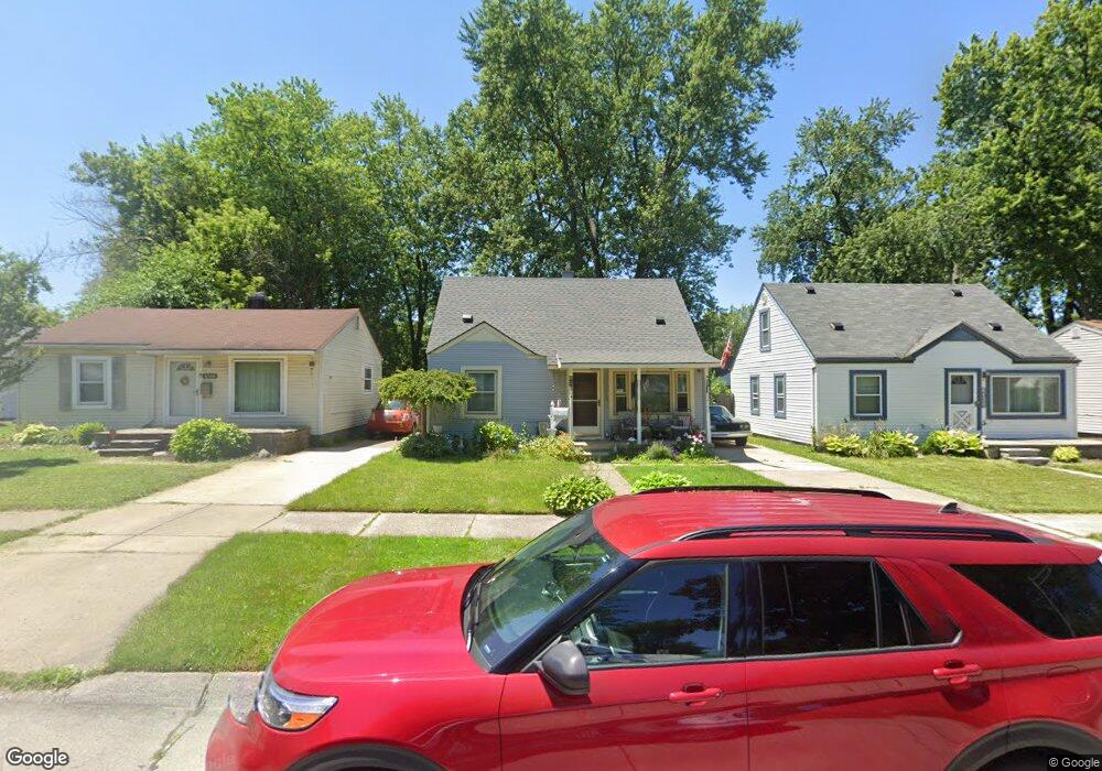
6136 Hazel St Taylor, MI 48180
Estimated Value: $133,000 - $143,000
3
Beds
1
Bath
1,000
Sq Ft
$139/Sq Ft
Est. Value
About This Home
This home is located at 6136 Hazel St, Taylor, MI 48180 and is currently estimated at $139,086, approximately $139 per square foot. 6136 Hazel St is a home located in Wayne County with nearby schools including Holland Elementary School, Hoover Middle School, and Taylor High School.
Ownership History
Date
Name
Owned For
Owner Type
Purchase Details
Closed on
Jul 21, 2009
Sold by
Elliott John W
Bought by
Elliott John
Current Estimated Value
Purchase Details
Closed on
Feb 16, 2009
Sold by
National Asset Management Group Llc
Bought by
Elliot John W
Purchase Details
Closed on
Dec 16, 2008
Sold by
National Asset Management Group
Bought by
National Asset Management Group Llc
Purchase Details
Closed on
Nov 3, 2008
Sold by
Wells Fargo Bank Na
Bought by
National Asset Management Group
Purchase Details
Closed on
Mar 26, 2008
Sold by
Hayley Donald M
Bought by
Wells Fargo Bank Na and Option One Mortgage Loan Trust 2006-1 As
Purchase Details
Closed on
May 2, 2007
Sold by
Hayley Donald M
Bought by
Wells Fargo Bank Na and Option One Mortgage Loan Trust 2006-1 As
Create a Home Valuation Report for This Property
The Home Valuation Report is an in-depth analysis detailing your home's value as well as a comparison with similar homes in the area
Home Values in the Area
Average Home Value in this Area
Purchase History
| Date | Buyer | Sale Price | Title Company |
|---|---|---|---|
| Elliott John | -- | None Available | |
| Elliot John W | $10,000 | Madison Title Agency Llc | |
| National Asset Management Group Llc | -- | Madison Title Agency Llc | |
| National Asset Management Group | -- | None Available | |
| National Asset Management Group | -- | Madison Title Agency Llc | |
| Wells Fargo Bank Na | $58,650 | None Available | |
| Wells Fargo Bank Na | $62,415 | None Available |
Source: Public Records
Tax History Compared to Growth
Tax History
| Year | Tax Paid | Tax Assessment Tax Assessment Total Assessment is a certain percentage of the fair market value that is determined by local assessors to be the total taxable value of land and additions on the property. | Land | Improvement |
|---|---|---|---|---|
| 2025 | $1,061 | $48,500 | $0 | $0 |
| 2024 | $1,061 | $41,400 | $0 | $0 |
| 2023 | $1,280 | $36,900 | $0 | $0 |
| 2022 | $1,013 | $30,200 | $0 | $0 |
| 2021 | $1,124 | $27,700 | $0 | $0 |
| 2020 | $1,113 | $26,200 | $0 | $0 |
| 2019 | $110,854 | $22,200 | $0 | $0 |
| 2018 | $869 | $20,300 | $0 | $0 |
| 2017 | $492 | $19,900 | $0 | $0 |
| 2016 | $915 | $19,400 | $0 | $0 |
| 2015 | $1,620 | $16,200 | $0 | $0 |
| 2013 | $1,870 | $19,400 | $0 | $0 |
| 2012 | $1,200 | $19,100 | $7,000 | $12,100 |
Source: Public Records
Map
Nearby Homes
- 6368 Hazel St
- 6107 John Daly St
- 5970 John Daly St
- 5993 John Daly St
- 6211 Inkster Rd
- 6221 Inkster Rd
- 6370 Hampden St
- 6075 Duncan St
- 5526 Sylvia St
- 6319 Duncan St
- 26215 Beverly Rd
- 6179 Fellrath St
- 6338 Marvin St
- 26532 Powers Ave
- 5961 Marvin St
- 27523 Powers St
- 6363 Mcguire St
- 4863 Glenis St
- 27620 Newcastle St
- 6349 Beech Daly Rd
- 6148 Hazel St
- 6130 Hazel St
- 6122 Hazel St
- 6176 Hazel St
- 6137 Sylvia St
- 6145 Sylvia St
- 6107 Sylvia St
- 6078 Hazel St
- 6182 Hazel St
- 6169 Sylvia St
- 6095 Sylvia St
- 6157 Hazel St Unit Bldg-Unit
- 6157 Hazel St
- 6161 Hazel St
- 6123 Hazel St
- 6064 Hazel St
- 6087 Sylvia St
- 6175 Hazel St
- 6115 Hazel St
- 6185 Sylvia St