Estimated Value: $72,000 - $288,000
--
Bed
--
Bath
1,584
Sq Ft
$92/Sq Ft
Est. Value
About This Home
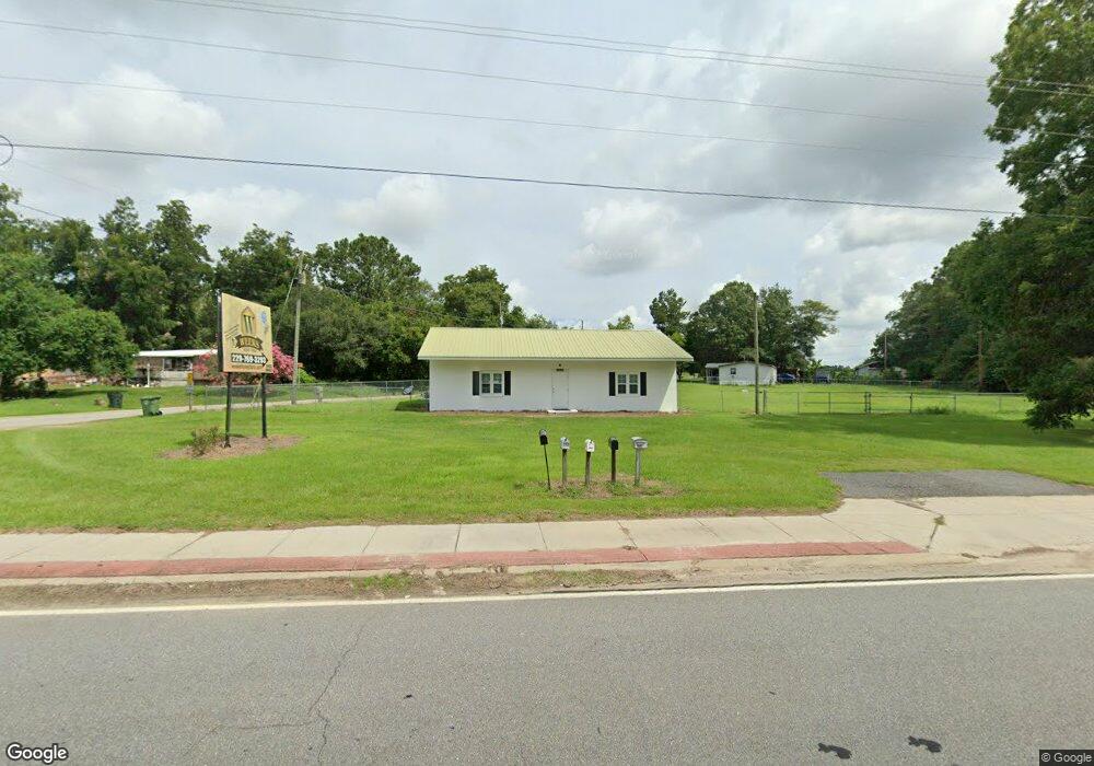
This home is located at 6137 Us Highway 319 N, Omega, GA 31775 and is currently estimated at $146,029, approximately $92 per square foot. 6137 Us Highway 319 N is a home with nearby schools including Norman Park Elementary School, C.A. Gray Junior High School, and Willie J. Williams Middle School.
Ownership History
Date
Name
Owned For
Owner Type
Purchase Details
Closed on
Jul 29, 2025
Sold by
Crosby Family Farm Llc
Bought by
Drcrp Llc
Current Estimated Value
Purchase Details
Closed on
May 11, 2016
Sold by
Crosby Sharon W
Bought by
Weeks Honey Farm Inc
Purchase Details
Closed on
Sep 13, 2011
Sold by
Crosby Sharon W and Crosby Donnie R
Bought by
Department Of Transportation
Purchase Details
Closed on
Nov 21, 1994
Bought by
Crosby Donnie R
Purchase Details
Closed on
Nov 8, 1994
Bought by
First Family Financial
Purchase Details
Closed on
Jun 25, 1992
Bought by
Castleberry Wilbur L
Purchase Details
Closed on
Mar 21, 1986
Bought by
Brown Doris W
Create a Home Valuation Report for This Property
The Home Valuation Report is an in-depth analysis detailing your home's value as well as a comparison with similar homes in the area
Home Values in the Area
Average Home Value in this Area
Purchase History
| Date | Buyer | Sale Price | Title Company |
|---|---|---|---|
| Drcrp Llc | -- | -- | |
| Weeks Honey Farm Inc | -- | -- | |
| Department Of Transportation | $600 | -- | |
| Crosby Donnie R | $24,100 | -- | |
| First Family Financial | $22,500 | -- | |
| Castleberry Wilbur L | -- | -- | |
| Brown Doris W | -- | -- |
Source: Public Records
Tax History Compared to Growth
Tax History
| Year | Tax Paid | Tax Assessment Tax Assessment Total Assessment is a certain percentage of the fair market value that is determined by local assessors to be the total taxable value of land and additions on the property. | Land | Improvement |
|---|---|---|---|---|
| 2024 | $507 | $23,345 | $1,921 | $21,424 |
| 2023 | $492 | $15,317 | $1,921 | $13,396 |
| 2022 | $414 | $17,378 | $1,707 | $15,671 |
| 2021 | $338 | $13,918 | $1,707 | $12,211 |
| 2020 | $344 | $13,918 | $1,707 | $12,211 |
| 2019 | $252 | $9,184 | $1,707 | $7,477 |
| 2018 | $235 | $9,184 | $1,707 | $7,477 |
Source: Public Records
Map
Nearby Homes
- 160 Main Street Crosland
- 1396 Livingston Bridge Rd
- 000 Star Cir
- 000 U S Highway 319
- 173 Middlebrooks St
- 146 Lamar St
- 142 Lamar St
- 122 New St
- 1427 S Ty Omega Rd
- 1852 Doerun Norman Park Rd
- 0 Sleepy Bear Rd
- 0 Mark Orton Ln
- 0 Old Norman Park Rd
- 3332 Ellenton Norman Park Rd
- 0 Murray McCranie Rd Unit 25079284
- 0 Murray McCranie Rd Unit 11586683
- 210 Arrowhead Dr
- 171 Ellis Bryan Rd
- 209 Cherokee Dr
- 441 Cherokee Dr
- 134 Crosland Scooterville Rd
- 125 Crosland Scooterville Rd
- 6138 Us Highway 319 N
- 6118 Us Highway 319 N
- 135 Crosland Scooterville Rd
- 135 Crosland Scooterville Rd
- 6114 Us Highway 319 N
- 137 Crosland Scooterville Rd
- 126 Main Street Crosland
- 154 Crosland Scooterville Rd
- 6147 Us Highway 319 N
- 127 Main Street Crosland
- 111 Main Street Crosland
- 136 Main St
- 6082 Us Highway 319 N
- 136 Main Street Crosland
- 6188 Us Highway 319 N
- 124 Lynch St
- 136 Lynch St
- 160 Main Street Crosland