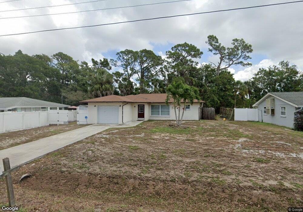
6139 Carlton Ave Unit 1 Sarasota, FL 34231
Estimated Value: $325,000 - $341,000
2
Beds
2
Baths
1,591
Sq Ft
$209/Sq Ft
Est. Value
About This Home
This home is located at 6139 Carlton Ave Unit 1, Sarasota, FL 34231 and is currently estimated at $333,060, approximately $209 per square foot. 6139 Carlton Ave Unit 1 is a home located in Sarasota County with nearby schools including Riverview High School, Gulf Gate Elementary School, and Brookside Middle School.
Ownership History
Date
Name
Owned For
Owner Type
Purchase Details
Closed on
Jul 14, 2011
Sold by
Federal National Mortgage Association
Bought by
Fisher Demitri
Current Estimated Value
Purchase Details
Closed on
May 19, 2011
Sold by
Nationstar Mortgage Llc
Bought by
Federal National Mortgage Association
Purchase Details
Closed on
Mar 3, 2011
Sold by
Smith Linda G and Smith Douglas Ross
Bought by
Nationstar Mortgage Llc
Purchase Details
Closed on
Sep 18, 2007
Sold by
Smith Linda G
Bought by
Smith Linda G and Smith Douglas Ross
Create a Home Valuation Report for This Property
The Home Valuation Report is an in-depth analysis detailing your home's value as well as a comparison with similar homes in the area
Home Values in the Area
Average Home Value in this Area
Purchase History
| Date | Buyer | Sale Price | Title Company |
|---|---|---|---|
| Fisher Demitri | $61,000 | Buyers Title Inc | |
| Federal National Mortgage Association | -- | Attorney | |
| Nationstar Mortgage Llc | $57,009 | None Available | |
| Smith Linda G | -- | Furlong Title Company |
Source: Public Records
Tax History Compared to Growth
Tax History
| Year | Tax Paid | Tax Assessment Tax Assessment Total Assessment is a certain percentage of the fair market value that is determined by local assessors to be the total taxable value of land and additions on the property. | Land | Improvement |
|---|---|---|---|---|
| 2024 | $3,608 | $256,803 | -- | -- |
| 2023 | $3,608 | $297,200 | $116,100 | $181,100 |
| 2022 | $3,239 | $259,700 | $98,100 | $161,600 |
| 2021 | $2,879 | $202,800 | $87,600 | $115,200 |
| 2020 | $2,629 | $175,400 | $54,100 | $121,300 |
| 2019 | $2,606 | $176,800 | $76,200 | $100,600 |
| 2018 | $2,544 | $177,800 | $64,600 | $113,200 |
| 2017 | $2,436 | $153,111 | $0 | $0 |
| 2016 | $2,255 | $151,100 | $46,900 | $104,200 |
| 2015 | $2,052 | $133,100 | $44,700 | $88,400 |
| 2014 | $1,831 | $100,400 | $0 | $0 |
Source: Public Records
Map
Nearby Homes
- 2460 Terry Ln
- 2918 Williamsburg St
- 0 Albert Place
- 2837 Yorktown St
- 2280 Stickney Point Rd Unit 432
- 2280 Stickney Point Rd Unit 425
- 3024 Williamsburg St
- 2260 Stickney Point Rd Unit 303
- 2300 Stickney Point Rd Unit 125
- 2240 Stickney Point Rd Unit 213
- 3040 New England St
- 2220 Stickney Point Rd Unit 519
- 2220 Stickney Point Rd Unit 528
- 2220 Stickney Point Rd Unit 531
- 5773 Britannia Dr
- 5846 Cavano Dr
- 2938 Clark Rd Unit 103
- 6220 Murdock Ave
- 2065 Sun Home St Unit Lot A-23
- 211 Southwinds Dr
- 6147 Carlton Ave Unit 1
- 6133 Carlton Ave
- 2805 Mayflower St
- 6127 Carlton Ave
- 6136 Carlton Ave
- 6142 Carlton Ave
- 2800 Valley Forge St
- 6211 Carlton Ave
- 2730 Linda St
- 6204 Carlton Ave
- 2811 Mayflower St
- 2804 Mayflower St
- 2806 Valley Forge St
- 6210 Carlton Ave
- 6115 Carlton Ave
- 6135 Rodgers Ave
- 6141 Rodgers Ave
- 2810 Mayflower St
- 6127 Rodgers Ave
- 6203 Rodgers Ave