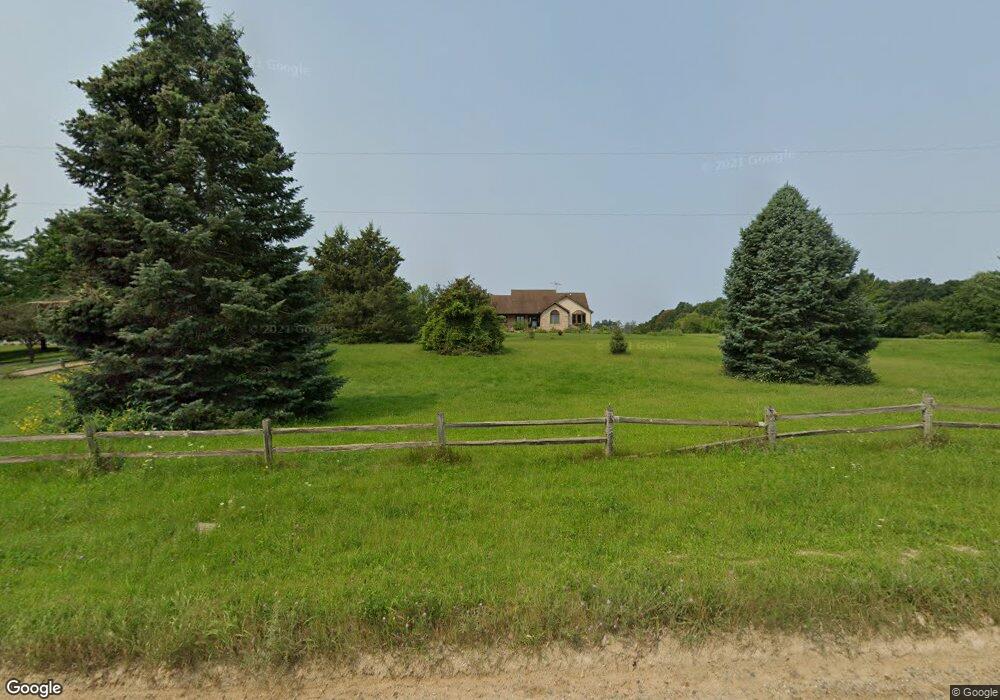
6139 Green Rd Fenton, MI 48430
Estimated Value: $477,000 - $693,317
2
Beds
3
Baths
1,640
Sq Ft
$363/Sq Ft
Est. Value
About This Home
This home is located at 6139 Green Rd, Fenton, MI 48430 and is currently estimated at $595,772, approximately $363 per square foot. 6139 Green Rd is a home located in Livingston County with nearby schools including Hartland High School.
Ownership History
Date
Name
Owned For
Owner Type
Purchase Details
Closed on
Dec 18, 2021
Sold by
Aigner Timothy D and Aigner Michelle V
Bought by
Aigner Timothy D and Aigner Timothy D
Current Estimated Value
Purchase Details
Closed on
Feb 3, 2016
Sold by
Aigner Timothy and Aigner Michelle
Bought by
Aigner Timothy D and Aigner Michelle V M
Purchase Details
Closed on
Aug 5, 2004
Sold by
Furnari Jean M
Bought by
Murray Robert Hugh and Murray Jennifer Mary
Purchase Details
Closed on
Aug 7, 1989
Sold by
Furnari Anthony
Bought by
Furnari Bill J and Furnari Jean M
Create a Home Valuation Report for This Property
The Home Valuation Report is an in-depth analysis detailing your home's value as well as a comparison with similar homes in the area
Home Values in the Area
Average Home Value in this Area
Purchase History
| Date | Buyer | Sale Price | Title Company |
|---|---|---|---|
| Aigner Timothy D | -- | Mcnulty Rebecca | |
| Aigner Timothy D | -- | None Available | |
| Murray Robert Hugh | -- | -- | |
| Furnari Bill J | $25,000 | -- |
Source: Public Records
Tax History Compared to Growth
Tax History
| Year | Tax Paid | Tax Assessment Tax Assessment Total Assessment is a certain percentage of the fair market value that is determined by local assessors to be the total taxable value of land and additions on the property. | Land | Improvement |
|---|---|---|---|---|
| 2025 | $6,391 | $297,400 | $0 | $0 |
| 2024 | $2,914 | $302,300 | $0 | $0 |
| 2023 | $2,785 | $281,800 | $0 | $0 |
| 2022 | $5,648 | $240,800 | $0 | $0 |
| 2021 | $5,648 | $227,500 | $0 | $0 |
| 2020 | $5,608 | $221,500 | $0 | $0 |
| 2019 | $1,318 | $58,200 | $0 | $0 |
| 2018 | $1,288 | $50,297 | $0 | $0 |
| 2017 | $1,159 | $50,297 | $0 | $0 |
| 2016 | $1,146 | $48,100 | $0 | $0 |
| 2014 | $1,090 | $41,630 | $0 | $0 |
| 2012 | $1,090 | $42,130 | $0 | $0 |
Source: Public Records
Map
Nearby Homes
- 6300 Hazard Rd
- 6140 Mcguire Rd
- 5359 Faussett Rd
- 7741 Clyde Rd
- 7739 Clyde Rd
- 7753 Clyde Rd
- 7386 Dean Rd
- 7680 Parshallville Rd
- 7670 Parshallville Rd
- V/L Parshallville Rd
- 00-Lot 128 Ledgewood Dr
- 7687 Parshallville Rd
- 000-Unit 3 Ledgewood Ravine
- 001 Driftwood Dr S
- 7447 Driftwood Dr S
- 8425 Parshallville Rd
- 8373 Riverwalk Dr
- 7477 Ore Knob Dr
- V/L Argentine Rd
- 7334 Parkwood Dr
- 6139 Green Rd
- 6171 Green Rd
- 6191 Green Rd
- 6133 Green Rd
- 6133 Green Rd
- 6078 Green Rd
- 6065 Green Rd
- 6211 Green Rd
- 6096 Green Rd
- 6915 E Allen Rd
- 6020 Green Rd
- 6010 Green Rd
- 6282 Green Rd Unit 9
- 7061 E Allen Rd
- 5985 Green Rd
- Parcel I E Allen Rd
- 6996 E Allen Rd
- 7135 E Allen Rd Unit Bldg-Unit
- 7135 E Allen Rd
- 7050 E Allen Rd