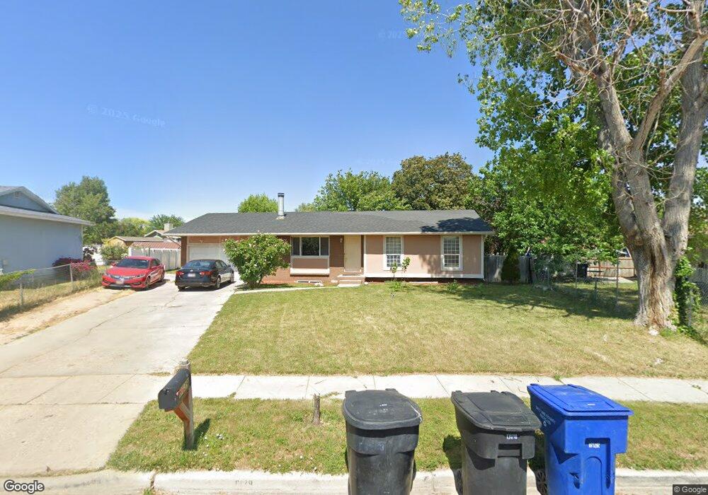
6139 S Aries Dr Salt Lake City, UT 84118
Estimated Value: $455,000 - $473,000
4
Beds
1
Bath
2,290
Sq Ft
$203/Sq Ft
Est. Value
About This Home
This home is located at 6139 S Aries Dr, Salt Lake City, UT 84118 and is currently estimated at $463,850, approximately $202 per square foot. 6139 S Aries Dr is a home located in Salt Lake County with nearby schools including South Kearns Elementary School, Kearns Jr High School, and Kearns High School.
Ownership History
Date
Name
Owned For
Owner Type
Purchase Details
Closed on
Dec 16, 2008
Sold by
Defa Richard L
Bought by
Pineda Miguel A
Current Estimated Value
Home Financials for this Owner
Home Financials are based on the most recent Mortgage that was taken out on this home.
Original Mortgage
$188,491
Outstanding Balance
$124,728
Interest Rate
6.16%
Mortgage Type
FHA
Estimated Equity
$339,122
Purchase Details
Closed on
May 13, 2008
Sold by
Wells Fargo Bank Na
Bought by
Defa Richard L
Home Financials for this Owner
Home Financials are based on the most recent Mortgage that was taken out on this home.
Original Mortgage
$139,815
Interest Rate
5.88%
Mortgage Type
Purchase Money Mortgage
Purchase Details
Closed on
Mar 13, 2008
Sold by
Williams Michael G
Bought by
Wells Fargo Bank Na
Create a Home Valuation Report for This Property
The Home Valuation Report is an in-depth analysis detailing your home's value as well as a comparison with similar homes in the area
Home Values in the Area
Average Home Value in this Area
Purchase History
| Date | Buyer | Sale Price | Title Company |
|---|---|---|---|
| Pineda Miguel A | -- | First American Title | |
| Defa Richard L | -- | First American Title | |
| Wells Fargo Bank Na | $150,735 | None Available |
Source: Public Records
Mortgage History
| Date | Status | Borrower | Loan Amount |
|---|---|---|---|
| Open | Pineda Miguel A | $188,491 | |
| Previous Owner | Defa Richard L | $139,815 |
Source: Public Records
Tax History Compared to Growth
Tax History
| Year | Tax Paid | Tax Assessment Tax Assessment Total Assessment is a certain percentage of the fair market value that is determined by local assessors to be the total taxable value of land and additions on the property. | Land | Improvement |
|---|---|---|---|---|
| 2025 | $2,851 | $411,200 | $97,500 | $313,700 |
| 2024 | $2,851 | $394,100 | $92,100 | $302,000 |
| 2023 | $2,811 | $373,800 | $88,500 | $285,300 |
| 2022 | $2,597 | $354,900 | $86,800 | $268,100 |
| 2021 | $2,329 | $286,800 | $66,700 | $220,100 |
| 2020 | $2,179 | $251,000 | $66,700 | $184,300 |
| 2019 | $2,110 | $240,900 | $62,900 | $178,000 |
| 2018 | $2,015 | $222,100 | $62,900 | $159,200 |
| 2017 | $1,656 | $191,900 | $56,700 | $135,200 |
| 2016 | $1,506 | $175,200 | $56,700 | $118,500 |
| 2015 | $1,346 | $146,000 | $54,600 | $91,400 |
| 2014 | $1,315 | $139,600 | $52,900 | $86,700 |
Source: Public Records
Map
Nearby Homes
- 3978 W Marlis Cir
- 4230 W Stratus St
- 6330 S 4015 W
- 6377 Fairwind Dr
- 6073 S 4350 W
- 5836 S 4270 W
- 3977 Rivendell Rd Unit A-B
- 4077 W 5740 S
- 4120 W 5740 S
- 6578 S 4165 W
- 4468 W Tidwell St
- 6033 S 4520 W
- 4164 W Millsden Ln
- 4321 W 5740 S
- 4207 W 5655 S
- 4340 W 5740 S
- 4243 W 5655 S
- 6102 S 4590 W
- 4161 W 5615 S
- 4371 W 5700 S
- 6139 Aries Dr
- 6131 S Aries Dr
- 6131 Aries Dr
- 4062 Scorpio Dr
- 4062 W Scorpio Dr
- 6134 Aquarius Dr
- 6134 S Aquarius Dr
- 6122 S Aquarius Dr
- 6122 Aquarius Dr
- 6148 Aquarius Dr
- 6121 Aries Dr
- 4082 W Scorpio Dr
- 4082 Scorpio Dr
- 4061 W Aquarius Ct
- 4061 Aquarius Ct
- 4053 Aquarius Ct
- 6138 Aries Dr
- 6138 S Aries Dr
- 6113 S Aries Dr
- 6113 Aries Dr