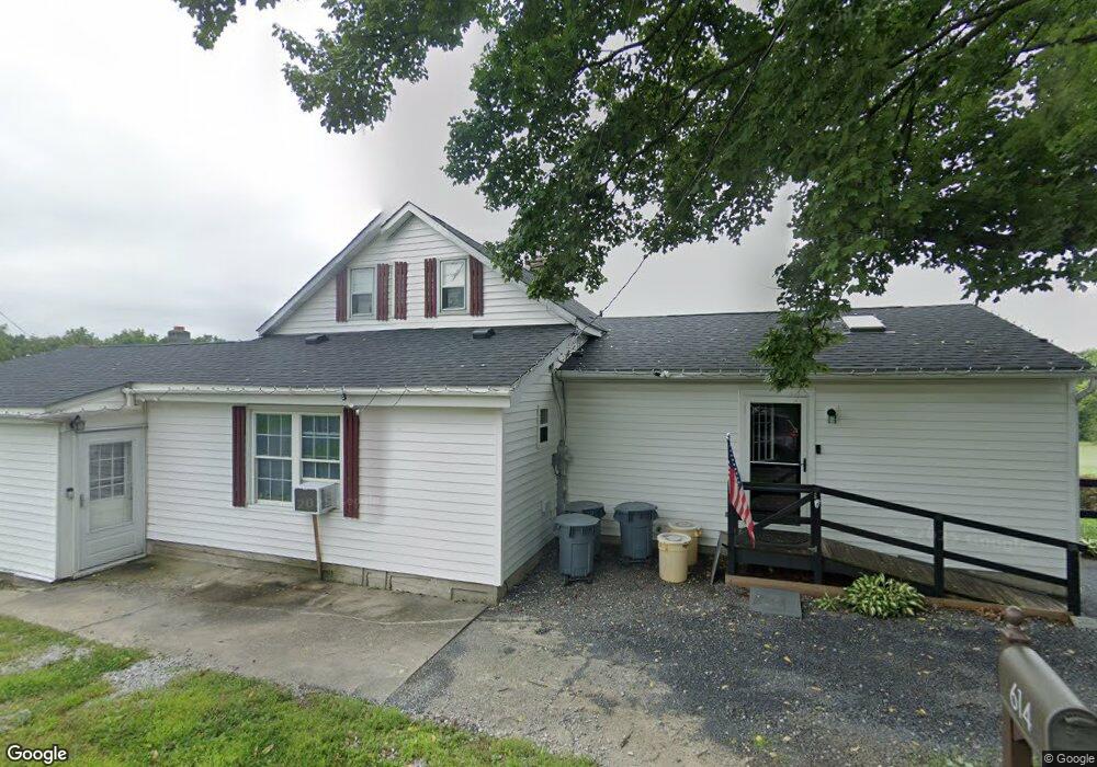
614 Abel Colony Rd Wind Gap, PA 18091
Estimated Value: $152,000 - $424,000
4
Beds
3
Baths
2,136
Sq Ft
$136/Sq Ft
Est. Value
About This Home
This home is located at 614 Abel Colony Rd, Wind Gap, PA 18091 and is currently estimated at $289,647, approximately $135 per square foot. 614 Abel Colony Rd is a home located in Northampton County with nearby schools including Plainfield Elementary School, Wind Gap Middle School, and Pen Argyl Area High School.
Ownership History
Date
Name
Owned For
Owner Type
Purchase Details
Closed on
Mar 7, 2024
Sold by
Allen Jason M
Bought by
Allen Jason M and Allen Mackenzie R
Current Estimated Value
Purchase Details
Closed on
Dec 15, 2021
Sold by
Allen Tara G
Bought by
Allen Jason M
Purchase Details
Closed on
Jun 18, 2021
Sold by
Allen Diane M and Allen Stefanel Diane
Bought by
Allen Jason and Allen Tara
Home Financials for this Owner
Home Financials are based on the most recent Mortgage that was taken out on this home.
Original Mortgage
$112,000
Interest Rate
2.9%
Mortgage Type
VA
Purchase Details
Closed on
Jul 1, 1986
Sold by
Allen Roger B and Allen Diane M
Bought by
Allen Diane M
Purchase Details
Closed on
Apr 1, 1982
Bought by
Allen Roger B and Allen Diane M
Create a Home Valuation Report for This Property
The Home Valuation Report is an in-depth analysis detailing your home's value as well as a comparison with similar homes in the area
Home Values in the Area
Average Home Value in this Area
Purchase History
| Date | Buyer | Sale Price | Title Company |
|---|---|---|---|
| Allen Jason M | -- | None Listed On Document | |
| Allen Jason M | -- | Midtown Abstract Inc | |
| Allen Jason | $112,000 | Monroe Abstract Company | |
| Allen Diane M | $52,000 | -- | |
| Allen Roger B | $27,000 | -- |
Source: Public Records
Mortgage History
| Date | Status | Borrower | Loan Amount |
|---|---|---|---|
| Previous Owner | Allen Jason | $112,000 |
Source: Public Records
Tax History
| Year | Tax Paid | Tax Assessment Tax Assessment Total Assessment is a certain percentage of the fair market value that is determined by local assessors to be the total taxable value of land and additions on the property. | Land | Improvement |
|---|---|---|---|---|
| 2026 | $714 | $66,100 | $34,900 | $31,200 |
| 2025 | $714 | $66,100 | $34,900 | $31,200 |
| 2024 | $4,710 | $62,500 | $34,900 | $27,600 |
| 2023 | $4,710 | $62,500 | $34,900 | $27,600 |
| 2022 | $4,616 | $62,500 | $34,900 | $27,600 |
| 2021 | $4,679 | $62,500 | $34,900 | $27,600 |
| 2020 | $4,679 | $62,500 | $34,900 | $27,600 |
| 2019 | $4,581 | $62,500 | $34,900 | $27,600 |
| 2018 | $4,478 | $62,500 | $34,900 | $27,600 |
| 2017 | $4,387 | $62,500 | $34,900 | $27,600 |
| 2016 | -- | $62,500 | $34,900 | $27,600 |
| 2015 | -- | $62,500 | $34,900 | $27,600 |
| 2014 | -- | $62,500 | $34,900 | $27,600 |
Source: Public Records
Map
Nearby Homes
- 0 Pennsylvania 33
- 118 E 1st St
- 38 W 2nd St
- 502 S Broadway
- 0 Male Rd
- 6366 Sullivan Trail
- 0 E West St Unit PM-138679
- 38 Water St
- 0 W Center St
- 67 Park Ave
- 1147 Jacobsburg Rd
- 508 Liberty St
- 901 Renaldi Rd
- 6 Indian Trail
- 3 Tribe Ln
- 12 Indian Trail
- 136 Sanders Rd
- 1020 Mountain Ave
- 0 Pa 33 Unit 18-3648
- 939 Constitution Ave
- 602 Abel Colony Rd
- 620 Abel Colony Rd
- 615 Abel Colony Rd
- 625 Abel Colony Rd
- 596 Abel Colony Rd
- 628 Abel Colony Rd
- 633 Abel Colony Rd
- 592 Abel Colony Rd
- 597 Abel Colony Rd
- 584 Abel Colony Rd
- 646 Abel Colony Rd
- 651 Abel Colony Rd
- 568 Abel Colony Rd
- 662 Abel Colony Rd
- 621 Abel Colony Rd
- 565 Abel Colony Rd
- 558 Abel Colony Rd
- 668 Abel Colony Rd
- 665 Abel Colony Rd
- 548 Abel Colony Rd
Your Personal Tour Guide
Ask me questions while you tour the home.