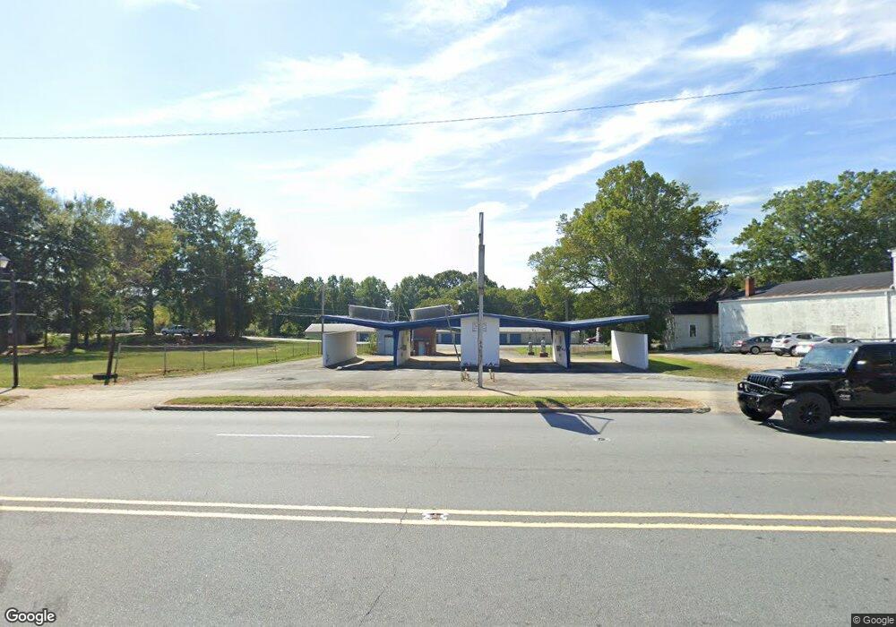
614 E Main St Lincolnton, NC 28092
Estimated Value: $591,205
Studio
--
Bath
1,800
Sq Ft
$328/Sq Ft
Est. Value
About This Home
This home is located at 614 E Main St, Lincolnton, NC 28092 and is currently estimated at $591,205, approximately $328 per square foot. 614 E Main St is a home located in Lincoln County with nearby schools including S. Ray Lowder Elementary School, Lincolnton Middle School, and Lincolnton High School.
Ownership History
Date
Name
Owned For
Owner Type
Purchase Details
Closed on
Sep 30, 2005
Sold by
Kwik Kar Wash Of Lincolnton Nc and Gilbert Hubert L
Bought by
South Oak Street Llc
Current Estimated Value
Home Financials for this Owner
Home Financials are based on the most recent Mortgage that was taken out on this home.
Original Mortgage
$200,000
Outstanding Balance
$107,117
Interest Rate
5.77%
Mortgage Type
Commercial
Estimated Equity
$484,088
Purchase Details
Closed on
Nov 6, 2001
Bought by
Whisonant, Paul & Kwik Kar Wash Of Linco
Create a Home Valuation Report for This Property
The Home Valuation Report is an in-depth analysis detailing your home's value as well as a comparison with similar homes in the area
Purchase History
| Date | Buyer | Sale Price | Title Company |
|---|---|---|---|
| South Oak Street Llc | $200,000 | None Available | |
| Whisonant, Paul & Kwik Kar Wash Of Linco | $50,000 | -- |
Source: Public Records
Mortgage History
| Date | Status | Borrower | Loan Amount |
|---|---|---|---|
| Open | South Oak Street Llc | $200,000 |
Source: Public Records
Tax History
| Year | Tax Paid | Tax Assessment Tax Assessment Total Assessment is a certain percentage of the fair market value that is determined by local assessors to be the total taxable value of land and additions on the property. | Land | Improvement |
|---|---|---|---|---|
| 2025 | $2,689 | $255,195 | $154,885 | $100,310 |
| 2024 | $2,669 | $255,195 | $154,885 | $100,310 |
| 2023 | $2,664 | $255,195 | $154,885 | $100,310 |
| 2022 | $2,661 | $215,906 | $160,635 | $55,271 |
| 2021 | $2,661 | $215,906 | $160,635 | $55,271 |
| 2020 | $2,502 | $215,906 | $160,635 | $55,271 |
| 2019 | $2,502 | $215,906 | $160,635 | $55,271 |
| 2018 | $2,486 | $203,646 | $160,635 | $43,011 |
| 2017 | $2,385 | $203,646 | $160,635 | $43,011 |
| 2016 | $2,385 | $203,646 | $160,635 | $43,011 |
| 2015 | $2,423 | $172,821 | $160,635 | $12,186 |
| 2014 | -- | $0 | $0 | $0 |
Source: Public Records
Map
Nearby Homes
- 331 S Laurel St
- 413 S Laurel St
- 4108 Summey Trail
- 110 W Pine St
- 1010 Catawba St
- 335 E Sumner St
- 608 N State St
- 711 N Oak St
- 102 Wendover Dr
- 0 N Carolina 27
- 202 Newbold St
- 308 W Sycamore St
- 221 Newbold St
- 906 N Flint St
- 329 W Main St
- 411 W Sycamore St
- 208 Hollow Rd
- 606 Childs St
- Lot 2 Louise Ave
- Lot 3 Louise Ave
- 618 & 624 E Main St
- 638 E Main St
- 602 E Main St
- 640 E Water St
- 628 E Main St Unit D
- 628 E Main St Unit C
- 628 E Main St Unit B
- 628 E Main St Unit A
- 628 E Main St Unit E
- 114 S Flint St
- 112 S Oak St
- 530 E Main St
- 00 S Oak St
- 526 E Main St Unit B,C,D
- 526 E Main St
- 0 D St
- 627 E Main St
- 114 N Oak St
- 00 Flint St
- 542 E Water St
Your Personal Tour Guide
Ask me questions while you tour the home.