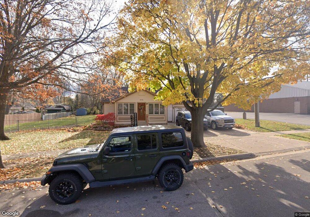
614 Holland Ave Port Huron, MI 48060
Estimated Value: $295,000
3
Beds
2
Baths
1,908
Sq Ft
$155/Sq Ft
Est. Value
About This Home
This home is located at 614 Holland Ave, Port Huron, MI 48060 and is currently priced at $295,000, approximately $154 per square foot. 614 Holland Ave is a home located in St. Clair County with nearby schools including Garfield Elementary School, Holland Woods Middle School, and Port Huron Northern High School.
Ownership History
Date
Name
Owned For
Owner Type
Purchase Details
Closed on
Feb 14, 2023
Sold by
Kearns Industries Llc
Bought by
Robert D Kearns And Annmarie Kearns Family Re
Current Estimated Value
Purchase Details
Closed on
Aug 23, 2019
Sold by
Kearns Robert D and Kearns Annmarie
Bought by
Kearns Industries Llc
Purchase Details
Closed on
Aug 22, 2019
Sold by
Kearns Robert D and Kearns Annmarie
Bought by
Kearns Industries Llc
Purchase Details
Closed on
Dec 6, 2009
Sold by
Kearns Dennis M and Kearns Cecilia J
Bought by
Kearns Dennis M and Kearns Cecilia J
Create a Home Valuation Report for This Property
The Home Valuation Report is an in-depth analysis detailing your home's value as well as a comparison with similar homes in the area
Home Values in the Area
Average Home Value in this Area
Purchase History
| Date | Buyer | Sale Price | Title Company |
|---|---|---|---|
| Robert D Kearns And Annmarie Kearns Family Re | -- | -- | |
| Kearns Industries Llc | -- | None Listed On Document | |
| Kearns Industries Llc | -- | None Listed On Document | |
| Kearns Robert D | -- | None Available | |
| Kearns Dennis M | -- | None Available |
Source: Public Records
Tax History Compared to Growth
Tax History
| Year | Tax Paid | Tax Assessment Tax Assessment Total Assessment is a certain percentage of the fair market value that is determined by local assessors to be the total taxable value of land and additions on the property. | Land | Improvement |
|---|---|---|---|---|
| 2022 | $3,576 | $0 | $0 | $0 |
| 2020 | $2,631 | $0 | $0 | $0 |
| 2019 | $2,631 | $75,100 | $0 | $0 |
| 2018 | $2,631 | $75,100 | $0 | $0 |
| 2017 | $2,348 | $68,000 | $0 | $0 |
| 2016 | $2,019 | $68,000 | $0 | $0 |
| 2015 | $1,982 | $60,200 | $60,200 | $0 |
| 2014 | $1,982 | $55,500 | $55,500 | $0 |
| 2013 | -- | $54,400 | $0 | $0 |
Source: Public Records
Map
Nearby Homes
- 3455 Gratiot Ave
- 3321 Stone St
- 1020 Sanborn St
- 3214 Poplar St
- 1424 Hazelwood Ln
- 1202 Palmer Ct
- 2913 11th Ave
- 1531 Robinson St
- 1434 Schumaker St
- 1218 Garfield St
- 3208 Mount Vernon Rd
- 1116 Hancock St
- 3419 Riverside Dr
- 2431 Armour St
- 2419 Cherry St
- 2400 Stone St Unit 2414
- 2812 19th Ave
- 2215 Hancock St
- 3515 Strawberry Ln
- 2857 Riverside Dr
- 3550 Gratiot Ave
- 3604 Gratiot Ave
- 3567 Armour St
- 3608 Gratiot Ave
- 521 Holland Ave
- 3540 Gratiot Ave
- 519 Holland Ave
- 3561 Armour St
- 3611 Lakeside Ct
- 510 Holland Ave
- 517 Holland Ave
- 3612 Gratiot Ave
- 3615 Lakeside Ct
- 3547 Armour St
- 3622 Gratiot Ave
- 3619 Lakeside Ct
- 3556 Armour St
- 3539 Armour St
- 3550 Armour St
- 419 Holland Ave