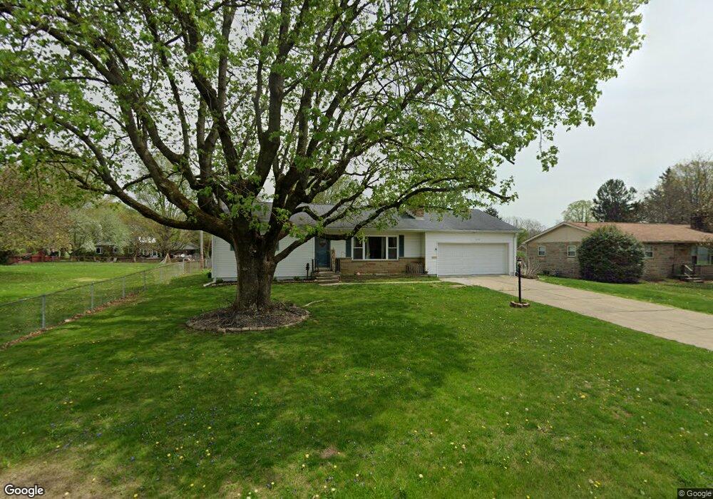
614 Manor Dr Newark, OH 43055
Estimated Value: $290,000 - $290,069
3
Beds
1
Bath
1,536
Sq Ft
$189/Sq Ft
Est. Value
About This Home
This home is located at 614 Manor Dr, Newark, OH 43055 and is currently estimated at $290,017, approximately $188 per square foot. 614 Manor Dr is a home located in Licking County with nearby schools including John Clem Elementary School, Liberty Middle School, and Newark High School.
Ownership History
Date
Name
Owned For
Owner Type
Purchase Details
Closed on
Apr 15, 2025
Sold by
Ward Jon P
Bought by
Adkins James
Current Estimated Value
Home Financials for this Owner
Home Financials are based on the most recent Mortgage that was taken out on this home.
Original Mortgage
$276,892
Outstanding Balance
$275,658
Interest Rate
6.63%
Mortgage Type
FHA
Estimated Equity
$14,359
Purchase Details
Closed on
Feb 19, 2008
Sold by
Harsh Paul L and Harsh Paulette J
Bought by
Ward Jon P
Home Financials for this Owner
Home Financials are based on the most recent Mortgage that was taken out on this home.
Original Mortgage
$136,881
Interest Rate
5.9%
Mortgage Type
VA
Purchase Details
Closed on
May 16, 1995
Sold by
Maguire Susanna H
Bought by
Harsh Paul L
Home Financials for this Owner
Home Financials are based on the most recent Mortgage that was taken out on this home.
Original Mortgage
$73,500
Interest Rate
8.39%
Mortgage Type
New Conventional
Create a Home Valuation Report for This Property
The Home Valuation Report is an in-depth analysis detailing your home's value as well as a comparison with similar homes in the area
Home Values in the Area
Average Home Value in this Area
Purchase History
| Date | Buyer | Sale Price | Title Company |
|---|---|---|---|
| Adkins James | $282,000 | None Listed On Document | |
| Ward Jon P | $134,000 | Lawyers | |
| Harsh Paul L | $93,500 | -- |
Source: Public Records
Mortgage History
| Date | Status | Borrower | Loan Amount |
|---|---|---|---|
| Open | Adkins James | $276,892 | |
| Previous Owner | Ward Jon P | $136,881 | |
| Previous Owner | Harsh Paul L | $73,500 |
Source: Public Records
Tax History Compared to Growth
Tax History
| Year | Tax Paid | Tax Assessment Tax Assessment Total Assessment is a certain percentage of the fair market value that is determined by local assessors to be the total taxable value of land and additions on the property. | Land | Improvement |
|---|---|---|---|---|
| 2024 | $2,492 | $67,940 | $19,920 | $48,020 |
| 2023 | $2,487 | $67,940 | $19,920 | $48,020 |
| 2022 | $2,602 | $63,320 | $14,950 | $48,370 |
| 2021 | $2,730 | $63,320 | $14,950 | $48,370 |
| 2020 | $2,792 | $63,320 | $14,950 | $48,370 |
| 2019 | $2,327 | $50,790 | $14,950 | $35,840 |
| 2018 | $2,328 | $0 | $0 | $0 |
| 2017 | $2,230 | $0 | $0 | $0 |
| 2016 | $2,076 | $0 | $0 | $0 |
| 2015 | $2,066 | $0 | $0 | $0 |
| 2014 | $2,646 | $0 | $0 | $0 |
| 2013 | $1,962 | $0 | $0 | $0 |
Source: Public Records
Map
Nearby Homes
- 36 Hall Ave
- 498 Marion Manor Woods
- 556 Highland Blvd
- 1269 Kreider Blvd
- 625 Country Club Dr Unit B5
- 625 Country Club Dr Unit B12
- 787 Country Club Dr
- 808 Craig Pkwy
- 1111 Lawnview Ave
- 855 E Village Dr
- 1442 Londondale Pkwy Unit 2-4
- 1005 Lawnview Ave
- 259 N 30th St
- 752 Maxola Ave
- 1475 Londondale Pkwy
- 863 Shelbourne Place Unit 863
- 712 Stone Ridge Way
- 892 Shelbourne Place Unit 892
- 632 Granville Rd
- 594 N 21st St
- 604 Manor Dr
- 1071 Granville Rd
- 1059 Granville Rd
- 15 Hall Ave
- 596 Manor Dr
- Lot 391 Country Club Manor
- 1053 Granville Rd
- 17 Hall Ave
- 1091 Granville Rd
- 586 Manor Dr
- 0 Hall Ave
- 19 Hall Ave
- 597 Kenwell Dr
- 587 Manor Dr
- 1105 Granville Rd
- 21 Hall Ave
- 1033 Granville Rd
- 578 Manor Dr
- 589 Kenwell Dr
- 20 Hall Ave