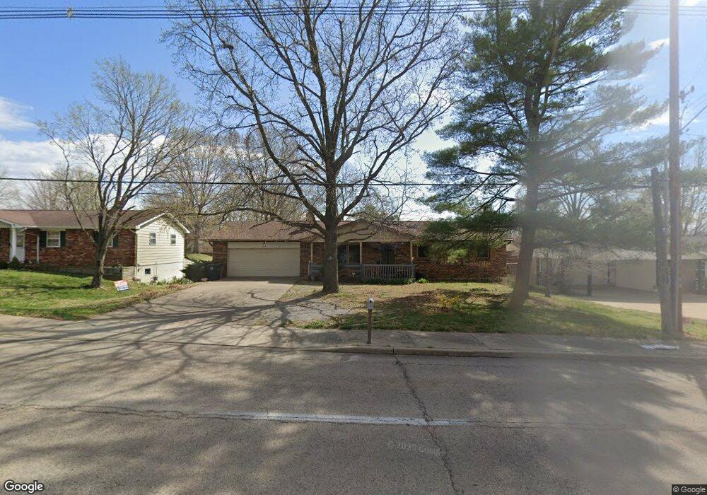
614 Mt Auburn Cape Girardeau, MO 63701
Estimated Value: $194,000 - $209,000
5
Beds
3
Baths
2
Sq Ft
$100,916/Sq Ft
Est. Value
About This Home
This home is located at 614 Mt Auburn, Cape Girardeau, MO 63701 and is currently estimated at $201,831, approximately $100,915 per square foot. 614 Mt Auburn is a home located in Cape Girardeau County with nearby schools including Clippard Elementary School, Central Junior High School, and Central Middle School.
Ownership History
Date
Name
Owned For
Owner Type
Purchase Details
Closed on
May 26, 2020
Sold by
Spence Investments Llc
Bought by
Ahmad Ijaz
Current Estimated Value
Purchase Details
Closed on
Sep 19, 2019
Sold by
Hilpert John W
Bought by
Spence Investments Llc
Purchase Details
Closed on
Aug 16, 2010
Sold by
Hilpert John William
Bought by
Hilpert John W
Purchase Details
Closed on
Oct 20, 2008
Sold by
Camp Charles and Camp Wilma
Bought by
Hilpert John William
Home Financials for this Owner
Home Financials are based on the most recent Mortgage that was taken out on this home.
Original Mortgage
$112,021
Interest Rate
5.83%
Mortgage Type
FHA
Purchase Details
Closed on
Aug 30, 2007
Sold by
Monia Keith and Monia Tammy L
Bought by
Camp Charles and Camp Wilma
Purchase Details
Closed on
Jan 26, 2007
Sold by
Monia Keith and Monia Tammy L
Bought by
Camp Charles and Camp Wilma
Create a Home Valuation Report for This Property
The Home Valuation Report is an in-depth analysis detailing your home's value as well as a comparison with similar homes in the area
Home Values in the Area
Average Home Value in this Area
Purchase History
| Date | Buyer | Sale Price | Title Company |
|---|---|---|---|
| Ahmad Ijaz | -- | None Available | |
| Spence Investments Llc | -- | None Available | |
| Hilpert John W | -- | None Available | |
| Hilpert John William | -- | None Available | |
| Camp Charles | -- | None Available | |
| Camp Charles | -- | None Available |
Source: Public Records
Mortgage History
| Date | Status | Borrower | Loan Amount |
|---|---|---|---|
| Previous Owner | Hilpert John William | $112,021 |
Source: Public Records
Tax History Compared to Growth
Tax History
| Year | Tax Paid | Tax Assessment Tax Assessment Total Assessment is a certain percentage of the fair market value that is determined by local assessors to be the total taxable value of land and additions on the property. | Land | Improvement |
|---|---|---|---|---|
| 2025 | $12 | $23,330 | $2,750 | $20,580 |
| 2024 | $12 | $22,220 | $2,620 | $19,600 |
| 2023 | $1,155 | $22,220 | $2,620 | $19,600 |
| 2022 | $1,065 | $20,480 | $2,410 | $18,070 |
| 2021 | $1,065 | $20,480 | $2,410 | $18,070 |
| 2020 | $1,068 | $20,480 | $2,410 | $18,070 |
| 2019 | $1,066 | $20,480 | $0 | $0 |
| 2018 | $1,064 | $20,480 | $0 | $0 |
| 2017 | $1,067 | $20,480 | $0 | $0 |
| 2016 | $1,063 | $20,480 | $0 | $0 |
| 2015 | $1,063 | $20,480 | $0 | $0 |
| 2014 | $1,069 | $20,480 | $0 | $0 |
Source: Public Records
Map
Nearby Homes
- 3027 Wisteria Dr
- 3022 Wisteria Dr
- 3106 Mimosa St
- 3269 Hopper Rd
- 3552 Mill View Crossing
- 901 Pheasant Cove Dr
- 1000 N Mount Auburn Rd
- 725 Old Mill Dr
- 3657 Engram St
- 769 Cedar Ln
- 807 Caribou Ct
- 3014 Keystone Dr
- 3466 Hopper Rd
- 835 Lochinvar Ln
- 3036 Keystone Dr
- 1070 Dorothy St
- 1107 Dorothy St
- 2 Schonoff Ln
- 2615 Maria Louise Ln
- 2811 Independence St
- 614 N Mount Auburn Rd
- 618 N Mount Auburn Rd
- 610 N Mount Auburn Rd
- 625 Redbud Cir
- 627 Redbud Cir
- 623 Redbud Cir
- 606 N Mount Auburn Rd
- 622 N Mount Auburn Rd
- 609 N Mount Auburn Rd
- 629 Redbud Cir
- 613 Mt Auburn
- 621 Redbud Cir
- 605 N Mount Auburn Rd
- 605 Mt Auburn
- 617 N Mount Auburn Rd
- 617 N My Auburn
- 602 N Mount Auburn Rd
- 626 N Mount Auburn Rd
- 631 Redbud Cir
- 619 Redbud Cir