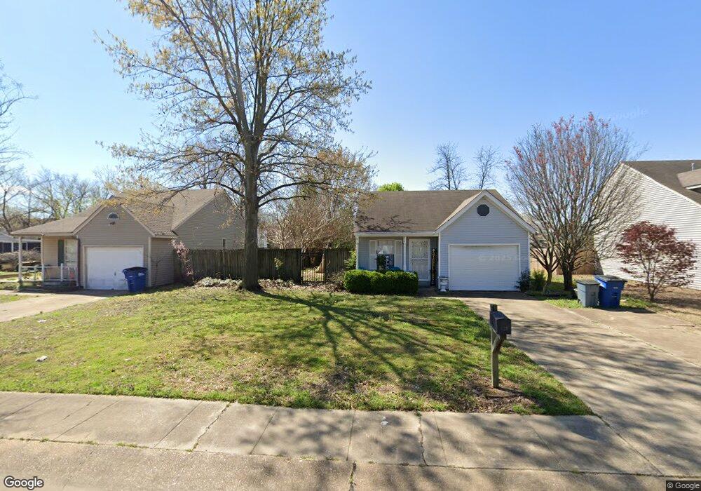
614 Westgate Cove West Memphis, AR 72301
Estimated Value: $75,000 - $128,000
--
Bed
2
Baths
979
Sq Ft
$109/Sq Ft
Est. Value
About This Home
This home is located at 614 Westgate Cove, West Memphis, AR 72301 and is currently estimated at $106,627, approximately $108 per square foot. 614 Westgate Cove is a home located in Crittenden County with nearby schools including Faulk Elementary School, Wonder Junior High School, and The Academies of West Memphis Charter School.
Ownership History
Date
Name
Owned For
Owner Type
Purchase Details
Closed on
Sep 4, 2018
Sold by
Est Malone Sheila Ann and Est Imogene Cummings
Bought by
Morgan David M and Morgan Canice L
Current Estimated Value
Home Financials for this Owner
Home Financials are based on the most recent Mortgage that was taken out on this home.
Original Mortgage
$54,000
Outstanding Balance
$33,252
Interest Rate
4.5%
Mortgage Type
Commercial
Estimated Equity
$73,375
Purchase Details
Closed on
Sep 1, 1989
Bought by
To
Purchase Details
Closed on
Jun 1, 1988
Bought by
To
Purchase Details
Closed on
Nov 1, 1987
Bought by
To
Create a Home Valuation Report for This Property
The Home Valuation Report is an in-depth analysis detailing your home's value as well as a comparison with similar homes in the area
Home Values in the Area
Average Home Value in this Area
Purchase History
| Date | Buyer | Sale Price | Title Company |
|---|---|---|---|
| Morgan David M | $46,000 | None Available | |
| Morgan David M | $46,000 | Stewart Title | |
| To | -- | -- | |
| To | $55,000 | -- | |
| To | $26,000 | -- |
Source: Public Records
Mortgage History
| Date | Status | Borrower | Loan Amount |
|---|---|---|---|
| Open | Morgan David M | $54,000 |
Source: Public Records
Tax History Compared to Growth
Tax History
| Year | Tax Paid | Tax Assessment Tax Assessment Total Assessment is a certain percentage of the fair market value that is determined by local assessors to be the total taxable value of land and additions on the property. | Land | Improvement |
|---|---|---|---|---|
| 2024 | $567 | $11,700 | $2,800 | $8,900 |
| 2023 | $567 | $11,700 | $2,800 | $8,900 |
| 2022 | $567 | $11,700 | $2,800 | $8,900 |
| 2021 | $567 | $11,700 | $2,800 | $8,900 |
| 2020 | $530 | $11,700 | $2,800 | $8,900 |
| 2019 | $424 | $11,230 | $2,800 | $8,430 |
| 2018 | $101 | $11,230 | $2,800 | $8,430 |
| 2017 | $101 | $11,230 | $2,800 | $8,430 |
| 2016 | $101 | $11,230 | $2,800 | $8,430 |
| 2015 | $106 | $11,230 | $2,800 | $8,430 |
| 2014 | $105 | $11,010 | $3,200 | $7,810 |
Source: Public Records
Map
Nearby Homes
- 522 Lois Marie Cove
- 765 Dogwood Cove
- 503 W Oliver Ave
- 402 Oxford St
- 503 Tulane Dr
- 501 Oxford St
- 511 W Cooper Ave
- 501 W Cooper Ave
- 302 Georgetown Dr
- 320 W Cooper Ave
- 607 W Barton Ave
- 307 W Cooper Ave
- 811 Maple Dr
- 715 Foxwood St
- 806 W Walnut Dr
- 807 W Barton Ave
- 623 S Roselawn Dr
- 210 W Cooper Ave
- 413 Gibson Ave
- 819 Walnut Dr
- 612 Westgate Cove
- 618 Westgate Cove
- 610 Westgate Cove
- 533 Lois Marie Cove
- 535 Lois Marie Cove
- 531 Lois Marie Cove
- 529 Lois Marie Cove
- 615 Westgate Cove
- 617 Westgate Cove
- 613 Westgate Cove
- 608 Westgate Cove
- 701 Dogwood Cove
- 527 Lois Marie Cove
- 700 Dogwood Cove
- 611 Westgate Cove
- 525 Lois Marie Cove
- 703 Dogwood Cove
- 609 Westgate Cove
- 606 Westgate Cove
- 523 Lois Marie Cove