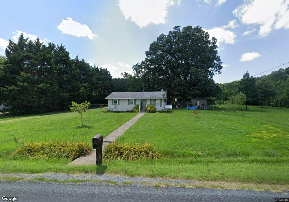
6142 Boston Cliff Rd Easton, MD 21601
Estimated Value: $194,973 - $225,000
--
Bed
1
Bath
936
Sq Ft
$225/Sq Ft
Est. Value
About This Home
This home is located at 6142 Boston Cliff Rd, Easton, MD 21601 and is currently estimated at $210,493, approximately $224 per square foot. 6142 Boston Cliff Rd is a home located in Talbot County with nearby schools including White Marsh Elementary School, Easton Middle School, and Easton High School.
Ownership History
Date
Name
Owned For
Owner Type
Purchase Details
Closed on
Jan 24, 2020
Sold by
Roe Charles E and Duncan Vicky J
Bought by
Roe Ian M
Current Estimated Value
Home Financials for this Owner
Home Financials are based on the most recent Mortgage that was taken out on this home.
Original Mortgage
$123,422
Outstanding Balance
$108,558
Interest Rate
3.37%
Mortgage Type
FHA
Estimated Equity
$101,935
Purchase Details
Closed on
Oct 10, 2007
Sold by
Roe Charles E
Bought by
Roe Charles E
Purchase Details
Closed on
Oct 4, 2007
Sold by
Roe Charles E
Bought by
Roe Charles E
Purchase Details
Closed on
Nov 29, 1983
Sold by
Sard Harold W and Sard Chyrle L
Bought by
Roe Charles E
Create a Home Valuation Report for This Property
The Home Valuation Report is an in-depth analysis detailing your home's value as well as a comparison with similar homes in the area
Home Values in the Area
Average Home Value in this Area
Purchase History
| Date | Buyer | Sale Price | Title Company |
|---|---|---|---|
| Roe Ian M | $130,000 | Eastern Shore Title Company | |
| Roe Charles E | -- | -- | |
| Roe Charles E | -- | -- | |
| Roe Charles E | $26,500 | -- |
Source: Public Records
Mortgage History
| Date | Status | Borrower | Loan Amount |
|---|---|---|---|
| Open | Roe Ian M | $123,422 |
Source: Public Records
Tax History Compared to Growth
Tax History
| Year | Tax Paid | Tax Assessment Tax Assessment Total Assessment is a certain percentage of the fair market value that is determined by local assessors to be the total taxable value of land and additions on the property. | Land | Improvement |
|---|---|---|---|---|
| 2025 | $1,166 | $161,333 | $0 | $0 |
| 2024 | $1,166 | $147,567 | $0 | $0 |
| 2023 | $1,094 | $133,800 | $68,500 | $65,300 |
| 2022 | $1,016 | $129,267 | $0 | $0 |
| 2021 | $2,082 | $124,733 | $0 | $0 |
| 2020 | $953 | $120,200 | $69,200 | $51,000 |
| 2019 | $511 | $119,600 | $0 | $0 |
| 2018 | $495 | $119,000 | $0 | $0 |
| 2017 | $468 | $118,400 | $0 | $0 |
| 2016 | $459 | $118,400 | $0 | $0 |
| 2015 | $419 | $118,400 | $0 | $0 |
| 2014 | $419 | $139,800 | $0 | $0 |
Source: Public Records
Map
Nearby Homes
- 0 Boston Cliff Rd
- 29862 Paddock Ln
- 29764 Paddock Ln
- 29579 Ella Brooks Ln
- 29543 Ella Brooks Ln
- 6296 Landing Neck Rd
- 29768 Hillary Ave
- 29782 Hillary Ave
- 29285 Pin Oak Way
- 29744 Dustin Ave
- 29830 Hillary Ave
- 29865 Hillary Ave
- 29184 Corbin Pkwy
- 29191 Corbin Pkwy
- 7144 Fir St
- 29728 Sullivan Dr
- 29678 Sullivan Dr
- 28850 Jennings Rd
- 7065 Dogwood Terrace
- 7212 Fir St
- 6136 Boston Cliff Rd
- 6108 Boston Cliff Rd
- 6194 Boston Cliff Rd
- 29920 Schwaninger Rd
- 6060 Boston Cliff Rd
- 6279 Boston Cliff Rd
- 29880 Schwaninger Rd
- 30010 Schwaninger Rd
- 5981 Boston Cliff Rd
- 6277 Manadier Rd
- 6231 Manadier Rd
- 6306 Boston Cliff Rd
- 6081 Manadier Rd
- 6311 Manadier Rd
- 0 Paddock Ln Unit TA7925202
- 0 Paddock Ln Unit TA7925185
- 0 Paddock Ln Unit TA7925173
- 0 Paddock Ln Unit TA7925157
- 0 Paddock Ln Unit TA7925125
- 0 Paddock Ln Unit TA8045849