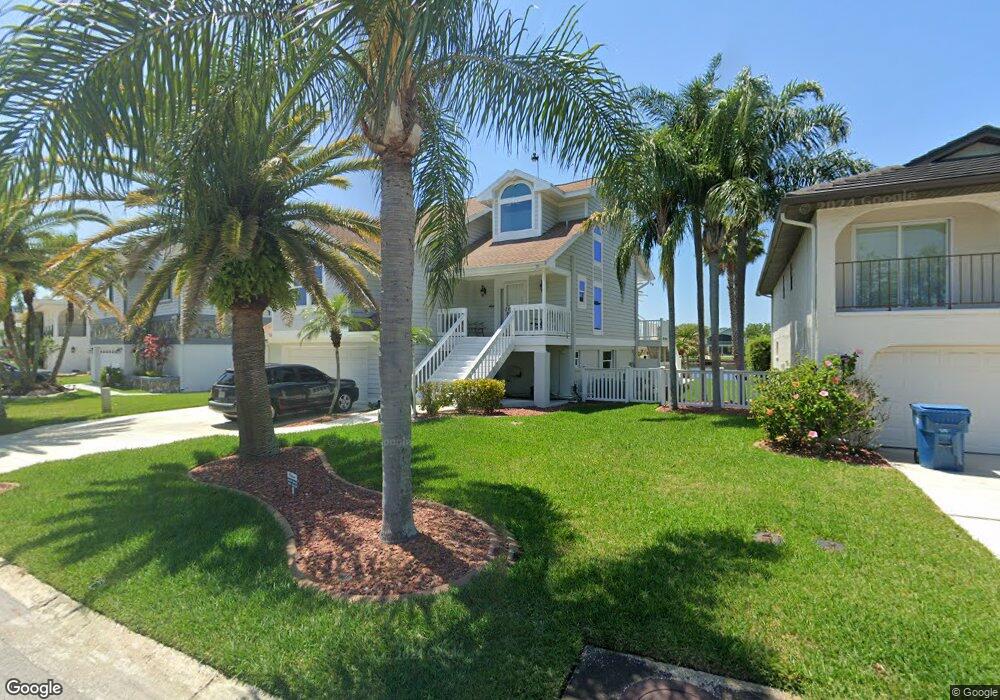
6145 Fjord Way New Port Richey, FL 34652
New Port Richey West NeighborhoodEstimated Value: $566,818 - $818,000
3
Beds
3
Baths
1,828
Sq Ft
$381/Sq Ft
Est. Value
About This Home
This home is located at 6145 Fjord Way, New Port Richey, FL 34652 and is currently estimated at $695,955, approximately $380 per square foot. 6145 Fjord Way is a home located in Pasco County with nearby schools including Richey Elementary School, Gulf Middle School, and Gulf High School.
Ownership History
Date
Name
Owned For
Owner Type
Purchase Details
Closed on
Jan 24, 2003
Sold by
Pollard David and Pollard Wendy J
Bought by
Pasaturo Michael A
Current Estimated Value
Home Financials for this Owner
Home Financials are based on the most recent Mortgage that was taken out on this home.
Original Mortgage
$225,000
Interest Rate
5.98%
Mortgage Type
Purchase Money Mortgage
Purchase Details
Closed on
Dec 12, 2001
Sold by
Wimberley Douglas
Bought by
Pollard David
Create a Home Valuation Report for This Property
The Home Valuation Report is an in-depth analysis detailing your home's value as well as a comparison with similar homes in the area
Home Values in the Area
Average Home Value in this Area
Purchase History
| Date | Buyer | Sale Price | Title Company |
|---|---|---|---|
| Pasaturo Michael A | $300,000 | -- | |
| Pollard David | $108,200 | -- | |
| Pollard David | $108,200 | -- |
Source: Public Records
Mortgage History
| Date | Status | Borrower | Loan Amount |
|---|---|---|---|
| Open | Pollard David | $225,000 | |
| Closed | Pollard David | $50,000 | |
| Closed | Pasaturo Michael A | $225,000 | |
| Previous Owner | Pollard David | $200,000 |
Source: Public Records
Tax History Compared to Growth
Tax History
| Year | Tax Paid | Tax Assessment Tax Assessment Total Assessment is a certain percentage of the fair market value that is determined by local assessors to be the total taxable value of land and additions on the property. | Land | Improvement |
|---|---|---|---|---|
| 2025 | $3,887 | $263,510 | -- | -- |
| 2024 | $3,887 | $256,090 | -- | -- |
| 2023 | $3,743 | $248,640 | $0 | $0 |
| 2022 | $3,364 | $241,400 | $0 | $0 |
| 2021 | $3,300 | $234,370 | $101,666 | $132,704 |
| 2020 | $3,224 | $229,660 | $98,885 | $130,775 |
| 2019 | $3,169 | $224,500 | $0 | $0 |
| 2018 | $3,109 | $220,318 | $0 | $0 |
| 2017 | $3,095 | $220,318 | $0 | $0 |
| 2016 | $3,025 | $211,348 | $0 | $0 |
| 2015 | $3,066 | $209,879 | $0 | $0 |
| 2014 | $2,983 | $240,309 | $97,031 | $143,278 |
Source: Public Records
Map
Nearby Homes
- 6225 Bayside Dr
- 6241 Bayside Dr
- 6344 Spoonbill Dr
- 6340 Spoonbill Dr
- 6312 Spoonbill Dr
- 6316 Spoonbill Dr
- 4820 Treasure Dr
- 6244 Spoonbill Dr
- 4827 Treasure Dr
- 6513 Sand Shore Ln
- 4425 Gulfside Dr
- 6317 Werner Ave
- 6209 Spoonbill Dr
- 6517 Channelside Dr
- 6116 Seaside Dr
- 6208 Spoonbill Dr
- 6340 Garland Ct
- 6415 Werner Ave
- 6307 Oelsner St Unit 11&12
- 6313 Oelsner St
- 6139 Fjord Way
- 6203 Fjord Way
- 6133 Fjord Way
- 6209 Fjord Way
- 6127 Fjord Way
- 6215 Fjord Way
- 6221 Fjord Way
- 6227 Fjord Way
- 6115 Fjord Way
- 6110 Bayside Dr
- 6116 Bayside Dr
- 6233 Fjord Way
- 6122 Bayside Dr Unit 2B
- 6239 Fjord Way
- 0 Oelsner-Main St Unit W7493782
- 0 W Main St Unit W7845198
- 0 W Main St Unit W7842850
- 0000 Main
- 6108 Randan Ct
- 6150 Bayside Dr