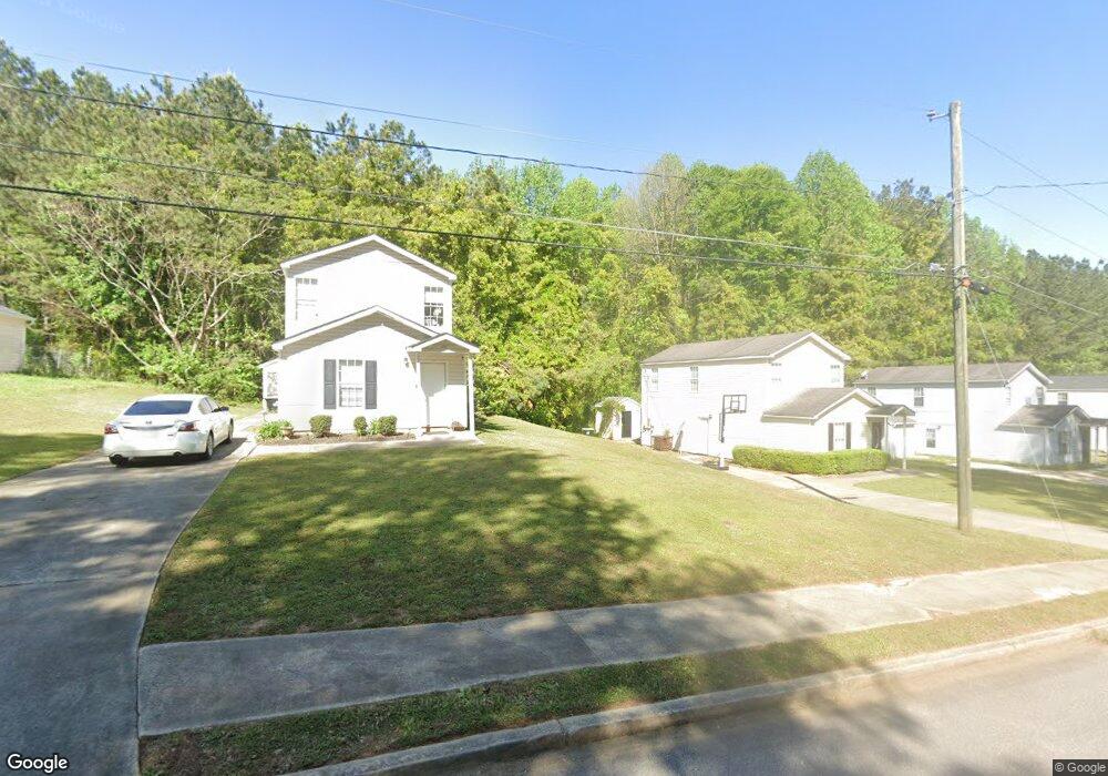
6145 Forrest Ave Union City, GA 30291
Estimated Value: $217,000 - $236,670
4
Beds
2
Baths
1,368
Sq Ft
$168/Sq Ft
Est. Value
About This Home
This home is located at 6145 Forrest Ave, Union City, GA 30291 and is currently estimated at $229,168, approximately $167 per square foot. 6145 Forrest Ave is a home located in Fulton County with nearby schools including Campbell Elementary School, Renaissance Middle School, and Creekside High School.
Ownership History
Date
Name
Owned For
Owner Type
Purchase Details
Closed on
May 12, 2017
Sold by
Not Provided
Bought by
Srp Sub Llc
Current Estimated Value
Purchase Details
Closed on
May 30, 2013
Sold by
Case James B
Bought by
Colfin Ai Ga 2 Llc
Purchase Details
Closed on
May 21, 2010
Sold by
Cwalt Inc Alt Trust 2006 & Oc5
Bought by
Case James B
Purchase Details
Closed on
Dec 1, 2009
Sold by
Foster Wayne C
Bought by
Cwalt Inc Alternat Trust 2006 &
Purchase Details
Closed on
Mar 29, 2006
Sold by
Wickard Charles G and Wickard Bart G
Bought by
Foster Wayne C
Home Financials for this Owner
Home Financials are based on the most recent Mortgage that was taken out on this home.
Original Mortgage
$86,320
Interest Rate
6.99%
Mortgage Type
New Conventional
Create a Home Valuation Report for This Property
The Home Valuation Report is an in-depth analysis detailing your home's value as well as a comparison with similar homes in the area
Home Values in the Area
Average Home Value in this Area
Purchase History
| Date | Buyer | Sale Price | Title Company |
|---|---|---|---|
| Srp Sub Llc | -- | -- | |
| Colfin Ai Ga 2 Llc | $75,000 | -- | |
| Case James B | $28,600 | -- | |
| Cwalt Inc Alternat Trust 2006 & | $20,250 | -- | |
| Foster Wayne C | $107,900 | -- |
Source: Public Records
Mortgage History
| Date | Status | Borrower | Loan Amount |
|---|---|---|---|
| Previous Owner | Foster Wayne C | $86,320 |
Source: Public Records
Tax History Compared to Growth
Tax History
| Year | Tax Paid | Tax Assessment Tax Assessment Total Assessment is a certain percentage of the fair market value that is determined by local assessors to be the total taxable value of land and additions on the property. | Land | Improvement |
|---|---|---|---|---|
| 2025 | $1,080 | $66,720 | $20,240 | $46,480 |
| 2023 | $2,118 | $75,040 | $23,640 | $51,400 |
| 2022 | $1,368 | $52,000 | $15,280 | $36,720 |
| 2021 | $1,061 | $39,120 | $9,520 | $29,600 |
| 2020 | $1,074 | $38,640 | $9,400 | $29,240 |
| 2019 | $1,223 | $28,960 | $6,720 | $22,240 |
| 2018 | $642 | $22,760 | $3,640 | $19,120 |
| 2017 | $664 | $22,760 | $3,640 | $19,120 |
| 2016 | $777 | $26,640 | $5,880 | $20,760 |
| 2015 | $1,199 | $26,640 | $5,880 | $20,760 |
| 2014 | $487 | $15,880 | $2,360 | $13,520 |
Source: Public Records
Map
Nearby Homes
- 6200 Ward Rd
- 6211 Ward Rd
- 0 Ward Rd Unit 7174145
- 0 Ward Rd Unit 20102427
- 0 Lower Dixie Lake Rd Unit 22475153
- 0 Lower Dixie Lake Rd Unit 7515143
- 0 Lakeside Dr Unit 22475152
- 0 Lakeside Dr Unit 7515650
- 4458 Manor Hill Dr
- 5278 Park Ave
- 4443 Manor Hill Dr
- 4439 Manor Hill Dr Unit 11
- 5900 Union Woods Way
- 5207 Dixie Lake Rd
- 6030 Stonewall Dr
- Sudbury Plan at Pointe Park
- ROBIE Plan at Pointe Park
- ELSTON Plan at Pointe Park
- BELHAVEN Plan at Pointe Park
- AISLE Plan at Pointe Park
- 6135 Forrest Ave
- 6155 Forrest Ave
- 6125 Forrest Ave
- 6165 Forrest Ave
- 6146 Forrest Ave
- 6175 Forrest Ave
- 6115 Forrest Ave
- 6115 Forrest Ave Unit 45
- 6160 Forrest Ave
- 6105 Forrest Ave Unit 44
- 6105 Forrest Ave
- 6105 Forrest Ave
- 6170 Forrest Ave
- 6185 Forrest Ave
- 5552 Lakeside Dr
- 5558 Lakeside Dr
- 5544 Lakeside Dr
- 6120 Forrest Ave
- 6095 Forrest Ave
- 6180 Forrest Ave