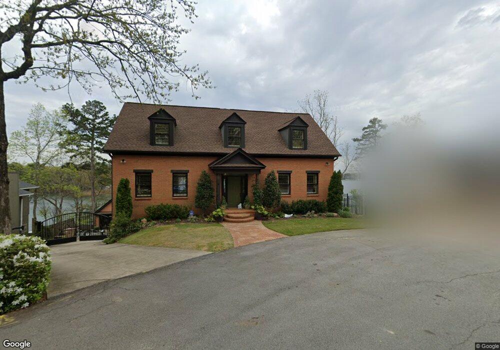
6145 N Point Dr Flowery Branch, GA 30542
Estimated Value: $819,864 - $1,223,000
3
Beds
4
Baths
3,612
Sq Ft
$290/Sq Ft
Est. Value
About This Home
This home is located at 6145 N Point Dr, Flowery Branch, GA 30542 and is currently estimated at $1,048,966, approximately $290 per square foot. 6145 N Point Dr is a home located in Hall County with nearby schools including Flowery Branch Elementary School, West Hall Middle School, and West Hall High School.
Ownership History
Date
Name
Owned For
Owner Type
Purchase Details
Closed on
May 25, 2011
Sold by
Sawyer-Desrosiers Kathy
Bought by
Sawyer-Desrosiers Kathy and Desrosiers Ivan
Current Estimated Value
Home Financials for this Owner
Home Financials are based on the most recent Mortgage that was taken out on this home.
Original Mortgage
$215,500
Outstanding Balance
$149,140
Interest Rate
4.79%
Mortgage Type
New Conventional
Estimated Equity
$899,826
Purchase Details
Closed on
May 23, 2011
Sold by
Dobbs H Talmage
Bought by
Sawyer-Desrosiers Kathy
Home Financials for this Owner
Home Financials are based on the most recent Mortgage that was taken out on this home.
Original Mortgage
$215,500
Outstanding Balance
$149,140
Interest Rate
4.79%
Mortgage Type
New Conventional
Estimated Equity
$899,826
Purchase Details
Closed on
Apr 19, 1999
Sold by
Trust Company Bank Trustee U/A
Bought by
White Joan Dobbs
Create a Home Valuation Report for This Property
The Home Valuation Report is an in-depth analysis detailing your home's value as well as a comparison with similar homes in the area
Home Values in the Area
Average Home Value in this Area
Purchase History
| Date | Buyer | Sale Price | Title Company |
|---|---|---|---|
| Sawyer-Desrosiers Kathy | -- | -- | |
| Sawyer-Desrosiers Kathy | -- | -- | |
| Sawyer-Desrosiers Kathy | $460,000 | -- | |
| State Of Georgia | -- | -- | |
| Desrosiers Kathy S | $230,000 | -- | |
| Sawyer-Desrosiers Kathy | -- | -- | |
| White Joan Dobbs | $700,000 | -- |
Source: Public Records
Mortgage History
| Date | Status | Borrower | Loan Amount |
|---|---|---|---|
| Open | Desrosiers Kathy S | $215,500 |
Source: Public Records
Tax History Compared to Growth
Tax History
| Year | Tax Paid | Tax Assessment Tax Assessment Total Assessment is a certain percentage of the fair market value that is determined by local assessors to be the total taxable value of land and additions on the property. | Land | Improvement |
|---|---|---|---|---|
| 2024 | $6,111 | $265,560 | $92,960 | $172,600 |
| 2023 | $5,492 | $256,320 | $92,960 | $163,360 |
| 2022 | $5,445 | $229,280 | $92,960 | $136,320 |
| 2021 | $5,575 | $211,800 | $92,960 | $118,840 |
| 2020 | $5,627 | $207,680 | $92,960 | $114,720 |
| 2019 | $5,554 | $203,160 | $92,960 | $110,200 |
| 2018 | $5,384 | $190,600 | $85,280 | $105,320 |
| 2017 | $5,119 | $183,120 | $85,280 | $97,840 |
| 2016 | $4,986 | $182,760 | $85,280 | $97,480 |
| 2015 | $4,177 | $182,760 | $85,280 | $97,480 |
| 2014 | $4,177 | $245,760 | $113,200 | $132,560 |
Source: Public Records
Map
Nearby Homes
- 6135 White Oak Dr
- 6137 White Oak Dr
- 6125 Jim Crow Rd
- 6026 Jim Crow Rd
- 5514 Mainsail Way
- 5610 Point Dr W
- 5359 Point Dr S
- 5046 McKinzey Ln
- 6025 River Oaks Dr
- 6144 Scott Dr
- 6144 Scott Dr Unit 8
- 5540 Stone Trace
- 6212 Costa Lake Point
- 5724 Sallee Cir
- 5411 Mayflower Ct
- 5657 Stephens Rd
- 6185 Old Stringer Rd
- 5626 Sallee Ave
- 5643 Stephens Rd
- 6141 N Point Dr
- 6147 N Point Dr
- 6147 N Point Dr Unit A
- 6147 Oak Hill Dr
- 6148 N Point Dr
- 6134 N Point Dr
- 6143 Oak Hill Dr
- 6146 N Point Dr
- 6139 Oak Hill Dr
- 6130 N Point Dr
- N N Point Dr Unit A
- N N Point Dr
- 6144 Oak Hill Dr
- 6135 Oak Hill Dr
- 6136 Oak Hill Dr
- 6122 N Point Dr
- 6121 N Point Dr
- 6133 Oak Hill Dr
- 6114 N Point Dr
- 6130 Oak Hill Dr