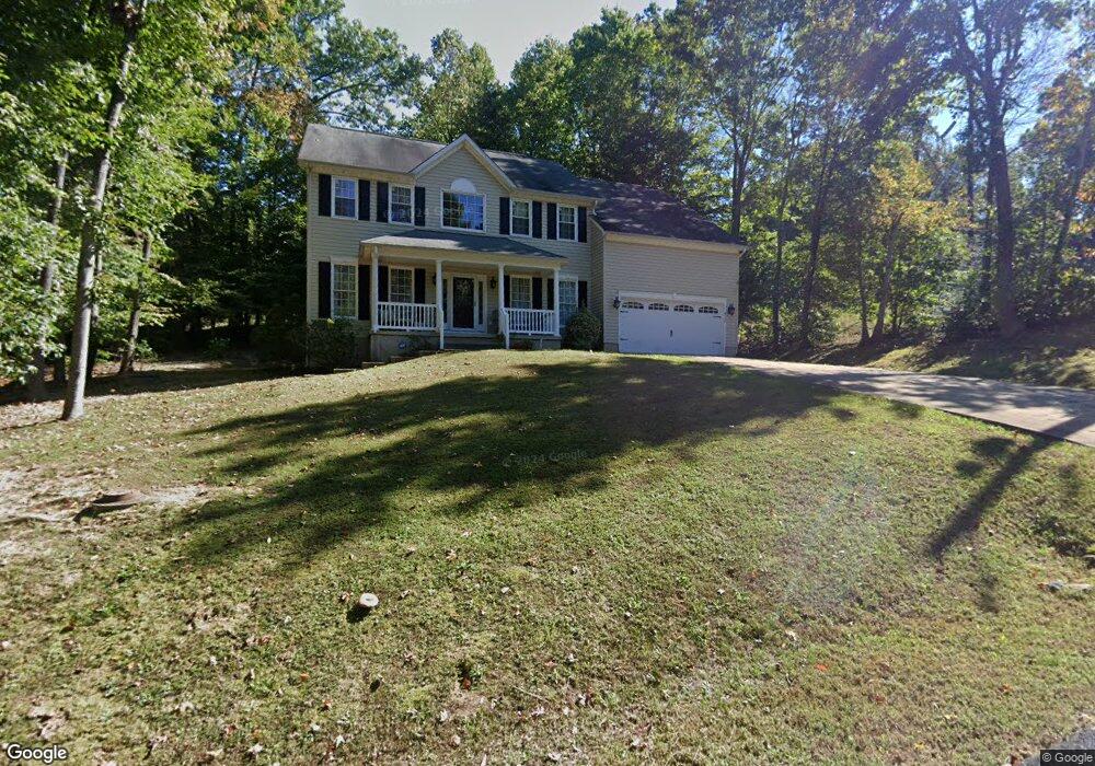
6146 Hobart Cir King George, VA 22485
Estimated Value: $437,943 - $514,000
4
Beds
3
Baths
2,520
Sq Ft
$190/Sq Ft
Est. Value
About This Home
This home is located at 6146 Hobart Cir, King George, VA 22485 and is currently estimated at $478,486, approximately $189 per square foot. 6146 Hobart Cir is a home located in King George County with nearby schools including Sealston Elementary School, King George Middle School, and King George High School.
Ownership History
Date
Name
Owned For
Owner Type
Purchase Details
Closed on
Feb 27, 2004
Sold by
Spear Bldrs Of Va Inc
Bought by
Ward Tia
Current Estimated Value
Home Financials for this Owner
Home Financials are based on the most recent Mortgage that was taken out on this home.
Original Mortgage
$215,600
Outstanding Balance
$100,621
Interest Rate
5.65%
Mortgage Type
New Conventional
Estimated Equity
$377,865
Purchase Details
Closed on
Dec 13, 2002
Sold by
Anderson Mary Eaton W
Bought by
Consolidated Land Inc
Create a Home Valuation Report for This Property
The Home Valuation Report is an in-depth analysis detailing your home's value as well as a comparison with similar homes in the area
Home Values in the Area
Average Home Value in this Area
Purchase History
| Date | Buyer | Sale Price | Title Company |
|---|---|---|---|
| Ward Tia | $269,525 | -- | |
| Consolidated Land Inc | $10,500 | -- |
Source: Public Records
Mortgage History
| Date | Status | Borrower | Loan Amount |
|---|---|---|---|
| Open | Ward Tia | $215,600 |
Source: Public Records
Tax History Compared to Growth
Tax History
| Year | Tax Paid | Tax Assessment Tax Assessment Total Assessment is a certain percentage of the fair market value that is determined by local assessors to be the total taxable value of land and additions on the property. | Land | Improvement |
|---|---|---|---|---|
| 2025 | $2,585 | $380,100 | $55,000 | $325,100 |
| 2024 | $2,585 | $380,100 | $55,000 | $325,100 |
| 2023 | $2,585 | $380,100 | $55,000 | $325,100 |
| 2022 | $2,433 | $380,100 | $55,000 | $325,100 |
| 2021 | $2,080 | $284,900 | $51,000 | $233,900 |
| 2020 | $1,994 | $284,900 | $51,000 | $233,900 |
| 2019 | $1,994 | $284,900 | $51,000 | $233,900 |
| 2018 | $1,994 | $284,900 | $51,000 | $233,900 |
| 2017 | $1,859 | $265,600 | $51,000 | $214,600 |
| 2016 | $1,806 | $265,600 | $51,000 | $214,600 |
| 2015 | -- | $265,600 | $51,000 | $214,600 |
| 2014 | -- | $265,600 | $51,000 | $214,600 |
Source: Public Records
Map
Nearby Homes
- 6193 Wheeler Dr
- 6234 Wheeler Dr
- 9065 Dallas Ct
- 6391 Wheeler Dr
- 8477 Colfax Dr
- LOT 117 Colfax Dr
- 6077 Hamlin Cir
- 8438 Colfax Dr
- 0 Belle Dr Unit VAKG2006212
- 7224 Washington Dr
- 9397 Inaugural Dr
- 0 Jefferson Dr Unit VAKG2006130
- 7512 Marmion Ln
- 8314 Myrtle Ln
- 7504 Cleveland Dr
- 7369 Buchanan Dr
- Lot 24 Compass Ct
- 8138 Lambs Creek Church Rd
- LOT 2 Caledon Rd
- 0 Dahlgren Rd
- 6136 Hobart Cir
- 6145 Hobart Cir
- 8584 Stevenson Dr
- 6123 Hobart Cir
- 6110 Hobart Cir
- 8558 Stevenson Dr
- 287 Dawes Dr
- 6218 Wheeler Dr
- 6223 Wheeler Dr
- 6159 Igo Rd
- 6184 Dawes Dr
- 6098 Hobart Cir
- 0 Hobart Cir Unit 1007730862
- 0 Hobart Cir Unit 1000911236
- 0 Hobart Cir Unit 1007133210
- 6097 Hobart Cir
- 6147 Igo Rd
- 8606 Stevenson Dr
- 8555 Stevenson Dr
- 8536 Stevenson Dr