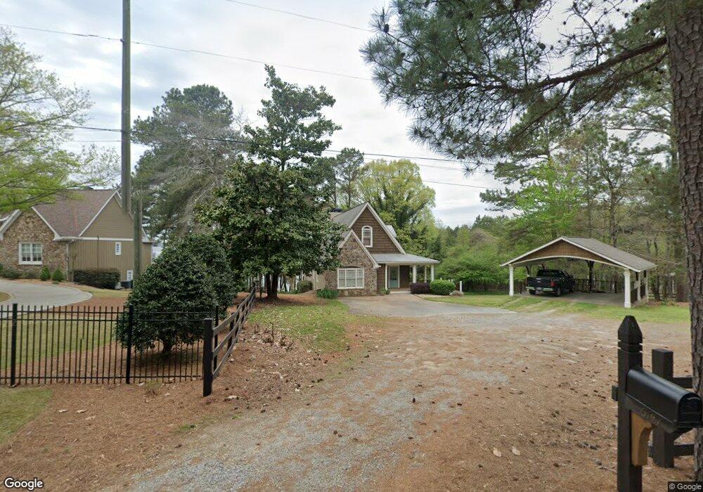
6147 Jim Crow Rd Flowery Branch, GA 30542
Estimated Value: $722,000 - $1,323,000
3
Beds
3
Baths
2,690
Sq Ft
$383/Sq Ft
Est. Value
About This Home
This home is located at 6147 Jim Crow Rd, Flowery Branch, GA 30542 and is currently estimated at $1,030,184, approximately $382 per square foot. 6147 Jim Crow Rd is a home located in Hall County with nearby schools including Flowery Branch Elementary School, West Hall Middle School, and West Hall High School.
Ownership History
Date
Name
Owned For
Owner Type
Purchase Details
Closed on
Aug 14, 2003
Sold by
Tyler Matthew G
Bought by
Tyler Matthew G and Tyler Mary
Current Estimated Value
Home Financials for this Owner
Home Financials are based on the most recent Mortgage that was taken out on this home.
Original Mortgage
$272,000
Outstanding Balance
$118,731
Interest Rate
5.5%
Mortgage Type
New Conventional
Estimated Equity
$911,454
Purchase Details
Closed on
Jan 4, 2002
Sold by
Bowers James R and Bowers Beverly S
Bought by
Tyler Matthew G and Tyler Mary Z
Create a Home Valuation Report for This Property
The Home Valuation Report is an in-depth analysis detailing your home's value as well as a comparison with similar homes in the area
Home Values in the Area
Average Home Value in this Area
Purchase History
| Date | Buyer | Sale Price | Title Company |
|---|---|---|---|
| Tyler Matthew G | -- | -- | |
| Tyler Matthew G | -- | -- | |
| Tyler Matthew G | -- | -- |
Source: Public Records
Mortgage History
| Date | Status | Borrower | Loan Amount |
|---|---|---|---|
| Open | Tyler Matthew G | $272,000 |
Source: Public Records
Tax History Compared to Growth
Tax History
| Year | Tax Paid | Tax Assessment Tax Assessment Total Assessment is a certain percentage of the fair market value that is determined by local assessors to be the total taxable value of land and additions on the property. | Land | Improvement |
|---|---|---|---|---|
| 2024 | $9,443 | $381,656 | $220,760 | $160,896 |
| 2023 | $5,947 | $255,808 | $110,360 | $145,448 |
| 2022 | $5,121 | $198,108 | $75,360 | $122,748 |
| 2021 | $5,197 | $197,392 | $75,360 | $122,032 |
| 2020 | $5,208 | $192,152 | $75,360 | $116,792 |
| 2019 | $5,102 | $186,552 | $75,360 | $111,192 |
| 2018 | $4,969 | $175,872 | $69,160 | $106,712 |
| 2017 | $4,659 | $166,592 | $69,160 | $97,432 |
| 2016 | $4,457 | $163,312 | $69,160 | $94,152 |
| 2015 | $4,442 | $161,432 | $69,160 | $92,272 |
| 2014 | $4,442 | $161,432 | $69,160 | $92,272 |
Source: Public Records
Map
Nearby Homes
- 6141 Jim Crow Rd
- 6157 Jim Crow Rd
- 6146 Jim Crow Rd
- 6133 Jim Crow Rd
- 6158 Jim Crow Rd
- 6136 Jim Crow Rd
- 6170 Jim Crow Rd
- 6117 Jim Crow Rd
- 6172 Jim Crow Rd
- 6196 Lakeside Dr
- 6194 Lakeside Dr
- 6198 Lakeside Dr
- 61197 Lakeside Dr
- 6105 Jim Crow Rd
- 6192 Lakeside Dr
- 6190 Lakeside Dr
- 6188 Lakeside Dr
- 6197 Lakeside Dr
- 6186 Lakeside Dr
- 6095 Jim Crow Rd