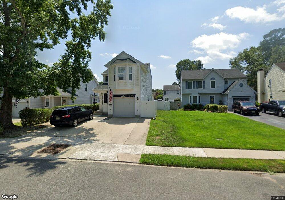
6148 Robin Dr Mays Landing, NJ 08330
Estimated Value: $356,562 - $370,000
3
Beds
3
Baths
1,716
Sq Ft
$212/Sq Ft
Est. Value
About This Home
This home is located at 6148 Robin Dr, Mays Landing, NJ 08330 and is currently estimated at $363,391, approximately $211 per square foot. 6148 Robin Dr is a home located in Atlantic County with nearby schools including Joseph Shaner School, George L. Hess Educational Complex, and William Davies Middle School.
Ownership History
Date
Name
Owned For
Owner Type
Purchase Details
Closed on
Apr 9, 2010
Sold by
Fraone Joseph and Fraone Carol A
Bought by
Taylor John C and Taylor Jennifer L
Current Estimated Value
Home Financials for this Owner
Home Financials are based on the most recent Mortgage that was taken out on this home.
Original Mortgage
$212,244
Outstanding Balance
$142,200
Interest Rate
5.12%
Mortgage Type
New Conventional
Estimated Equity
$221,191
Purchase Details
Closed on
Jul 30, 1993
Sold by
Hamilton Pointe Holdings Corp
Bought by
Fraone Joseph and Fraone Carol A
Create a Home Valuation Report for This Property
The Home Valuation Report is an in-depth analysis detailing your home's value as well as a comparison with similar homes in the area
Home Values in the Area
Average Home Value in this Area
Purchase History
| Date | Buyer | Sale Price | Title Company |
|---|---|---|---|
| Taylor John C | $208,000 | Foundation Title | |
| Fraone Joseph | $108,400 | -- |
Source: Public Records
Mortgage History
| Date | Status | Borrower | Loan Amount |
|---|---|---|---|
| Open | Taylor John C | $212,244 |
Source: Public Records
Tax History Compared to Growth
Tax History
| Year | Tax Paid | Tax Assessment Tax Assessment Total Assessment is a certain percentage of the fair market value that is determined by local assessors to be the total taxable value of land and additions on the property. | Land | Improvement |
|---|---|---|---|---|
| 2025 | $6,069 | $176,900 | $32,600 | $144,300 |
| 2024 | $6,069 | $176,900 | $32,600 | $144,300 |
| 2023 | $5,707 | $176,900 | $32,600 | $144,300 |
| 2022 | $5,707 | $176,900 | $32,600 | $144,300 |
| 2021 | $5,694 | $176,900 | $32,600 | $144,300 |
| 2020 | $5,694 | $176,900 | $32,600 | $144,300 |
| 2019 | $5,709 | $176,900 | $32,600 | $144,300 |
| 2018 | $5,509 | $176,900 | $32,600 | $144,300 |
| 2017 | $5,422 | $176,900 | $32,600 | $144,300 |
| 2016 | $5,624 | $188,800 | $42,600 | $146,200 |
| 2015 | $5,434 | $188,800 | $42,600 | $146,200 |
| 2014 | $5,401 | $205,600 | $47,600 | $158,000 |
Source: Public Records
Map
Nearby Homes
- 6140 Robin Dr
- 0 Harding Hwy Unit 597638
- 0 Harding Hwy Unit NJAC2019438
- 6251 Old Harding Hwy
- 6206 Roberts Ave
- 6302 Palmer Ave
- 6126 Longwood Ave
- 87 Devon Rd
- 6314 Lance Ave
- 6301 Knight Ave
- 6310 Phillips Ave
- 37 Delancy Ct
- 80 Mill St
- 1305 Matthews Ave
- 15 Lowell St
- 1 Lafayette Ave
- 1404 Loretta Ave
- 16 Holly Ct
- 24 Holly Ct
- 1403 Loretta Ave
- 6146 Robin Dr
- 6150 Robin Dr
- 6144 Robin Dr
- 6152 Robin Dr
- 6147 Goldfinch Dr
- 6149 Goldfinch Dr
- 6145 Goldfinch Dr
- 6142 Robin Dr
- 6143 Goldfinch Ct
- 6151 Goldfinch Dr
- 6154 Robin Dr
- 6153 Goldfinch Dr
- 6147 Robin Dr
- 6141 Goldfinch Ct
- 6145 Robin Dr
- 6155 Goldfinch Dr
- 6149 Robin Dr
- 6151 Robin Dr
- 6139 Goldfinch Ct
- 6143 Robin Dr