Estimated Value: $125,556 - $164,000
3
Beds
2
Baths
1,104
Sq Ft
$135/Sq Ft
Est. Value
About This Home
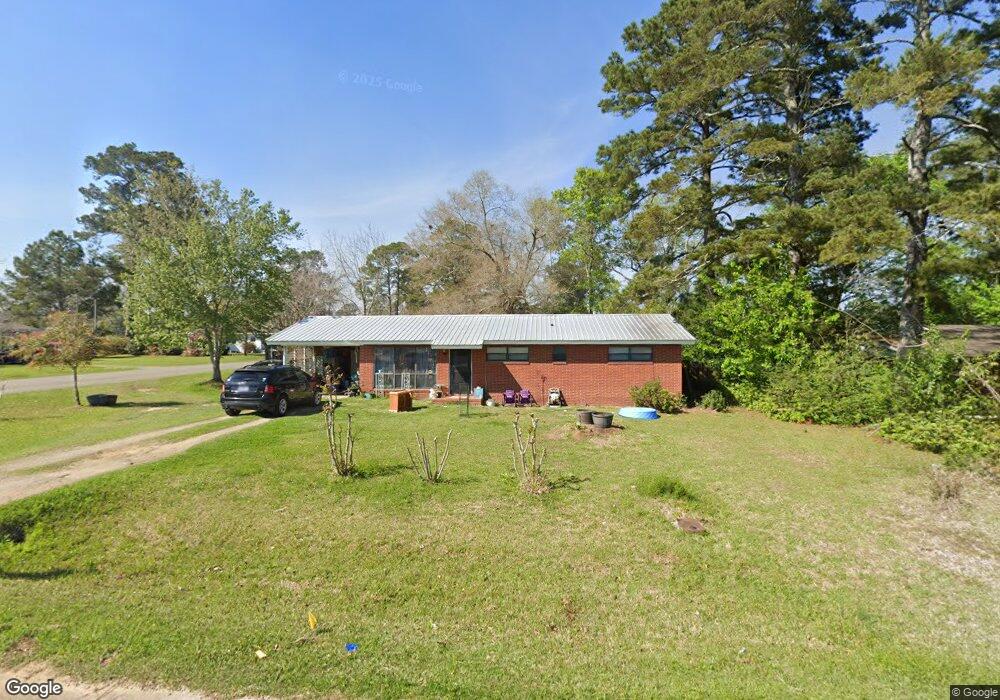
This home is located at 615 10th Ave SE, Cairo, GA 39828 and is currently estimated at $148,889, approximately $134 per square foot. 615 10th Ave SE is a home located in Grady County with nearby schools including Cairo High School.
Ownership History
Date
Name
Owned For
Owner Type
Purchase Details
Closed on
Mar 12, 2013
Sold by
Vickers Wanda Sue
Bought by
Graham Brittany S
Current Estimated Value
Home Financials for this Owner
Home Financials are based on the most recent Mortgage that was taken out on this home.
Original Mortgage
$55,612
Outstanding Balance
$38,618
Interest Rate
3.57%
Mortgage Type
New Conventional
Estimated Equity
$110,271
Purchase Details
Closed on
Jan 6, 2011
Sold by
Thomas Shirley Marion
Bought by
Vickers Wanda Sue
Purchase Details
Closed on
Sep 14, 2005
Sold by
Britt Eilene H
Bought by
Vickers Wanda S and Vickers Thomas Shirley Marion
Purchase Details
Closed on
Oct 31, 1977
Bought by
Britt Eilene
Create a Home Valuation Report for This Property
The Home Valuation Report is an in-depth analysis detailing your home's value as well as a comparison with similar homes in the area
Purchase History
| Date | Buyer | Sale Price | Title Company |
|---|---|---|---|
| Graham Brittany S | $54,000 | -- | |
| Vickers Wanda Sue | -- | -- | |
| Vickers Wanda S | -- | -- | |
| Britt Eilene | -- | -- |
Source: Public Records
Mortgage History
| Date | Status | Borrower | Loan Amount |
|---|---|---|---|
| Open | Graham Brittany S | $55,612 |
Source: Public Records
Tax History
| Year | Tax Paid | Tax Assessment Tax Assessment Total Assessment is a certain percentage of the fair market value that is determined by local assessors to be the total taxable value of land and additions on the property. | Land | Improvement |
|---|---|---|---|---|
| 2025 | $1,348 | $44,760 | $2,420 | $42,340 |
| 2024 | $1,348 | $40,158 | $2,420 | $37,738 |
| 2023 | $943 | $25,465 | $2,880 | $22,585 |
| 2022 | $981 | $25,465 | $2,880 | $22,585 |
| 2021 | $983 | $25,465 | $2,880 | $22,585 |
| 2020 | $986 | $25,465 | $2,880 | $22,585 |
| 2019 | $976 | $25,210 | $2,880 | $22,330 |
| 2018 | $927 | $25,210 | $2,880 | $22,330 |
| 2017 | $892 | $25,210 | $2,880 | $22,330 |
| 2016 | $762 | $21,052 | $2,880 | $18,172 |
| 2015 | $754 | $21,052 | $2,880 | $18,172 |
| 2014 | $754 | $21,052 | $2,880 | $18,172 |
| 2013 | -- | $18,472 | $2,880 | $15,592 |
Source: Public Records
Map
Nearby Homes
- 530 6th St
- 530 6th Ave SE
- 580 5th St SE
- 306 Midland Place
- 1405 Platt Ave
- 1406 Platt Ave
- 1193 S Broad St
- 592 20th St SE
- 309 3rd St SE
- 112 Pine Cir SW
- 117 SW Pine Cirlce
- 00 Blackberry Ln
- 00 Meridian Rd
- 460 2nd St SW
- 198 Oakdale Rd SE
- 711 2nd Ave NE
- 130 17th Ave SE
- X 1st St
- 0 1st St
- 4761 Hadley Ferry Rd
- 635 10th Ave SE
- 984 6th St SE
- 610 9th Ave SE
- 1087 6th St SE
- 634 9th Ave SE
- 577 10th Ave SE
- 590 9th Ave SE
- 673 10th Ave SE
- 611 9th Ave SE
- 631 9th Ave SE
- 644 9th Ave SE
- 664 10th Ave SE
- 559 10th Ave SE
- 1185 6th St SE
- 808 6th St SE
- 560 9th Ave SE
- 690 10th Ave SE
- 647 9th Ave SE
- 647 9th Ave SE
- 658 11th Ave SE
Your Personal Tour Guide
Ask me questions while you tour the home.