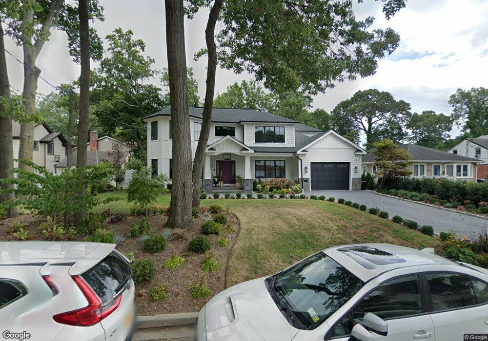
615 Adams Place West Hempstead, NY 11552
Estimated Value: $1,808,000 - $1,923,456
2
Beds
1
Bath
3,568
Sq Ft
$523/Sq Ft
Est. Value
About This Home
This home is located at 615 Adams Place, West Hempstead, NY 11552 and is currently estimated at $1,865,728, approximately $522 per square foot. 615 Adams Place is a home located in Nassau County with nearby schools including Chestnut Street School, West Hempstead Secondary School, and Hebrew Academy of Nassau County (HANC).
Ownership History
Date
Name
Owned For
Owner Type
Purchase Details
Closed on
May 28, 2015
Sold by
Niedz Justine
Bought by
Isseroff Donnie and Isseroff Tova
Current Estimated Value
Home Financials for this Owner
Home Financials are based on the most recent Mortgage that was taken out on this home.
Original Mortgage
$288,000
Outstanding Balance
$222,265
Interest Rate
3.65%
Mortgage Type
New Conventional
Estimated Equity
$1,643,463
Create a Home Valuation Report for This Property
The Home Valuation Report is an in-depth analysis detailing your home's value as well as a comparison with similar homes in the area
Home Values in the Area
Average Home Value in this Area
Purchase History
| Date | Buyer | Sale Price | Title Company |
|---|---|---|---|
| Isseroff Donnie | $375,000 | Sutton Land Title |
Source: Public Records
Mortgage History
| Date | Status | Borrower | Loan Amount |
|---|---|---|---|
| Open | Isseroff Donnie | $288,000 |
Source: Public Records
Tax History Compared to Growth
Tax History
| Year | Tax Paid | Tax Assessment Tax Assessment Total Assessment is a certain percentage of the fair market value that is determined by local assessors to be the total taxable value of land and additions on the property. | Land | Improvement |
|---|---|---|---|---|
| 2025 | $15,409 | $1,123 | $265 | $858 |
| 2024 | $4,039 | $1,140 | $238 | $902 |
| 2023 | $5,903 | $968 | $265 | $703 |
| 2022 | $5,055 | $238 | $238 | $0 |
| 2021 | $10,884 | $459 | $295 | $164 |
| 2020 | $10,019 | $557 | $556 | $1 |
| 2019 | $3,157 | $597 | $492 | $105 |
| 2018 | $6,963 | $608 | $0 | $0 |
| 2017 | $8,194 | $778 | $664 | $114 |
| 2016 | $11,942 | $778 | $664 | $114 |
| 2015 | $3,485 | $778 | $664 | $114 |
| 2014 | $3,485 | $778 | $664 | $114 |
| 2013 | $3,265 | $778 | $664 | $114 |
Source: Public Records
Map
Nearby Homes
- 321 Oakford St
- 757 Harrison St
- 686 Tanwood Dr
- 513 Washington Ave
- 635 Hempstead Ave
- 853 Arthur St
- 613 Adams Ave
- 590 Langley Ave
- 518 Nassau Blvd
- 582 Gaynor Place
- 467 Susan Ct
- 647 Jennings Ave
- 596 Lincoln Ave
- 899 Cleveland St
- 537 Madison Ave
- 815 Sunshine Ave
- 629 Park Ave
- 450 Rhodes Ln
- 841 Woodfield Rd
- 0 Rhodes Ln