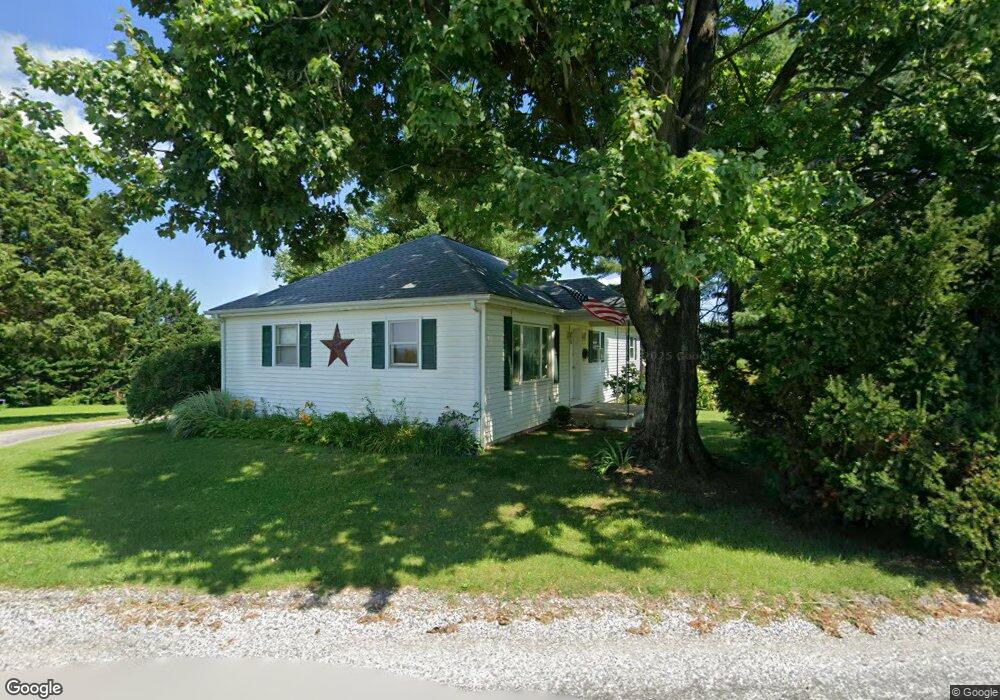
615 Alum Rock Rd New Park, PA 17352
Estimated Value: $215,809 - $675,000
2
Beds
1
Bath
1,104
Sq Ft
$337/Sq Ft
Est. Value
About This Home
This home is located at 615 Alum Rock Rd, New Park, PA 17352 and is currently estimated at $372,452, approximately $337 per square foot. 615 Alum Rock Rd is a home located in York County with nearby schools including South Eastern Intermediate School, South Eastern Middle School, and Kennard-Dale High School.
Ownership History
Date
Name
Owned For
Owner Type
Purchase Details
Closed on
May 24, 2010
Sold by
Traynor Karen A and Traynor Leonard M
Bought by
Traynor Leonard M
Current Estimated Value
Home Financials for this Owner
Home Financials are based on the most recent Mortgage that was taken out on this home.
Original Mortgage
$130,000
Outstanding Balance
$87,475
Interest Rate
5.13%
Mortgage Type
New Conventional
Estimated Equity
$284,977
Purchase Details
Closed on
Jul 16, 2004
Sold by
Young Donald A and Young Barbara J
Bought by
Traynor Karen A and Traynor Leonard M
Purchase Details
Closed on
May 27, 1999
Sold by
Dennett Lucy A
Bought by
Young Donald A and Young Barbara J
Home Financials for this Owner
Home Financials are based on the most recent Mortgage that was taken out on this home.
Original Mortgage
$105,950
Interest Rate
6.82%
Mortgage Type
VA
Create a Home Valuation Report for This Property
The Home Valuation Report is an in-depth analysis detailing your home's value as well as a comparison with similar homes in the area
Home Values in the Area
Average Home Value in this Area
Purchase History
| Date | Buyer | Sale Price | Title Company |
|---|---|---|---|
| Traynor Leonard M | -- | None Available | |
| Traynor Karen A | $92,501 | -- | |
| Young Donald A | $103,900 | -- |
Source: Public Records
Mortgage History
| Date | Status | Borrower | Loan Amount |
|---|---|---|---|
| Open | Traynor Leonard M | $130,000 | |
| Previous Owner | Young Donald A | $105,950 |
Source: Public Records
Tax History Compared to Growth
Tax History
| Year | Tax Paid | Tax Assessment Tax Assessment Total Assessment is a certain percentage of the fair market value that is determined by local assessors to be the total taxable value of land and additions on the property. | Land | Improvement |
|---|---|---|---|---|
| 2025 | $3,660 | $122,420 | $50,000 | $72,420 |
| 2024 | $3,660 | $122,420 | $50,000 | $72,420 |
| 2023 | $3,660 | $122,420 | $50,000 | $72,420 |
| 2022 | $3,660 | $122,420 | $50,000 | $72,420 |
| 2021 | $3,538 | $122,420 | $50,000 | $72,420 |
| 2020 | $3,538 | $122,420 | $50,000 | $72,420 |
| 2019 | $3,526 | $122,420 | $50,000 | $72,420 |
| 2018 | $3,526 | $122,420 | $50,000 | $72,420 |
| 2017 | $3,526 | $122,420 | $50,000 | $72,420 |
| 2016 | $0 | $122,420 | $50,000 | $72,420 |
| 2015 | -- | $122,420 | $50,000 | $72,420 |
| 2014 | -- | $122,420 | $50,000 | $72,420 |
Source: Public Records
Map
Nearby Homes
- 0 Lutz Rd Unit PAYK2091350
- 387 Garvine Mill Rd
- 9377 Hickory Rd
- 14292 Kilgore Rd
- 370 High Rock Rd
- 31 N Market St
- 15792 Cross Mill Rd
- 2131 Channel Rd
- 1701 Scott Rd
- 18183 Piedmont Rd
- Lot 4 Ridge Rd
- 18010 Dave Anne Cir
- 1081 Bridgeton Rd
- 140 Lantern Ln
- 5403 New Park Rd
- 8290 Woodbine Rd
- 194 Cook Rd
- 267 Cook Rd
- 14754 Lowe Rd
- 4816 Amos Rd
- 686 Alum Rock Rd
- 688 Alum Rock Rd
- 712 Alum Rock Rd
- 740 Alum Rock Rd
- 717 Cedar Valley Rd
- 779 Cedar Valley Rd
- 815 Cedar Valley Rd
- 760 Cedar Valley Rd
- 782 Cedar Valley Rd
- 825 Cedar Valley Rd
- 362 Cedar Valley Rd
- 808 Alum Rock Rd
- 465 Channell Rd
- 499 Channell Rd
- 828 Alum Rock Rd
- 324 Cedar Valley Rd
- 441 Channell Rd
- 415 Channell Rd
- 496 Channell Rd
- 128 Strawbridge Rd