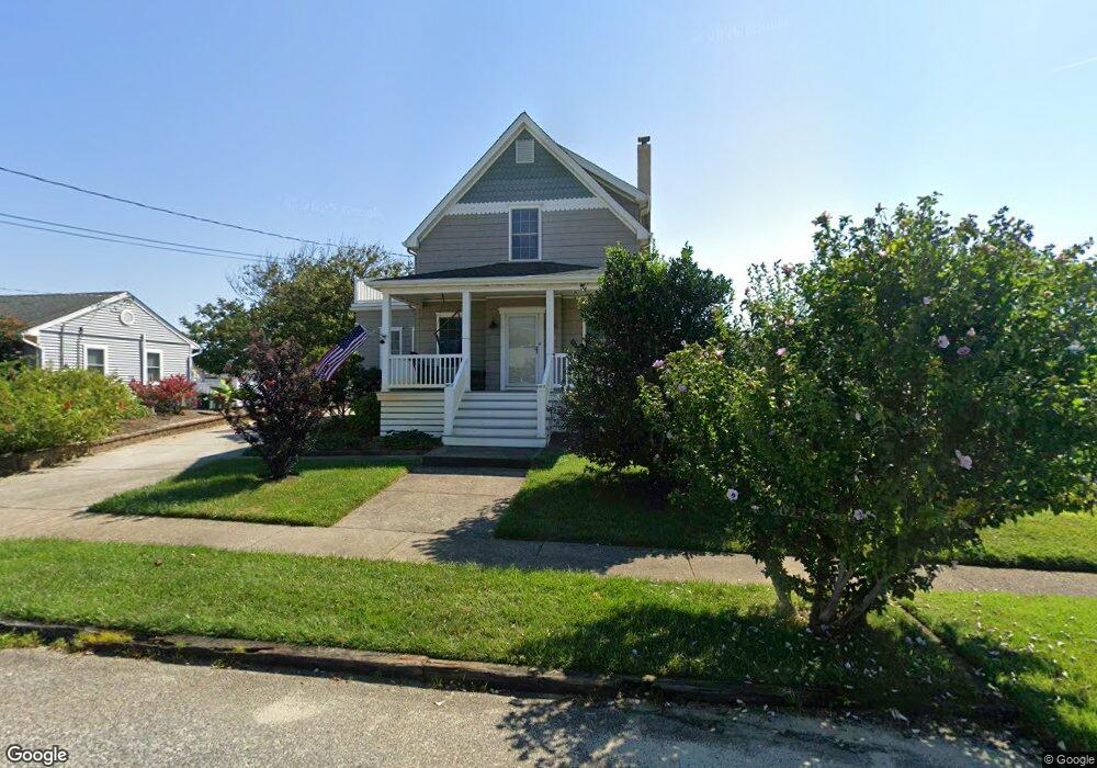
615 Atlantic Ave Cape May, NJ 08204
Estimated Value: $892,444 - $1,325,000
--
Bed
--
Bath
1,934
Sq Ft
$551/Sq Ft
Est. Value
About This Home
This home is located at 615 Atlantic Ave, Cape May, NJ 08204 and is currently estimated at $1,066,111, approximately $551 per square foot. 615 Atlantic Ave is a home located in Cape May County with nearby schools including Carl T. Mitnick School, David C. Douglass Veterans Memorial School, and Maud Abrams School.
Ownership History
Date
Name
Owned For
Owner Type
Purchase Details
Closed on
Jul 15, 2002
Sold by
Dolt Alvin
Bought by
Ward John J and Ward Kathleen
Current Estimated Value
Home Financials for this Owner
Home Financials are based on the most recent Mortgage that was taken out on this home.
Original Mortgage
$131,100
Outstanding Balance
$55,655
Interest Rate
6.73%
Estimated Equity
$1,010,456
Create a Home Valuation Report for This Property
The Home Valuation Report is an in-depth analysis detailing your home's value as well as a comparison with similar homes in the area
Home Values in the Area
Average Home Value in this Area
Purchase History
| Date | Buyer | Sale Price | Title Company |
|---|---|---|---|
| Ward John J | $160,000 | -- |
Source: Public Records
Mortgage History
| Date | Status | Borrower | Loan Amount |
|---|---|---|---|
| Open | Ward John J | $131,100 |
Source: Public Records
Tax History Compared to Growth
Tax History
| Year | Tax Paid | Tax Assessment Tax Assessment Total Assessment is a certain percentage of the fair market value that is determined by local assessors to be the total taxable value of land and additions on the property. | Land | Improvement |
|---|---|---|---|---|
| 2025 | $6,844 | $349,800 | $182,400 | $167,400 |
| 2024 | $6,844 | $349,800 | $182,400 | $167,400 |
| 2023 | $6,743 | $349,800 | $182,400 | $167,400 |
| 2022 | $6,529 | $349,800 | $182,400 | $167,400 |
| 2021 | $6,060 | $349,800 | $182,400 | $167,400 |
| 2020 | $6,221 | $349,800 | $182,400 | $167,400 |
| 2019 | $6,060 | $349,800 | $182,400 | $167,400 |
| 2018 | $5,910 | $349,800 | $182,400 | $167,400 |
| 2017 | $5,917 | $349,800 | $182,400 | $167,400 |
| 2016 | $5,823 | $349,800 | $182,400 | $167,400 |
| 2015 | $5,627 | $349,800 | $182,400 | $167,400 |
| 2014 | $5,434 | $349,800 | $182,400 | $167,400 |
Source: Public Records
Map
Nearby Homes
- 1500 Franklin Ave
- 711 Beach Dr
- 1400 Franklin Ave
- 503 Beach Dr
- 508 Adriatic Ave
- 712 Indian Ave
- 401 Beach Dr
- 1607 Scott Ave
- 1310 Browning Ave
- 702 Gordon Terrace
- 507 Scotty Blvd Unit 12
- 219 Town Bank Rd
- 402 Whildam Ave
- 602 Gorham Ave
- 113 Beachhurst Dr
- 712 Gorham Ave
- 305 Whildam Ave
- 106 Racetrack Dr
- 66 Beachhurst Dr
- 10 Folsom Ave
- 1603 Rosehill Pkwy
- 613 Atlantic Ave
- 611 Atlantic Ave
- 614 Pacific Ave
- 612 Pacific Ave
- 1601 Rosehill Pkwy
- 610 Pacific Ave
- 609 Atlantic Ave
- 614 Atlantic Ave
- 701 Atlantic Ave
- 1701 Rosehill Pkwy
- 612 Atlantic Ave
- 608 Pacific Ave
- 610 Atlantic Ave
- 700 Pacific Ave
- 607 Atlantic Ave
- 703 Atlantic Ave
- 608 Atlantic Ave
- 1700 Rosehill Pkwy
- 606 Pacific Ave