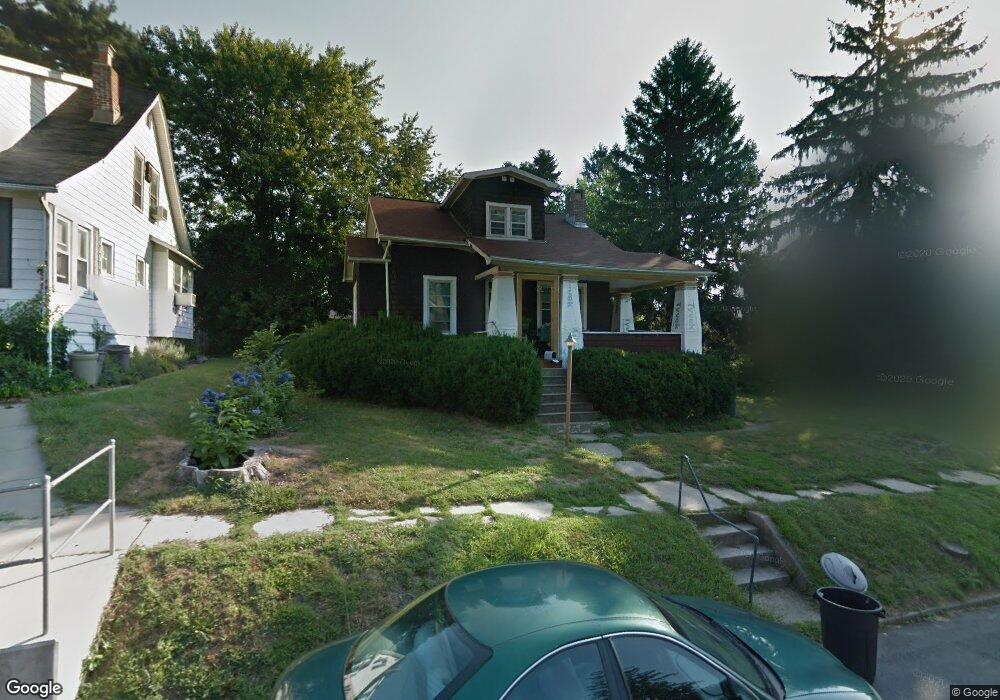
615 Coleraine Rd Baltimore, MD 21229
Estimated Value: $268,033 - $397,000
--
Bed
1
Bath
1,570
Sq Ft
$224/Sq Ft
Est. Value
About This Home
This home is located at 615 Coleraine Rd, Baltimore, MD 21229 and is currently estimated at $351,758, approximately $224 per square foot. 615 Coleraine Rd is a home located in Baltimore County with nearby schools including Westowne Elementary, Catonsville Middle School, and Catonsville High School.
Ownership History
Date
Name
Owned For
Owner Type
Purchase Details
Closed on
Feb 1, 2005
Sold by
Ingerson Gordon T Ingerson Gerri
Bought by
Ingerson Gordon T and Ingerson Gerri
Current Estimated Value
Home Financials for this Owner
Home Financials are based on the most recent Mortgage that was taken out on this home.
Original Mortgage
$115,000
Outstanding Balance
$64,292
Interest Rate
7.3%
Mortgage Type
Adjustable Rate Mortgage/ARM
Estimated Equity
$287,466
Purchase Details
Closed on
Jan 31, 2005
Sold by
Ingerson Gordon T Ingerson Gerri
Bought by
Ingerson Gordon T and Ingerson Gerri
Home Financials for this Owner
Home Financials are based on the most recent Mortgage that was taken out on this home.
Original Mortgage
$115,000
Outstanding Balance
$64,292
Interest Rate
7.3%
Mortgage Type
Adjustable Rate Mortgage/ARM
Estimated Equity
$287,466
Create a Home Valuation Report for This Property
The Home Valuation Report is an in-depth analysis detailing your home's value as well as a comparison with similar homes in the area
Home Values in the Area
Average Home Value in this Area
Purchase History
| Date | Buyer | Sale Price | Title Company |
|---|---|---|---|
| Ingerson Gordon T | -- | -- | |
| Ingerson Gordon T | -- | -- |
Source: Public Records
Mortgage History
| Date | Status | Borrower | Loan Amount |
|---|---|---|---|
| Open | Ingerson Gordon T | $115,000 |
Source: Public Records
Tax History Compared to Growth
Tax History
| Year | Tax Paid | Tax Assessment Tax Assessment Total Assessment is a certain percentage of the fair market value that is determined by local assessors to be the total taxable value of land and additions on the property. | Land | Improvement |
|---|---|---|---|---|
| 2025 | $3,117 | $233,467 | -- | -- |
| 2024 | $3,117 | $219,300 | $82,200 | $137,100 |
| 2023 | $3,031 | $209,800 | $0 | $0 |
| 2022 | $3,102 | $200,300 | $0 | $0 |
| 2021 | $2,644 | $190,800 | $82,200 | $108,600 |
| 2020 | $2,644 | $184,967 | $0 | $0 |
| 2019 | $2,623 | $179,133 | $0 | $0 |
| 2018 | $2,489 | $173,300 | $77,200 | $96,100 |
| 2017 | $2,727 | $164,467 | $0 | $0 |
| 2016 | -- | $155,633 | $0 | $0 |
| 2015 | $1,946 | $146,800 | $0 | $0 |
| 2014 | $1,946 | $146,800 | $0 | $0 |
Source: Public Records
Map
Nearby Homes
- 632 Plymouth Rd
- 639 Plymouth Rd
- 617 North Bend
- 413 Lambeth Rd
- 630 Braeside Rd
- 321 Stratford Rd
- 5301 Edmondson Ave
- 315 Westowne Rd
- 5904 Edmondson Ave
- 6 Cromarty Rd
- 112 Mallow Hill Rd
- 5201 Old Frederick Rd
- 10 Mardrew Rd
- 322 Whitfield Rd
- 215 Medwick Garth E
- 6142 Regent Park Rd
- 408 N Rock Glen Rd
- 19 Somerset Rd
- 711 W Hills Pkwy
- 961 Saint Agnes Ln
- 617 Coleraine Rd
- 613 Coleraine Rd
- 619 Coleraine Rd
- 618 Plymouth Rd
- 620 Plymouth Rd
- 620 Plymouth Rd Unit B
- 616 Plymouth Rd
- 622 Plymouth Rd
- 611 Coleraine Rd
- 621 Coleraine Rd
- 614 Coleraine Rd
- 616 Coleraine Rd
- 614 Plymouth Rd
- 624 Plymouth Rd
- 618 Coleraine Rd
- 612 Coleraine Rd
- 609 Coleraine Rd
- 610 Coleraine Rd
- 626 Plymouth Rd
- 620 Coleraine Rd