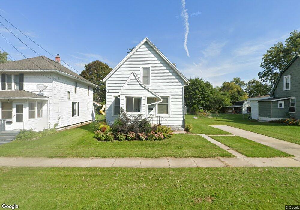
615 Eaton St Unit 615 Eaton St Jackson, MI 49202
West Ganson NeighborhoodEstimated Value: $138,000 - $162,000
4
Beds
2
Baths
1,512
Sq Ft
$101/Sq Ft
Est. Value
About This Home
This home is located at 615 Eaton St Unit 615 Eaton St, Jackson, MI 49202 and is currently estimated at $151,982, approximately $100 per square foot. 615 Eaton St Unit 615 Eaton St is a home located in Jackson County with nearby schools including Hunt Elementary School, Middle School at Parkside, and Jackson High School.
Ownership History
Date
Name
Owned For
Owner Type
Purchase Details
Closed on
Mar 16, 2021
Sold by
Huynh Ngoc Que Thi
Bought by
Alsobrooks Amy
Current Estimated Value
Home Financials for this Owner
Home Financials are based on the most recent Mortgage that was taken out on this home.
Original Mortgage
$81,600
Outstanding Balance
$73,272
Interest Rate
2.8%
Mortgage Type
New Conventional
Estimated Equity
$78,710
Purchase Details
Closed on
Apr 25, 2018
Sold by
Cousino Alvin and Cousino Alvin Ervin
Bought by
Thi Huynh Ngoc Que
Purchase Details
Closed on
Jan 26, 2016
Sold by
Jimenez Corey and Jimenez Katharine
Bought by
Cousino Alvin Ervin
Create a Home Valuation Report for This Property
The Home Valuation Report is an in-depth analysis detailing your home's value as well as a comparison with similar homes in the area
Home Values in the Area
Average Home Value in this Area
Purchase History
| Date | Buyer | Sale Price | Title Company |
|---|---|---|---|
| Alsobrooks Amy | $102,000 | Devon Title Agency | |
| Thi Huynh Ngoc Que | $25,000 | Barrister Settlement & Title | |
| Cousino Alvin Ervin | $5,753 | At |
Source: Public Records
Mortgage History
| Date | Status | Borrower | Loan Amount |
|---|---|---|---|
| Open | Alsobrooks Amy | $81,600 |
Source: Public Records
Tax History Compared to Growth
Tax History
| Year | Tax Paid | Tax Assessment Tax Assessment Total Assessment is a certain percentage of the fair market value that is determined by local assessors to be the total taxable value of land and additions on the property. | Land | Improvement |
|---|---|---|---|---|
| 2025 | $2,886 | $73,300 | $0 | $0 |
| 2024 | $2,357 | $66,100 | $0 | $0 |
| 2023 | $2,269 | $57,900 | $0 | $0 |
| 2022 | $2,646 | $51,900 | $0 | $0 |
| 2021 | $1,684 | $42,750 | $0 | $0 |
| 2020 | $2,240 | $39,150 | $0 | $0 |
| 2019 | $2,179 | $31,050 | $0 | $0 |
| 2018 | $1,557 | $25,600 | $0 | $0 |
| 2017 | $1,428 | $22,250 | $0 | $0 |
| 2016 | $1,214 | $23,600 | $23,600 | $0 |
| 2015 | $979 | $26,500 | $26,500 | $0 |
| 2014 | $979 | $26,100 | $0 | $0 |
| 2013 | -- | $26,100 | $26,100 | $0 |
Source: Public Records
Map
Nearby Homes
- 804 Hibbard Ave
- 821 N Wisner St
- 819 N West Ave
- 713 Webb St
- 612 Bush St
- 836 Lincoln St
- 916 Wildwood Ave
- V/L N Brown St
- 834 N Brown St
- 1513 Daniel Rd
- 613 Backus St
- 828 Backus St
- 807 Winifred St
- 902 Backus St
- 923 Wayne St
- 205 N West Ave
- 910 Backus St
- 108 N Thompson St
- 109 N Thompson St
- 806 W Michigan Ave Unit 32