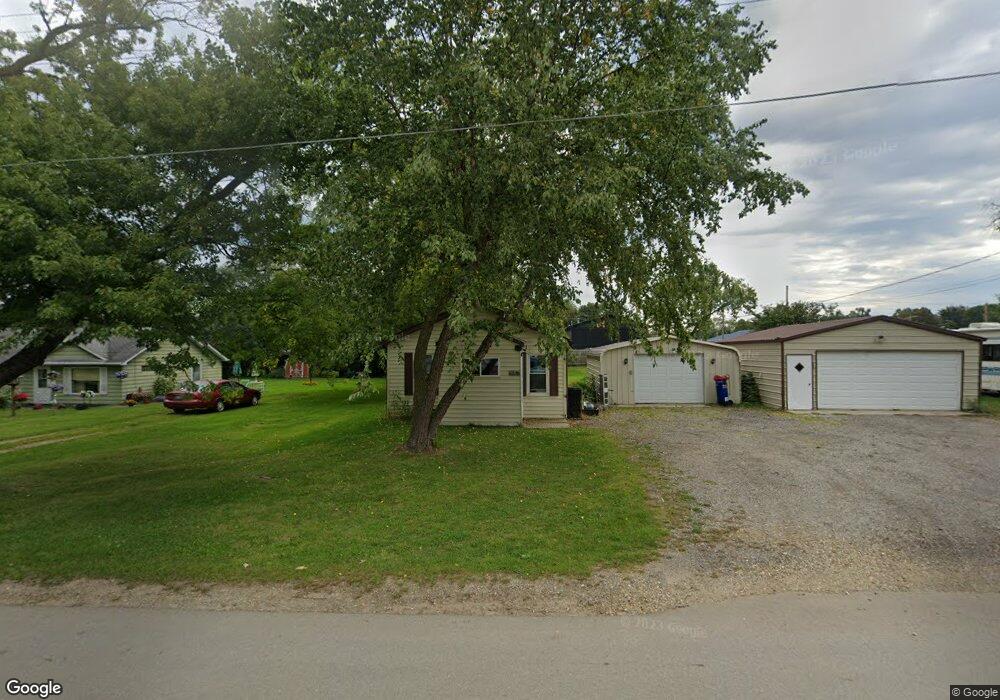
615 Evanston Dr Jackson, MI 49202
Estimated Value: $108,000 - $179,000
Studio
--
Bath
--
Sq Ft
5,358
Sq Ft
About This Home
This home is located at 615 Evanston Dr, Jackson, MI 49202 and is currently estimated at $137,953. 615 Evanston Dr is a home located in Jackson County with nearby schools including Hunt Elementary School, Middle School at Parkside, and Jackson High School.
Ownership History
Date
Name
Owned For
Owner Type
Purchase Details
Closed on
Sep 5, 2003
Sold by
Castle Brian C and Castle Corrie L
Bought by
Mcphail David L
Current Estimated Value
Home Financials for this Owner
Home Financials are based on the most recent Mortgage that was taken out on this home.
Original Mortgage
$76,500
Outstanding Balance
$35,342
Interest Rate
6.18%
Mortgage Type
VA
Estimated Equity
$102,611
Purchase Details
Closed on
Mar 31, 1997
Bought by
R G Hubbard Company Inc
Create a Home Valuation Report for This Property
The Home Valuation Report is an in-depth analysis detailing your home's value as well as a comparison with similar homes in the area
Home Values in the Area
Average Home Value in this Area
Purchase History
| Date | Buyer | Sale Price | Title Company |
|---|---|---|---|
| Mcphail David L | $75,000 | -- | |
| R G Hubbard Company Inc | -- | -- |
Source: Public Records
Mortgage History
| Date | Status | Borrower | Loan Amount |
|---|---|---|---|
| Open | Mcphail David L | $76,500 |
Source: Public Records
Tax History
| Year | Tax Paid | Tax Assessment Tax Assessment Total Assessment is a certain percentage of the fair market value that is determined by local assessors to be the total taxable value of land and additions on the property. | Land | Improvement |
|---|---|---|---|---|
| 2025 | $349 | $11,900 | $0 | $0 |
| 2024 | $2 | $10,750 | $0 | $0 |
| 2023 | $194 | $9,800 | $0 | $0 |
| 2022 | $312 | $9,300 | $0 | $0 |
| 2021 | $306 | $8,300 | $0 | $0 |
| 2020 | $302 | $7,900 | $0 | $0 |
| 2019 | $294 | $7,800 | $0 | $0 |
| 2018 | $269 | $7,500 | $0 | $0 |
| 2017 | $234 | $7,100 | $0 | $0 |
| 2016 | $144 | $7,052 | $7,052 | $0 |
| 2015 | $179 | $5,247 | $5,247 | $0 |
| 2014 | $179 | $5,231 | $5,231 | $0 |
| 2013 | -- | $5,231 | $5,231 | $0 |
Source: Public Records
Map
Nearby Homes
- VL Laurence Ave
- 0 VL Laurence Ave
- 534 Barrett Ave
- 0 Laurence Ave Unit 25062864
- 2318 Westminster Blvd
- 1050 Maynard Ave
- 870 Bryant Ave
- 242 Kenneth St
- 0 Evelyn St
- 1802 W Argyle St
- 0 N Brown St
- 923 Wayne St
- 310 21st St
- 693 Leo Rd
- 406 21st St
- 3250 Carlton Blvd
- 1604 W Washington Ave
- 760 Woodbine Blvd
- 1512 W Washington Ave
- 723 22nd St
- 615 Evanston Dr
- 615 Evanston Dr
- 621 Evanston Dr
- 692 Evanston Dr
- 704 Evanston Dr
- 2890 Wildwood Ave
- 721 Evanston Dr
- 700 Evanston Dr
- 2910 Wildwood Ave
- 740 Laurence Ave
- 700 Laurence Ave
- 708 Evanston Dr
- 725 Evanston Dr
- 2918 Wildwood Ave
- 1 Laurence Ave
- V/L Laurence Ave
- 800 Evanston Dr
- 800 Evanston Dr
- 2922 Wildwood Ave
- 2922 Wildwood Ave
Your Personal Tour Guide
Ask me questions while you tour the home.