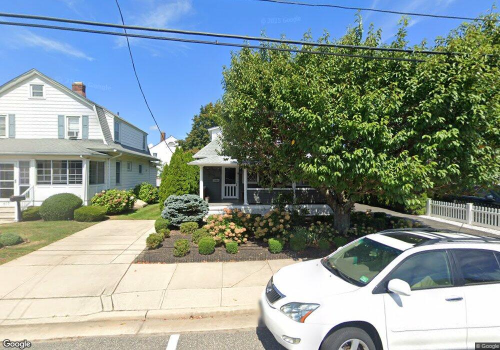
615 Forman Ave Point Pleasant Beach, NJ 08742
Point Pleasant Beach NeighborhoodEstimated Value: $699,128 - $817,000
3
Beds
2
Baths
3,024
Sq Ft
$255/Sq Ft
Est. Value
About This Home
This home is located at 615 Forman Ave, Point Pleasant Beach, NJ 08742 and is currently estimated at $771,532, approximately $255 per square foot. 615 Forman Ave is a home located in Ocean County with nearby schools including G Harold Antrim Elementary School, Point Pleasant Beach High School, and St. Peter School.
Ownership History
Date
Name
Owned For
Owner Type
Purchase Details
Closed on
Feb 18, 2020
Sold by
Rozell Barbara Marie and Durik Giovannina
Bought by
Blanco Raul and Blanco Jane
Current Estimated Value
Home Financials for this Owner
Home Financials are based on the most recent Mortgage that was taken out on this home.
Original Mortgage
$369,000
Outstanding Balance
$326,724
Interest Rate
3.6%
Mortgage Type
New Conventional
Estimated Equity
$444,808
Purchase Details
Closed on
Jan 20, 1982
Bought by
Durik Giovannino
Create a Home Valuation Report for This Property
The Home Valuation Report is an in-depth analysis detailing your home's value as well as a comparison with similar homes in the area
Home Values in the Area
Average Home Value in this Area
Purchase History
| Date | Buyer | Sale Price | Title Company |
|---|---|---|---|
| Blanco Raul | $410,000 | Old Republic Title | |
| Durik Giovannino | $35,000 | -- |
Source: Public Records
Mortgage History
| Date | Status | Borrower | Loan Amount |
|---|---|---|---|
| Open | Blanco Raul | $369,000 |
Source: Public Records
Tax History Compared to Growth
Tax History
| Year | Tax Paid | Tax Assessment Tax Assessment Total Assessment is a certain percentage of the fair market value that is determined by local assessors to be the total taxable value of land and additions on the property. | Land | Improvement |
|---|---|---|---|---|
| 2025 | $5,561 | $323,700 | $240,000 | $83,700 |
| 2024 | $5,393 | $323,700 | $240,000 | $83,700 |
| 2023 | $5,241 | $323,700 | $240,000 | $83,700 |
| 2022 | $5,241 | $323,700 | $240,000 | $83,700 |
| 2021 | $4,731 | $323,700 | $240,000 | $83,700 |
| 2020 | $5,118 | $323,700 | $240,000 | $83,700 |
| 2019 | $5,046 | $323,700 | $240,000 | $83,700 |
| 2018 | $4,969 | $323,700 | $240,000 | $83,700 |
| 2017 | $4,891 | $323,700 | $240,000 | $83,700 |
| 2016 | $4,664 | $323,700 | $240,000 | $83,700 |
| 2015 | $4,625 | $323,700 | $240,000 | $83,700 |
| 2014 | $4,602 | $323,700 | $240,000 | $83,700 |
Source: Public Records
Map
Nearby Homes
- 607 Richmond Ave Unit 4
- 606 Bay Ave Unit 2
- 606 Bay Ave Unit 3
- 704 Forman Ave
- 503 Atlantic Ave
- 728 Arnold Ave
- 818 Atlantic Ave
- 800 Grove St
- 842 Arnold Ave Unit 2
- 842 Arnold Ave Unit 3
- 325 Hawthorne Ave Unit 327
- 845 Arnold Ave Unit 3
- 326 Curtis Ave Unit Lot 27
- 804 Clark St
- 201 Forman Ave
- 328 Curtis Ave Unit Lot 28
- 118 New York Ave
- 909 Ocean Rd Unit 4
- 1008 Ocean Ave N
- 204 Curtis Ave
- 617 Forman Ave
- 613 Forman Ave
- 611 Forman Ave
- 612 Trenton Ave
- 609 Forman Ave
- 621 Forman Ave
- 610 Trenton Ave
- 614 Forman Ave
- 612 Forman Ave
- 612 Forman Ave Unit garage apartment
- 612 Forman Ave Unit right side
- 616 Forman Ave
- 608 Trenton Ave
- 618 Forman Ave
- 610 Forman Ave
- 607 Forman Ave
- 623 Forman Ave
- 606 Trenton Ave
- 622 Trenton Ave Unit 201
- 622 Trenton Ave Unit 202