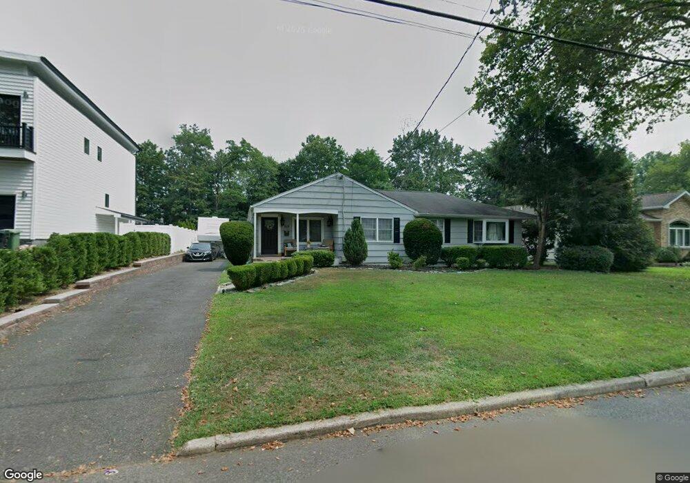
615 Freeland Ave Paramus, NJ 07652
Estimated Value: $913,000 - $993,000
4
Beds
2
Baths
1,772
Sq Ft
$537/Sq Ft
Est. Value
About This Home
This home is located at 615 Freeland Ave, Paramus, NJ 07652 and is currently estimated at $952,439, approximately $537 per square foot. 615 Freeland Ave is a home located in Bergen County with nearby schools including Paramus High School, Alpine Learning Group, and Paramus Catholic High School.
Ownership History
Date
Name
Owned For
Owner Type
Purchase Details
Closed on
Dec 30, 2020
Sold by
Introna Michael and Introna Kim
Bought by
Nunez Luis Enrique and Toribio Emiliana Marisol
Current Estimated Value
Home Financials for this Owner
Home Financials are based on the most recent Mortgage that was taken out on this home.
Original Mortgage
$557,676
Interest Rate
2.65%
Mortgage Type
FHA
Purchase Details
Closed on
Aug 22, 2006
Sold by
Vella William M
Bought by
Introna Michael and Introna Kim
Create a Home Valuation Report for This Property
The Home Valuation Report is an in-depth analysis detailing your home's value as well as a comparison with similar homes in the area
Home Values in the Area
Average Home Value in this Area
Purchase History
| Date | Buyer | Sale Price | Title Company |
|---|---|---|---|
| Nunez Luis Enrique | $599,000 | Stewart Title Guaranty | |
| Introna Michael | $537,500 | -- |
Source: Public Records
Mortgage History
| Date | Status | Borrower | Loan Amount |
|---|---|---|---|
| Previous Owner | Nunez Luis Enrique | $557,676 |
Source: Public Records
Tax History Compared to Growth
Tax History
| Year | Tax Paid | Tax Assessment Tax Assessment Total Assessment is a certain percentage of the fair market value that is determined by local assessors to be the total taxable value of land and additions on the property. | Land | Improvement |
|---|---|---|---|---|
| 2025 | $9,647 | $687,200 | $396,500 | $290,700 |
| 2024 | $9,339 | $637,200 | $361,800 | $275,400 |
| 2023 | $8,825 | $608,800 | $344,500 | $264,300 |
| 2022 | $8,825 | $568,600 | $321,000 | $247,600 |
| 2021 | $8,584 | $519,000 | $291,400 | $227,600 |
| 2020 | $7,666 | $480,600 | $286,400 | $194,200 |
| 2019 | $7,446 | $401,200 | $257,900 | $143,300 |
| 2018 | $7,354 | $401,200 | $257,900 | $143,300 |
| 2017 | $7,226 | $401,200 | $257,900 | $143,300 |
| 2016 | $7,029 | $401,200 | $257,900 | $143,300 |
| 2015 | $6,957 | $401,200 | $257,900 | $143,300 |
| 2014 | $6,897 | $401,200 | $257,900 | $143,300 |
Source: Public Records
Map
Nearby Homes
- 605 Craig Ave
- 648 Falmouth Ave
- 83 Birchwood Rd
- 133 Morristown Place
- 232 W Midland Ave
- 265 Purdue Ct
- 602 Mill Run
- 495 Paramus Rd
- 101 Glen Ave
- 660 Arcadia Rd
- 33 Oliver Rd
- 12 Pershing Ave
- 827 Alden Rd
- 780 Hilton Place
- 11 Gabriel Ct
- 12 Gabriel Ct
- 16 Gabriel Ct
- 801 Godwin Rd
- 479 S Pleasant Ave
- 683 Eastern Ct
- 611 Freeland Ave
- 619 Freeland Ave
- 607 Freeland Ave
- 623 Freeland Ave
- 614 Falmouth Ave
- 618 Falmouth Ave
- 610 Falmouth Ave
- 614 Freeland Ave
- 142 Arundel Rd
- 603 Freeland Ave
- 620 Falmouth Ave
- 627 Freeland Ave
- 606 Falmouth Ave
- 610 Freeland Ave
- 624 Freeland Ave
- 606 Freeland Ave
- 599 Freeland Ave
- 602 Falmouth Ave
- 624 Falmouth Ave
- 145 Arundel Rd