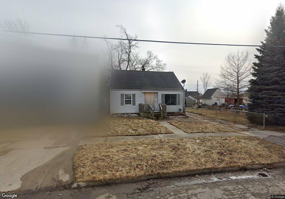
615 Huron St Flint, MI 48507
South Side NeighborhoodEstimated Value: $54,000 - $98,000
3
Beds
1
Bath
933
Sq Ft
$79/Sq Ft
Est. Value
About This Home
This home is located at 615 Huron St, Flint, MI 48507 and is currently estimated at $73,398, approximately $78 per square foot. 615 Huron St is a home located in Genesee County with nearby schools including Neithercut Elementary School, Flint Southwestern Classical Academy, and International Academy of Flint (K-12).
Ownership History
Date
Name
Owned For
Owner Type
Purchase Details
Closed on
May 23, 2022
Sold by
Genesee County Land Bank Authority
Bought by
Snyder Kim Oliver
Current Estimated Value
Purchase Details
Closed on
Mar 30, 2022
Sold by
Frost Theresa A
Bought by
Circuit Court For Genesee County
Purchase Details
Closed on
Dec 19, 2019
Sold by
Cherry Deborah L
Bought by
County Land Bank Authority
Purchase Details
Closed on
Dec 3, 2014
Sold by
Estate Of Michael G Bradley
Bought by
Frost Theresa A
Purchase Details
Closed on
Aug 20, 2010
Sold by
Delaine Thomas Michael James and Delaine Thomas
Bought by
Bradley Michael G
Create a Home Valuation Report for This Property
The Home Valuation Report is an in-depth analysis detailing your home's value as well as a comparison with similar homes in the area
Home Values in the Area
Average Home Value in this Area
Purchase History
| Date | Buyer | Sale Price | Title Company |
|---|---|---|---|
| Snyder Kim Oliver | $5,000 | None Listed On Document | |
| Circuit Court For Genesee County | -- | -- | |
| County Land Bank Authority | -- | None Available | |
| Frost Theresa A | -- | None Available | |
| Bradley Michael G | $29,000 | Sargents Title Company |
Source: Public Records
Tax History
| Year | Tax Paid | Tax Assessment Tax Assessment Total Assessment is a certain percentage of the fair market value that is determined by local assessors to be the total taxable value of land and additions on the property. | Land | Improvement |
|---|---|---|---|---|
| 2025 | $1,557 | $25,700 | $0 | $0 |
| 2024 | $1,433 | $22,500 | $0 | $0 |
| 2023 | $1,393 | $17,600 | $0 | $0 |
| 2022 | $0 | $16,400 | $0 | $0 |
| 2021 | $0 | $0 | $0 | $0 |
| 2020 | $268 | $0 | $0 | $0 |
| 2019 | $1,555 | $11,100 | $0 | $0 |
| 2018 | $1,015 | $11,900 | $0 | $0 |
| 2017 | $1,485 | $0 | $0 | $0 |
| 2016 | $981 | $0 | $0 | $0 |
| 2015 | -- | $0 | $0 | $0 |
| 2014 | -- | $0 | $0 | $0 |
| 2012 | -- | $14,900 | $0 | $0 |
Source: Public Records
Map
Nearby Homes
- 612 Clinton St
- 652 Crawford St
- 1216 E Hemphill Rd
- 805 Alvord Ave
- 806 Alvord Ave
- 829 Clinton St
- 3902 Cuthbertson St
- 845 Alvord Ave
- 1219 Norton St
- 912 Huron St
- 846 W Hemphill Rd
- 822 Campbell St
- 3902 Brunswick Ave
- 1015 Alvord Ave
- 1388 Carman St
- 805 Vermilya Ave
- 825 Vermilya Ave
- 1453 Carman St
- 1028 Campbell St
- 3214 S Grand Traverse St
- 611 Huron St
- 623 Huron St
- 616 Ingleside Ave
- 612 Ingleside Ave
- 620 Ingleside Ave
- 4402 S Grand Traverse St
- 4408 S Grand Traverse St
- 627 Huron St
- 624 Ingleside Ave
- 4412 S Grand Traverse St
- 616 Huron St
- 612 Huron St
- 620 Huron St
- 4416 S Grand Traverse St
- 628 Ingleside Ave
- 4316 S Grand Traverse St
- 631 Huron St
- 624 Huron St
- 628 Huron St
- 4312 S Grand Traverse St
Your Personal Tour Guide
Ask me questions while you tour the home.