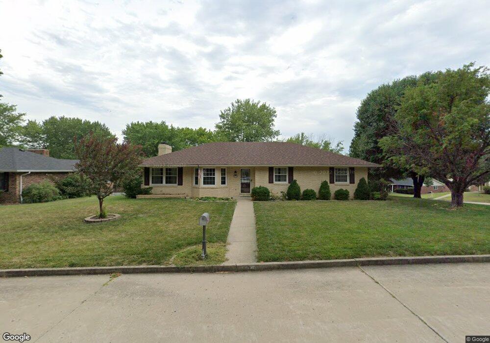
615 Meier Dr Jefferson City, MO 65109
Estimated Value: $272,000 - $290,000
3
Beds
3
Baths
1,692
Sq Ft
$165/Sq Ft
Est. Value
About This Home
This home is located at 615 Meier Dr, Jefferson City, MO 65109 and is currently estimated at $278,760, approximately $164 per square foot. 615 Meier Dr is a home located in Cole County with nearby schools including West Elementary School, Thomas Jefferson Middle School, and Jefferson City High School.
Ownership History
Date
Name
Owned For
Owner Type
Purchase Details
Closed on
Mar 1, 2021
Sold by
Convery James C and Convery Denise A
Bought by
Convery Shane M
Current Estimated Value
Home Financials for this Owner
Home Financials are based on the most recent Mortgage that was taken out on this home.
Original Mortgage
$180,000
Outstanding Balance
$147,514
Interest Rate
2.7%
Mortgage Type
Stand Alone Refi Refinance Of Original Loan
Estimated Equity
$131,246
Create a Home Valuation Report for This Property
The Home Valuation Report is an in-depth analysis detailing your home's value as well as a comparison with similar homes in the area
Home Values in the Area
Average Home Value in this Area
Purchase History
| Date | Buyer | Sale Price | Title Company |
|---|---|---|---|
| Convery Shane M | -- | None Available |
Source: Public Records
Mortgage History
| Date | Status | Borrower | Loan Amount |
|---|---|---|---|
| Open | Convery Shane M | $180,000 |
Source: Public Records
Tax History Compared to Growth
Tax History
| Year | Tax Paid | Tax Assessment Tax Assessment Total Assessment is a certain percentage of the fair market value that is determined by local assessors to be the total taxable value of land and additions on the property. | Land | Improvement |
|---|---|---|---|---|
| 2025 | $1,835 | $30,770 | $3,420 | $27,350 |
| 2024 | $1,835 | $30,770 | $3,420 | $27,350 |
| 2023 | $1,835 | $30,770 | $3,420 | $27,350 |
| 2022 | $1,748 | $29,220 | $0 | $29,220 |
| 2021 | $1,758 | $29,220 | $0 | $29,220 |
| 2020 | $1,779 | $29,222 | $3,420 | $25,802 |
| 2019 | $1,730 | $29,222 | $3,420 | $25,802 |
| 2018 | $1,615 | $30,495 | $3,420 | $27,075 |
| 2017 | $1,577 | $27,322 | $3,420 | $23,902 |
| 2016 | $1,343 | $27,322 | $3,420 | $23,902 |
| 2015 | $1,348 | $0 | $0 | $0 |
| 2014 | $1,348 | $27,322 | $3,420 | $23,902 |
Source: Public Records
Map
Nearby Homes
- 604 Norris Dr
- 406 Meier Dr
- 301 Binder Dr
- 325 Crest Dr
- 401 Norris Dr
- 812 Boonville Rd
- 713 Belmont Dr
- 1934 Hayselton Dr
- 2628 Lola Dr
- 117 Bolton Dr
- 0 Jaycee Dr
- 134 W Circle Dr
- 2016 W Main St
- 130 Lavinia St
- 140 Riverwood Dr
- 1128 Boonville Rd
- 2910 Sue Dr
- 1615 Paddlewheel Cir
- 1837 W Mccarty St
- 1626 W Main St