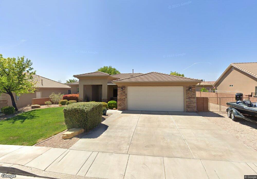
615 N 1620 W St. George, UT 84770
Estimated Value: $476,000 - $490,000
4
Beds
2
Baths
1,850
Sq Ft
$261/Sq Ft
Est. Value
About This Home
This home is located at 615 N 1620 W, St. George, UT 84770 and is currently estimated at $482,271, approximately $260 per square foot. 615 N 1620 W is a home located in Washington County with nearby schools including Sunset School, Snow Canyon Middle School, and Lava Ridge Intermediate School.
Ownership History
Date
Name
Owned For
Owner Type
Purchase Details
Closed on
Dec 6, 2018
Sold by
Jarman Deborah
Bought by
Jarman William and Jarman Deborah L
Current Estimated Value
Purchase Details
Closed on
Jul 5, 2016
Sold by
Mott Connie Hene and Mott Revocable Trust
Bought by
Jarman Deborah
Purchase Details
Closed on
May 8, 2008
Sold by
Mott Connie Ilene and Mott Donald Barry
Bought by
Mott Donald Barry and Mott Connie Ilene
Purchase Details
Closed on
Nov 20, 2007
Sold by
Mott Donald B and Mott Connie I
Bought by
Mott Donald Barry and Mott Connie Ilene
Home Financials for this Owner
Home Financials are based on the most recent Mortgage that was taken out on this home.
Original Mortgage
$85,000
Interest Rate
6.38%
Mortgage Type
Credit Line Revolving
Purchase Details
Closed on
Sep 8, 2005
Sold by
Mott Donald B and Mott Connie I
Bought by
Mott Donald Barry and Mott Connie Ilene
Create a Home Valuation Report for This Property
The Home Valuation Report is an in-depth analysis detailing your home's value as well as a comparison with similar homes in the area
Home Values in the Area
Average Home Value in this Area
Purchase History
| Date | Buyer | Sale Price | Title Company |
|---|---|---|---|
| Jarman William | -- | None Available | |
| Jarman Deborah | -- | Southern Utah Title | |
| Mott Donald Barry | -- | First American Clv | |
| Mott Donald Barry | -- | American Secure Title St Geo | |
| Mott Donald B | -- | American Secure Title St Geo | |
| Mott Donald Barry | -- | None Available |
Source: Public Records
Mortgage History
| Date | Status | Borrower | Loan Amount |
|---|---|---|---|
| Previous Owner | Mott Donald B | $85,000 |
Source: Public Records
Tax History Compared to Growth
Tax History
| Year | Tax Paid | Tax Assessment Tax Assessment Total Assessment is a certain percentage of the fair market value that is determined by local assessors to be the total taxable value of land and additions on the property. | Land | Improvement |
|---|---|---|---|---|
| 2025 | $1,721 | $262,735 | $46,750 | $215,985 |
| 2023 | $1,831 | $273,625 | $35,750 | $237,875 |
| 2022 | $1,920 | $269,720 | $35,750 | $233,970 |
| 2021 | $1,735 | $363,500 | $45,000 | $318,500 |
| 2020 | $1,558 | $307,400 | $45,000 | $262,400 |
| 2019 | $1,541 | $297,100 | $50,000 | $247,100 |
| 2018 | $1,473 | $146,630 | $0 | $0 |
| 2017 | $1,365 | $131,945 | $0 | $0 |
| 2016 | $1,413 | $126,280 | $0 | $0 |
| 2015 | $1,342 | $115,115 | $0 | $0 |
| 2014 | $153 | $124,465 | $0 | $0 |
Source: Public Records
Map
Nearby Homes
- 1732 N 540 W Unit 120
- 1732 W 540 N Unit 120
- 1732 W 540 N Unit 13
- 1732 W 540 N Unit 68
- 1732 W 540 N Unit 17
- 1732 W 540 N Unit 92
- 1735 W 540 N Unit 1006
- 1735 W 540 N Unit 2302
- 1735 W 540 N Unit 2302
- 1735 W 540 N Unit 1202
- 1735 W 540 N Unit 1001
- 1385 W 625 N
- 1385 W 625 North St
- 954 N 1725 W Unit 32
- 1793 W 950 N Unit 3
- 695 N Daybreak Dr
- 727 N 1275 W
- 1244 W 620 Cir N
- 1708 W 1020 N Unit 146
- 1742 W 1020 N Unit 123
- 615 N 1620 West Cir
- 627 N 1620 West Cir
- 599 N 1620 West Cir
- 599 N 1620 W Unit 25
- 585 N 1620 W
- 641 N 1620 West Cir
- 641 N 1620 W
- 612 N 1620 W
- 612 N 1620 West Cir
- 585 N 1620 West Cir
- 626 N 1620 West Cir
- 598 N 1620 W Unit 3
- 598 N 1620 W
- 598 N 1620 West Cir
- 1611 W 650 N
- 0 1620 St W
- 0 1620 St W
- 0 1620 St W
- 584 N 1620 W
- 584 N 1620 West Cir