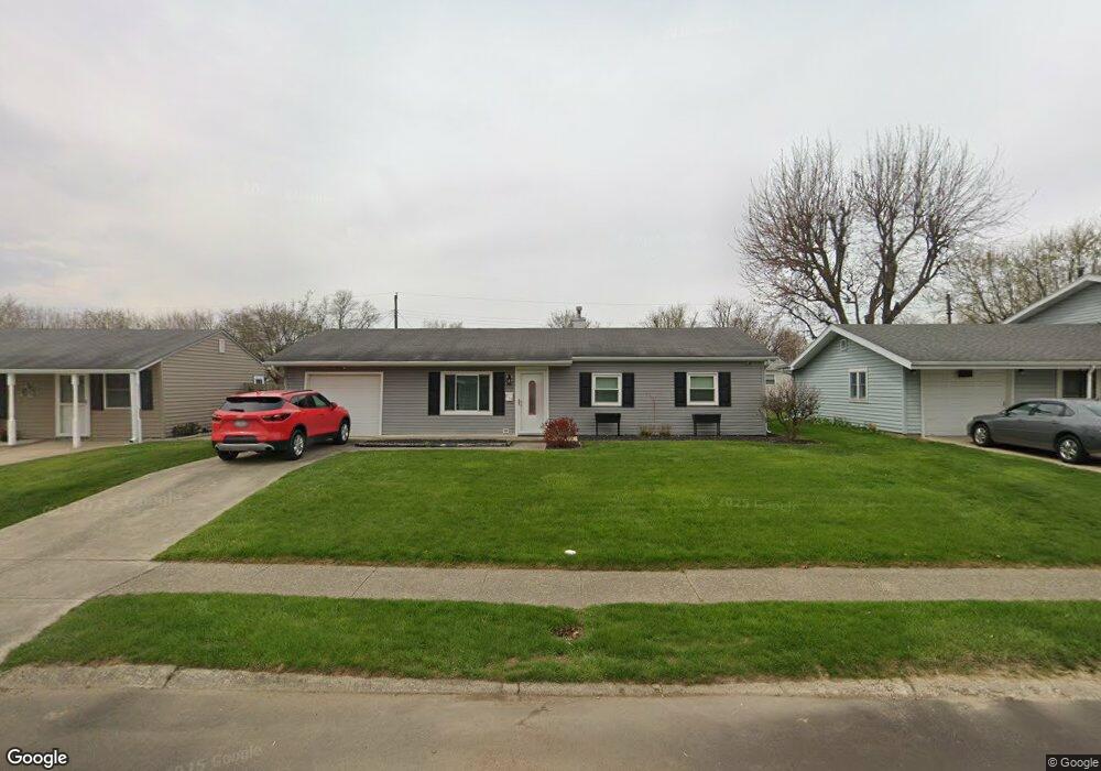
615 N Bradner Ave Marion, IN 46952
Sunnywest NeighborhoodEstimated Value: $120,000 - $133,611
3
Beds
1
Bath
912
Sq Ft
$138/Sq Ft
Est. Value
About This Home
This home is located at 615 N Bradner Ave, Marion, IN 46952 and is currently estimated at $126,153, approximately $138 per square foot. 615 N Bradner Ave is a home located in Grant County with nearby schools including John W. Kendall Elementary School, Justice Thurgood Marshall Intermediate School, and John L. McCulloch Junior High School.
Ownership History
Date
Name
Owned For
Owner Type
Purchase Details
Closed on
Mar 19, 2008
Sold by
Sproat Donald J and Sproat Terrie L
Bought by
Sproat Terrie L
Current Estimated Value
Home Financials for this Owner
Home Financials are based on the most recent Mortgage that was taken out on this home.
Original Mortgage
$79,373
Outstanding Balance
$51,070
Interest Rate
6.36%
Mortgage Type
FHA
Estimated Equity
$75,083
Create a Home Valuation Report for This Property
The Home Valuation Report is an in-depth analysis detailing your home's value as well as a comparison with similar homes in the area
Home Values in the Area
Average Home Value in this Area
Purchase History
| Date | Buyer | Sale Price | Title Company |
|---|---|---|---|
| Sproat Terrie L | -- | Land America Onestop | |
| Sproat Terrie L | -- | None Available |
Source: Public Records
Mortgage History
| Date | Status | Borrower | Loan Amount |
|---|---|---|---|
| Open | Sproat Terrie L | $79,373 |
Source: Public Records
Tax History Compared to Growth
Tax History
| Year | Tax Paid | Tax Assessment Tax Assessment Total Assessment is a certain percentage of the fair market value that is determined by local assessors to be the total taxable value of land and additions on the property. | Land | Improvement |
|---|---|---|---|---|
| 2024 | $992 | $99,200 | $14,500 | $84,700 |
| 2023 | $795 | $89,200 | $14,500 | $74,700 |
| 2022 | $624 | $77,700 | $12,700 | $65,000 |
| 2021 | $534 | $69,800 | $12,700 | $57,100 |
| 2020 | $470 | $68,900 | $12,700 | $56,200 |
| 2019 | $420 | $66,000 | $12,700 | $53,300 |
| 2018 | $312 | $56,100 | $12,700 | $43,400 |
| 2017 | $303 | $56,600 | $12,700 | $43,900 |
| 2016 | $281 | $56,500 | $14,100 | $42,400 |
| 2014 | $287 | $57,800 | $14,100 | $43,700 |
| 2013 | $287 | $57,800 | $14,100 | $43,700 |
Source: Public Records
Map
Nearby Homes
- 1805 W Wenlock Dr
- 803 N Guinivere Dr
- 940 N Park Ave
- 502 N Lenfesty Ave
- 0 W Kem Rd Unit 202512289
- 304 N Norton Ave
- 1101 W Riga Ave
- 1018 N Lincolnshire Blvd
- 1032 W Brandon Ave
- 1436 W Spencer Ave
- 1512 W Spencer Ave
- 2200 W 2nd St
- 1406 Fox Trail Unit 30
- 1404 Fox Trail Unit 31
- 2010 W Wilno Dr
- 1408 Fox Trail Unit 29
- 1402 Fox Trail Unit 32
- 1410 Fox Trail Unit 28
- 2376 W Kem Rd
- 1400 Fox Trail Unit 33
- 617 N Bradner Ave
- 613 N Bradner Ave
- 616 N Farlook Dr
- 618 N Farlook Dr
- 619 N Bradner Ave
- 614 N Farlook Dr
- 611 N Bradner Ave
- 620 N Farlook Dr
- 612 N Bradner Ave
- 614 N Bradner Ave
- 612 N Farlook Dr
- 610 N Bradner Ave
- 616 N Bradner Ave
- 621 N Bradner Ave
- 609 N Bradner Ave
- 622 N Farlook Dr
- 618 N Bradner Ave
- 610 N Farlook Dr
- 608 N Bradner Ave
- 607 N Bradner Ave