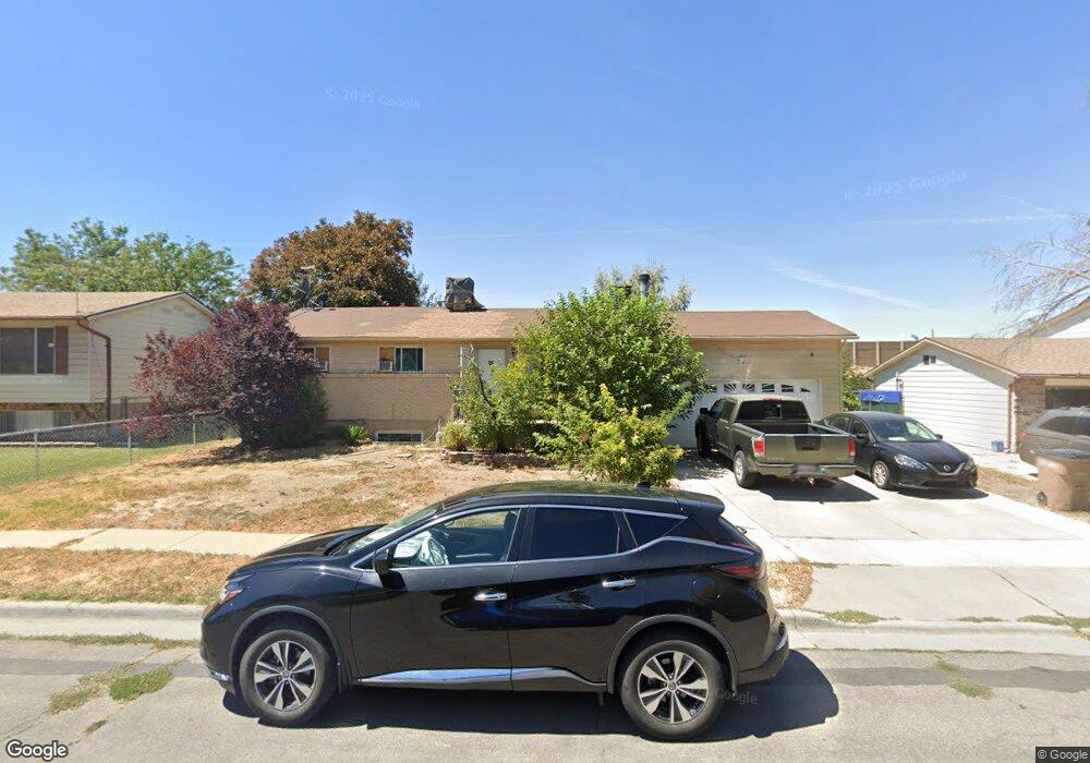
615 N Sir Philip Dr Salt Lake City, UT 84116
Jordan Meadows NeighborhoodEstimated Value: $432,000 - $482,000
6
Beds
3
Baths
2,042
Sq Ft
$225/Sq Ft
Est. Value
About This Home
This home is located at 615 N Sir Philip Dr, Salt Lake City, UT 84116 and is currently estimated at $459,965, approximately $225 per square foot. 615 N Sir Philip Dr is a home located in Salt Lake County with nearby schools including Meadowlark School, Northwest Middle School, and West High.
Ownership History
Date
Name
Owned For
Owner Type
Purchase Details
Closed on
Nov 15, 2007
Sold by
Pineda Manuelita A
Bought by
Gomez Joel
Current Estimated Value
Home Financials for this Owner
Home Financials are based on the most recent Mortgage that was taken out on this home.
Original Mortgage
$180,500
Outstanding Balance
$114,027
Interest Rate
6.35%
Mortgage Type
Purchase Money Mortgage
Estimated Equity
$345,938
Purchase Details
Closed on
Oct 28, 2005
Sold by
Hardy Rex W and Hardy Norma H
Bought by
Pineda Manuelita A
Home Financials for this Owner
Home Financials are based on the most recent Mortgage that was taken out on this home.
Original Mortgage
$119,200
Interest Rate
6.74%
Mortgage Type
Purchase Money Mortgage
Purchase Details
Closed on
Aug 30, 2004
Sold by
Jackson Melanie H
Bought by
Hardy Rex W and Hardy Norma H
Purchase Details
Closed on
Nov 18, 1996
Sold by
Jackson Scott D
Bought by
Jackson Melanie H
Create a Home Valuation Report for This Property
The Home Valuation Report is an in-depth analysis detailing your home's value as well as a comparison with similar homes in the area
Home Values in the Area
Average Home Value in this Area
Purchase History
| Date | Buyer | Sale Price | Title Company |
|---|---|---|---|
| Gomez Joel | -- | None Available | |
| Pineda Manuelita A | -- | 1St National Title Ins Agenc | |
| Hardy Rex W | -- | -- | |
| Jackson Melanie H | -- | -- |
Source: Public Records
Mortgage History
| Date | Status | Borrower | Loan Amount |
|---|---|---|---|
| Open | Gomez Joel | $180,500 | |
| Previous Owner | Pineda Manuelita A | $119,200 |
Source: Public Records
Tax History Compared to Growth
Tax History
| Year | Tax Paid | Tax Assessment Tax Assessment Total Assessment is a certain percentage of the fair market value that is determined by local assessors to be the total taxable value of land and additions on the property. | Land | Improvement |
|---|---|---|---|---|
| 2025 | $2,043 | $421,900 | $101,900 | $320,000 |
| 2024 | $2,043 | $389,900 | $96,400 | $293,500 |
| 2023 | $1,910 | $351,200 | $92,700 | $258,500 |
| 2022 | $2,065 | $356,400 | $90,900 | $265,500 |
| 2021 | $1,819 | $284,100 | $73,200 | $210,900 |
| 2020 | $1,777 | $264,200 | $65,300 | $198,900 |
| 2019 | $1,814 | $253,800 | $62,600 | $191,200 |
| 2018 | $1,546 | $210,600 | $62,600 | $148,000 |
| 2017 | $1,604 | $204,700 | $62,600 | $142,100 |
| 2016 | $1,553 | $188,200 | $60,300 | $127,900 |
| 2015 | $1,440 | $165,400 | $54,800 | $110,600 |
| 2014 | $1,382 | $157,500 | $53,600 | $103,900 |
Source: Public Records
Map
Nearby Homes
- 1978 Sir Robert Dr
- 555 N Starcrest Dr Unit B15
- 1860 W 500 N Unit 13
- 1860 W 500 N Unit 20
- 1860 W 500 N Unit 7
- 825 Star Crest Dr W
- 475 N Redwood Rd #58 Rd
- 475 N Redwood Rd Unit 49
- 548 N Redwood Rd
- 558 N Redwood Rd Unit 1
- 558 N Redwood Rd Unit 3
- 949 Libby Way
- 1711 W 400 N Unit 1719
- 768 N Redwood Rd Unit 19
- 768 N Redwood Rd Unit 1
- 1827 Omni Ave
- 1004 N Sir Michael Dr
- 1989 Sir Timothy Ave
- 261 N Redwood Rd
- 261 N Redwood Rd Unit 1
- 615 Sir Philip Dr
- 607 Sir Philip Dr
- 623 N Sir Philip Dr
- 623 Sir Philip Dr
- 599 Sir Philip Dr
- 599 N Sir Philip Dr
- 631 Sir Philip Dr
- 631 N Sir Philip Dr
- 618 Sir Philip Dr
- 628 Sir Philip Dr
- 608 Sir Philip Dr
- 638 Sir Philip Dr
- 591 Sir Philip Dr
- 639 Sir Philip Dr W
- 598 Sir Philip Dr
- 598 N Sir Philip Dr
- 639 Sir Philip Dr
- 639 N Sir Philip Dr
- 639 N Sir Philip Dr Unit 1990
- 617 Sir Michael Dr