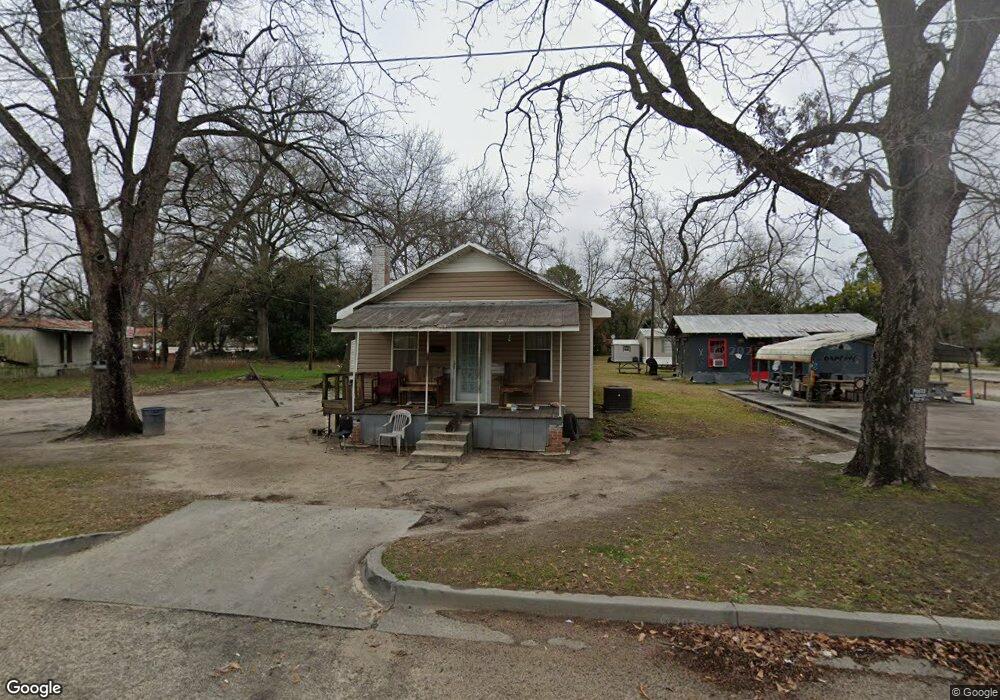
615 NE Broad St Metter, GA 30439
Estimated Value: $65,259 - $166,000
--
Bed
1
Bath
940
Sq Ft
$132/Sq Ft
Est. Value
About This Home
This home is located at 615 NE Broad St, Metter, GA 30439 and is currently estimated at $123,815, approximately $131 per square foot. 615 NE Broad St is a home located in Candler County with nearby schools including Metter Elementary School, Metter Intermediate School, and Metter Middle School.
Ownership History
Date
Name
Owned For
Owner Type
Purchase Details
Closed on
Jul 25, 2019
Sold by
Lanier Melanie Lois
Bought by
Davis Tonya Lynette
Current Estimated Value
Purchase Details
Closed on
May 21, 2019
Sold by
Summerlin Mary
Bought by
Lanier Melanie Lois
Purchase Details
Closed on
Feb 5, 1999
Sold by
Jones John E
Bought by
Summerlin Mary
Purchase Details
Closed on
Sep 3, 1998
Sold by
Rountree Miriam P
Bought by
Jones John E
Purchase Details
Closed on
Jul 23, 1996
Sold by
Rountree Perry L
Bought by
Rountree Miriam P
Purchase Details
Closed on
May 9, 1995
Sold by
Rountree Perry L
Bought by
Rountree Perry L
Create a Home Valuation Report for This Property
The Home Valuation Report is an in-depth analysis detailing your home's value as well as a comparison with similar homes in the area
Home Values in the Area
Average Home Value in this Area
Purchase History
| Date | Buyer | Sale Price | Title Company |
|---|---|---|---|
| Davis Tonya Lynette | $12,000 | -- | |
| Lanier Melanie Lois | $5,500 | -- | |
| Summerlin Mary | $19,000 | -- | |
| Jones John E | -- | -- | |
| Rountree Miriam P | -- | -- | |
| Rountree Perry L | -- | -- |
Source: Public Records
Tax History Compared to Growth
Tax History
| Year | Tax Paid | Tax Assessment Tax Assessment Total Assessment is a certain percentage of the fair market value that is determined by local assessors to be the total taxable value of land and additions on the property. | Land | Improvement |
|---|---|---|---|---|
| 2024 | $648 | $10,930 | $1,246 | $9,684 |
| 2023 | $648 | $10,277 | $1,246 | $9,031 |
| 2022 | $580 | $9,243 | $1,246 | $7,997 |
| 2021 | $520 | $8,194 | $1,246 | $6,948 |
| 2020 | $388 | $8,194 | $1,246 | $6,948 |
| 2019 | $504 | $9,094 | $1,070 | $8,024 |
| 2018 | $325 | $8,164 | $1,070 | $7,094 |
| 2017 | $286 | $8,546 | $1,452 | $7,094 |
| 2016 | $525 | $8,546 | $1,452 | $7,094 |
| 2015 | $418 | $8,677 | $1,452 | $7,225 |
| 2014 | $418 | $8,678 | $1,452 | $7,225 |
Source: Public Records
Map
Nearby Homes
- 245 N Terrell St
- 250 S Lewis St
- 295 S Lewis St
- 365 S Leroy St
- 405 S Leroy St
- 40 Hickory St
- 450 S Rountree St
- 550 S Rountree St
- 405 Preston St
- 465 Cedar St
- 150 W Willow Lake Dr
- 0 Central Ave Unit 10628403
- 4515 Harper Rd
- 1449 Hulsey Dr
- 286 Webb Cir
- 0 Oak Tree Rd Unit (31.62 AC) 10490874
- 0 Indigo Rd Unit 10425491
- 743 Ann's Ln
- 15238 Turner Rd
- 0 Canoochee Rd Unit 10565737
- 621 NE Broad St
- N NE Broad St
- 605 NE Broad St
- 4 Bulloch St
- 30 Martin Luther King jr Blvd
- 10 Bulloch St
- 0 NE Broad St Unit 7414148
- 0 NE Broad St Unit 8477684
- 30 Bulloch St
- 640 E Lee St
- 690 E Lee St
- 709 NE Broad St
- 684 E Lee St
- 630 E Lee St
- 70 Bulloch St
- 714 NE Broad St
- 711 NE Broad St
- 240 Martin Luther King jr Blvd
- 240 Martin Luther King jr Blvd
- 204 Bulloch St