Estimated Value: $311,000 - $329,650
3
Beds
2
Baths
1,054
Sq Ft
$304/Sq Ft
Est. Value
About This Home
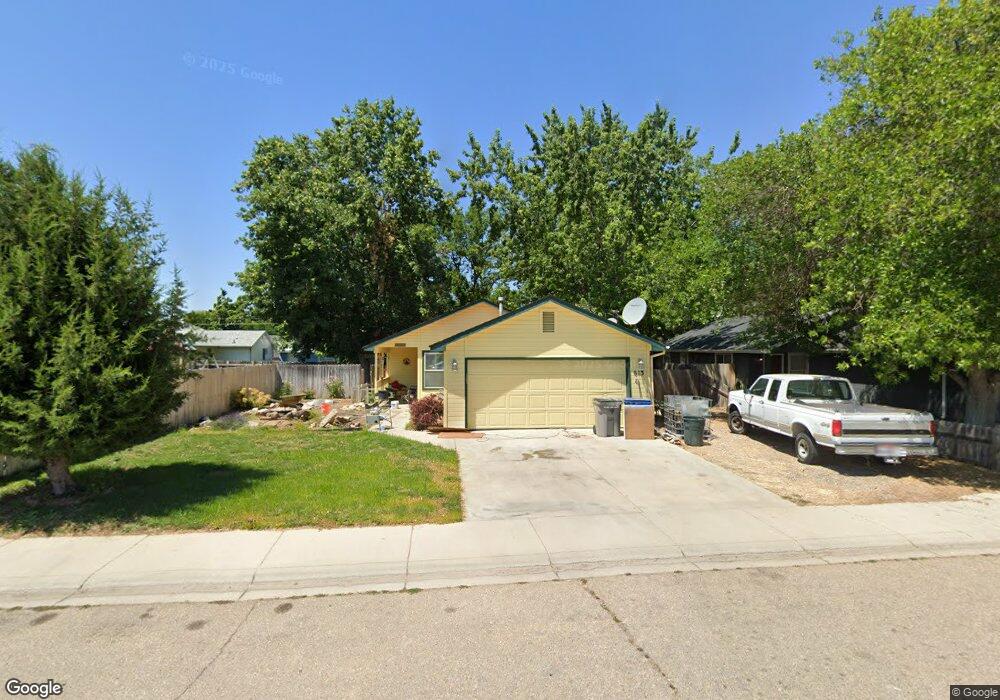
This home is located at 615 S Banner Ct, Nampa, ID 83686 and is currently estimated at $320,413, approximately $303 per square foot. 615 S Banner Ct is a home located in Canyon County with nearby schools including Kamali'i Elementary School, Waikele Elementary School, and Sherman Elementary School.
Ownership History
Date
Name
Owned For
Owner Type
Purchase Details
Closed on
Aug 25, 2006
Sold by
Aranguiz Sergio D and Fernandez Aranguiz Viola P
Bought by
Lunsford Joyce
Current Estimated Value
Home Financials for this Owner
Home Financials are based on the most recent Mortgage that was taken out on this home.
Original Mortgage
$130,000
Outstanding Balance
$78,198
Interest Rate
6.7%
Mortgage Type
Purchase Money Mortgage
Estimated Equity
$242,216
Create a Home Valuation Report for This Property
The Home Valuation Report is an in-depth analysis detailing your home's value as well as a comparison with similar homes in the area
Home Values in the Area
Average Home Value in this Area
Purchase History
| Date | Buyer | Sale Price | Title Company |
|---|---|---|---|
| Lunsford Joyce | -- | Title One |
Source: Public Records
Mortgage History
| Date | Status | Borrower | Loan Amount |
|---|---|---|---|
| Open | Lunsford Joyce | $130,000 |
Source: Public Records
Tax History Compared to Growth
Tax History
| Year | Tax Paid | Tax Assessment Tax Assessment Total Assessment is a certain percentage of the fair market value that is determined by local assessors to be the total taxable value of land and additions on the property. | Land | Improvement |
|---|---|---|---|---|
| 2025 | $959 | $292,100 | $108,000 | $184,100 |
| 2024 | $959 | $279,800 | $96,000 | $183,800 |
| 2023 | $962 | $286,900 | $96,000 | $190,900 |
| 2022 | $1,326 | $304,700 | $96,000 | $208,700 |
| 2021 | $1,254 | $212,900 | $45,000 | $167,900 |
| 2020 | $1,172 | $181,000 | $39,000 | $142,000 |
| 2019 | $1,289 | $160,600 | $36,000 | $124,600 |
| 2018 | $1,237 | $0 | $0 | $0 |
| 2017 | $1,121 | $0 | $0 | $0 |
| 2016 | $1,040 | $0 | $0 | $0 |
| 2015 | $921 | $0 | $0 | $0 |
| 2014 | $834 | $85,600 | $15,500 | $70,100 |
Source: Public Records
Map
Nearby Homes
- 1115 E Clark Ave
- 1207 E Sheridan Ave
- 416 S Powerline Rd
- 912 E Amity Ave
- 315 S Powerline Rd
- 216 S Powerline Rd
- 223 S Elder St
- 1426 E Sharons Loop
- 111 S Almond St
- 1157 S Powerline Rd
- 1716 Nixon Ave
- 1810 E Sherman Ave
- 1047 S 20th St
- 516 20th Ave S
- 511 20th Ave S
- 507 20th Ave S
- 512 19th Ave S
- 615 18th Ave S
- 1801 E Iowa Ave
- 2308 E Elm Grove Dr
- 619 S Banner Ct
- 711 Banner St
- 704 S Chestnut St
- 628 S Chestnut St
- 623 S Banner Ct
- 708 S Chestnut St
- 616 S Banner Ct
- 626 S Chestnut St
- 1224 E Amity Ave
- 716 S Chestnut St
- 627 S Banner Ct
- 624 S Chestnut St
- 1212 E Amity Ave
- 1216 E Amity Ave
- 1208 E Amity Ave
- 613 S Banner St
- 1220 E Amity Ave
- 724 S Chestnut St
- 631 S Banner Ct
- 1304 E Amity Ave