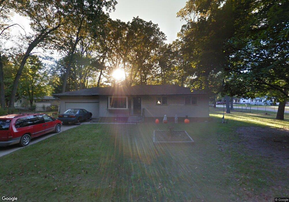
615 S Densmore St Muskegon, MI 49442
Estimated Value: $213,000 - $222,000
3
Beds
1
Bath
1,092
Sq Ft
$200/Sq Ft
Est. Value
About This Home
This home is located at 615 S Densmore St, Muskegon, MI 49442 and is currently estimated at $218,535, approximately $200 per square foot. 615 S Densmore St is a home located in Muskegon County with nearby schools including Orchard View Early Elementary School, Cardinal Elementary School, and Orchard View Middle School.
Ownership History
Date
Name
Owned For
Owner Type
Purchase Details
Closed on
Mar 7, 2024
Sold by
Carlisle Barbara Sue
Bought by
Christie Marjorie
Current Estimated Value
Purchase Details
Closed on
Jan 15, 2015
Sold by
Carlisle Roger D
Bought by
Carlisle Barbara S
Purchase Details
Closed on
Aug 2, 2013
Sold by
Carlisle Roger D
Bought by
Carlisle Roger
Purchase Details
Closed on
Apr 12, 2007
Sold by
Cox Helen and Carlisle Helen M
Bought by
Cox Helen and Carlisle Roger D
Create a Home Valuation Report for This Property
The Home Valuation Report is an in-depth analysis detailing your home's value as well as a comparison with similar homes in the area
Home Values in the Area
Average Home Value in this Area
Purchase History
| Date | Buyer | Sale Price | Title Company |
|---|---|---|---|
| Christie Marjorie | -- | None Listed On Document | |
| Carlisle Barbara S | -- | None Available | |
| Carlisle Roger | -- | None Available | |
| Cox Helen | -- | None Available |
Source: Public Records
Tax History Compared to Growth
Tax History
| Year | Tax Paid | Tax Assessment Tax Assessment Total Assessment is a certain percentage of the fair market value that is determined by local assessors to be the total taxable value of land and additions on the property. | Land | Improvement |
|---|---|---|---|---|
| 2025 | $2,817 | $91,300 | $0 | $0 |
| 2024 | $619 | $84,400 | $0 | $0 |
| 2023 | $592 | $69,900 | $0 | $0 |
| 2022 | $4,452 | $60,100 | $0 | $0 |
| 2021 | $2,802 | $53,600 | $0 | $0 |
| 2020 | $1,944 | $50,300 | $0 | $0 |
| 2019 | $2,536 | $48,300 | $0 | $0 |
| 2018 | $2,467 | $47,000 | $0 | $0 |
| 2017 | $2,489 | $46,300 | $0 | $0 |
| 2016 | $505 | $42,700 | $0 | $0 |
| 2015 | -- | $40,200 | $0 | $0 |
| 2014 | -- | $39,000 | $0 | $0 |
| 2013 | -- | $36,400 | $0 | $0 |
Source: Public Records
Map
Nearby Homes
- 687 S Sheridan Dr
- 415 S Densmore St
- 517 S Sheridan Dr
- 470 S Sheridan Dr
- 2369 James Ave
- 2756 Marquette Ave
- 2916 E Apple Ave
- 123 Darwin Dr
- 2028 Marcoux Ave
- 936 West St
- 960 Carlton St
- 3075 Lenore Ave
- 947 Carlton St
- 16 S Densmore St
- 30 S Sheridan Dr
- 3186 E Apple Ave
- 1190 Center St
- 1051 West St
- 2576 Vine Ave
- 3172 Hall Rd
- 2655 Ezekiel Dr
- 631 S Densmore St
- 2657 Ezekiel Dr
- 2596 Wesley Ave
- 2656 Ezekiel Dr
- 2570 Marcoux Ave
- 2659 Ezekiel Dr
- 2583 Marcoux Ave
- 2568 Wesley Ave
- 2553 Wesley Ave
- 2554 Marcoux Ave
- 2569 Marcoux Ave
- 2660 Ezekiel Dr Unit 2
- 2540 Marcoux Ave
- 2556 Wesley Ave
- 0 V L Marcoux Ave
- 2545 Wesley Ave
- 2555 Marcoux Ave
- 2662 Ezekiel Dr
- 2546 Wesley Ave