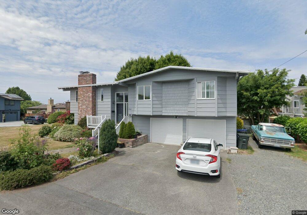
615 Sater Ln Edmonds, WA 98020
Edmonds Bowl NeighborhoodEstimated Value: $1,232,000 - $1,338,000
4
Beds
3
Baths
2,093
Sq Ft
$612/Sq Ft
Est. Value
About This Home
This home is located at 615 Sater Ln, Edmonds, WA 98020 and is currently estimated at $1,281,643, approximately $612 per square foot. 615 Sater Ln is a home located in Snohomish County with nearby schools including Edmonds Elementary School, College Place Middle School, and Edmonds-Woodway High School.
Ownership History
Date
Name
Owned For
Owner Type
Purchase Details
Closed on
Jun 3, 2019
Sold by
Birkby Craig
Bought by
Sater Lane Llc
Current Estimated Value
Purchase Details
Closed on
Sep 7, 2010
Sold by
Procore Holdings Llc
Bought by
Birkby Craig
Purchase Details
Closed on
May 24, 2010
Sold by
Black Patricia A
Bought by
Procore Holdings Llc
Purchase Details
Closed on
Oct 19, 2004
Sold by
Black Patricia A
Bought by
Black Patricia A
Purchase Details
Closed on
Mar 14, 1994
Sold by
Black Patricia and Fyfe Patricia Ann
Bought by
Black William A and Black Patricia A
Home Financials for this Owner
Home Financials are based on the most recent Mortgage that was taken out on this home.
Original Mortgage
$164,250
Interest Rate
7.21%
Create a Home Valuation Report for This Property
The Home Valuation Report is an in-depth analysis detailing your home's value as well as a comparison with similar homes in the area
Home Values in the Area
Average Home Value in this Area
Purchase History
| Date | Buyer | Sale Price | Title Company |
|---|---|---|---|
| Sater Lane Llc | -- | None Available | |
| Birkby Craig | $367,000 | First American Title Ins Co | |
| Procore Holdings Llc | $289,001 | None Available | |
| Black Patricia A | -- | -- | |
| Black William A | -- | Commonwealth Land Title Ins |
Source: Public Records
Mortgage History
| Date | Status | Borrower | Loan Amount |
|---|---|---|---|
| Previous Owner | Black William A | $164,250 |
Source: Public Records
Tax History Compared to Growth
Tax History
| Year | Tax Paid | Tax Assessment Tax Assessment Total Assessment is a certain percentage of the fair market value that is determined by local assessors to be the total taxable value of land and additions on the property. | Land | Improvement |
|---|---|---|---|---|
| 2025 | $7,121 | $1,035,400 | $768,000 | $267,400 |
| 2024 | $7,121 | $1,000,800 | $733,400 | $267,400 |
| 2023 | $7,016 | $1,021,900 | $713,900 | $308,000 |
| 2022 | $7,024 | $841,100 | $580,300 | $260,800 |
| 2020 | $6,572 | $703,800 | $474,300 | $229,500 |
| 2019 | $6,023 | $649,700 | $427,800 | $221,900 |
| 2018 | $6,199 | $577,700 | $376,700 | $201,000 |
| 2017 | $5,376 | $524,200 | $338,500 | $185,700 |
| 2016 | $5,001 | $483,100 | $305,000 | $178,100 |
| 2015 | $4,796 | $436,300 | $277,100 | $159,200 |
| 2013 | $3,856 | $330,800 | $198,100 | $132,700 |
Source: Public Records
Map
Nearby Homes
- 611 3rd Ave N
- 625 Aloha Way
- 609 7th Ave N Unit B204
- 603 7th Ave N Unit A306
- 621 Daley St
- 1414 9th Ave N Unit 105
- 1514 9th Ave N
- 1030 Grandview St
- 302 6th Ave S
- 233 3rd Ave S Unit 304
- 335 3rd Ave S Unit 203
- 816 Walnut St
- 404 3rd Ave S Unit A201
- 1021 Walnut St
- 9533 Bowdoin Way
- 960 5th Ave S Unit 208
- 192 XX Olympic View Dr
- 1071 4th Ave S Unit 302
- 21232 92nd Place W
- 1110 5th Ave S Unit 204