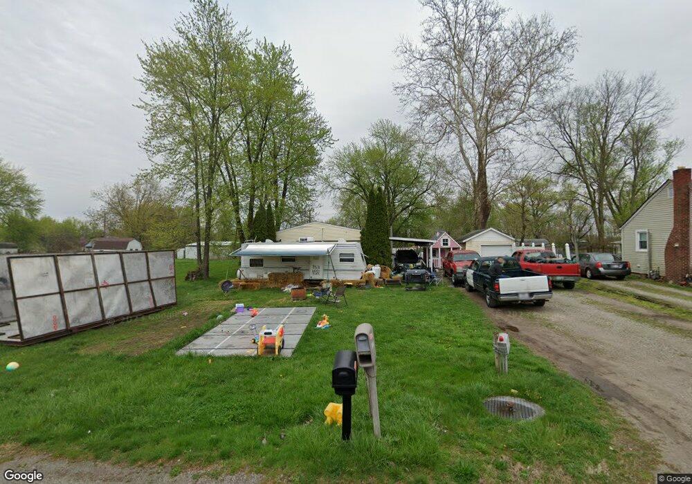
615 Spillson Ave Fort Wayne, IN 46803
Estimated Value: $97,000 - $296,000
Studio
--
Bath
2,052
Sq Ft
$76/Sq Ft
Est. Value
About This Home
This home is located at 615 Spillson Ave, Fort Wayne, IN 46803 and is currently estimated at $155,673, approximately $75 per square foot. 615 Spillson Ave is a home with nearby schools including New Haven Primary School, New Haven Intermediate School, and New Haven High School.
Ownership History
Date
Name
Owned For
Owner Type
Purchase Details
Closed on
Aug 7, 2021
Sold by
6 5 Spillson Avenue Land Trusts
Bought by
Shusher Kody Lynn
Current Estimated Value
Home Financials for this Owner
Home Financials are based on the most recent Mortgage that was taken out on this home.
Original Mortgage
$38,900
Outstanding Balance
$35,226
Interest Rate
3.05%
Mortgage Type
Land Contract Argmt. Of Sale
Estimated Equity
$120,447
Purchase Details
Closed on
Mar 2, 2021
Sold by
Hess & Hess Llc
Bought by
615 Spillson Avenue Land Trusts
Purchase Details
Closed on
Nov 6, 2020
Sold by
Auditor Of The County Of Allen
Bought by
Hess & Hess Llc
Purchase Details
Closed on
Sep 29, 2001
Sold by
Zent Robbin E
Bought by
Speith Debra Lynn
Create a Home Valuation Report for This Property
The Home Valuation Report is an in-depth analysis detailing your home's value as well as a comparison with similar homes in the area
Home Values in the Area
Average Home Value in this Area
Purchase History
| Date | Buyer | Sale Price | Title Company |
|---|---|---|---|
| Shusher Kody Lynn | $42,900 | None Available | |
| 615 Spillson Avenue Land Trusts | -- | None Available | |
| Hess & Hess Llc | -- | None Listed On Document | |
| Speith Debra Lynn | -- | -- |
Source: Public Records
Mortgage History
| Date | Status | Borrower | Loan Amount |
|---|---|---|---|
| Open | Shusher Kody Lynn | $38,900 |
Source: Public Records
Tax History
| Year | Tax Paid | Tax Assessment Tax Assessment Total Assessment is a certain percentage of the fair market value that is determined by local assessors to be the total taxable value of land and additions on the property. | Land | Improvement |
|---|---|---|---|---|
| 2025 | $196 | $42,000 | $3,400 | $38,600 |
| 2024 | $1,601 | $44,300 | $1,700 | $42,600 |
| 2023 | $47 | $11,900 | $1,700 | $10,200 |
| 2022 | $50 | $11,500 | $1,700 | $9,800 |
| 2021 | $52 | $10,600 | $1,700 | $8,900 |
| 2020 | $207 | $10,700 | $1,700 | $9,000 |
| 2019 | $774 | $10,400 | $1,700 | $8,700 |
| 2018 | $666 | $10,400 | $1,700 | $8,700 |
| 2017 | $746 | $10,300 | $1,700 | $8,600 |
| 2016 | $250 | $12,500 | $1,700 | $10,800 |
| 2014 | $67 | $12,800 | $1,700 | $11,100 |
| 2013 | $67 | $12,800 | $1,700 | $11,100 |
Source: Public Records
Map
Nearby Homes
- 1304 Ardsley Ct
- 7336 Regina Dr
- 7437 Regina Dr
- 7401 Placer Run
- 6822 Forest Glen Ct
- 1729 Lofton Way
- 1617 Darien Dr
- 8267 Caverango Blvd
- 2130 Sunnymede Dr
- 5708 Countess Dr
- 5102 Nassau Dr
- 2130 Medford Dr
- 1345 Kayenta Trail
- 1323 Kayenta Trail
- 1301 Kayenta Trail
- 1395 Montura Cove Unit 5
- 8245 Caverango Blvd
- 8320 Caverango Blvd
- 6334 Bennington Dr
- 8289 Caverango Blvd
- 611 Spillson Ave
- 701 Spillson Ave
- 607 Spillson Ave
- 616 Madge Ave
- 624 Madge Ave
- 705 Spillson Ave
- 710 Spillson Ave
- 701 Pluma Dr
- 506 Spillson Ave
- 711 Pluma Dr
- 724 Spillson Ave
- 717 Pluma Dr
- 619 Madge Ave
- 6745 Mcbride Dr
- 6715 Mcbride Dr
- 6717 Mcbride Dr
- 517 Madge Ave
- 504 Madge Ave
- 719 Madge Ave
- 6812 Mcbride Dr
Your Personal Tour Guide
Ask me questions while you tour the home.