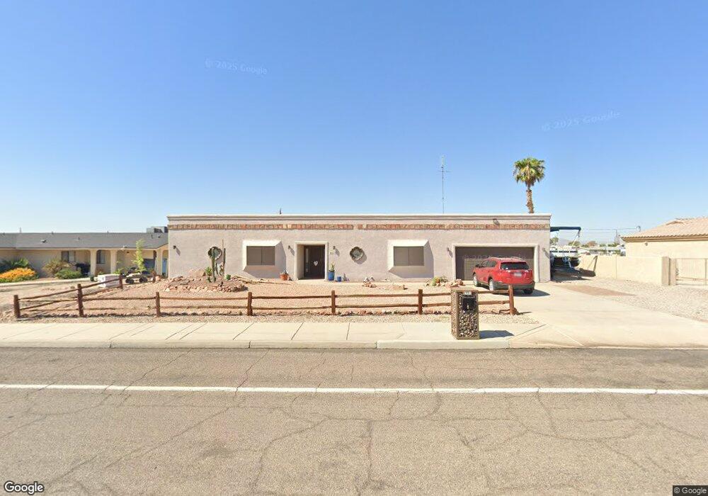
615 Thunderbolt Ave Lake Havasu City, AZ 86406
Estimated Value: $378,000 - $466,000
2
Beds
3
Baths
1,870
Sq Ft
$235/Sq Ft
Est. Value
About This Home
This home is located at 615 Thunderbolt Ave, Lake Havasu City, AZ 86406 and is currently estimated at $439,759, approximately $235 per square foot. 615 Thunderbolt Ave is a home located in Mohave County with nearby schools including Starline Elementary School, Thunderbolt Middle School, and Lake Havasu High School.
Ownership History
Date
Name
Owned For
Owner Type
Purchase Details
Closed on
Jun 17, 2022
Sold by
Wilson B Sherwood And Ruth A Sherwood Re
Bought by
Dale Karen L
Current Estimated Value
Purchase Details
Closed on
Apr 15, 2019
Sold by
Rlt Wilson B Sherwood and Rlt Ruth A Sherwood
Bought by
Ruth A Sherwood Family Living Trust
Purchase Details
Closed on
Jul 17, 2007
Sold by
Paris Deloris and Salem Rashiel
Bought by
Sherwood Wilson B and Sherwood Ruth A
Purchase Details
Closed on
Nov 4, 2002
Sold by
Paris Deloris
Bought by
Paris Deloris
Home Financials for this Owner
Home Financials are based on the most recent Mortgage that was taken out on this home.
Original Mortgage
$239,400
Interest Rate
13.29%
Mortgage Type
Credit Line Revolving
Create a Home Valuation Report for This Property
The Home Valuation Report is an in-depth analysis detailing your home's value as well as a comparison with similar homes in the area
Home Values in the Area
Average Home Value in this Area
Purchase History
| Date | Buyer | Sale Price | Title Company |
|---|---|---|---|
| Dale Karen L | -- | None Listed On Document | |
| Ruth A Sherwood Family Living Trust | -- | None Available | |
| Sherwood Wilson B | $200,000 | First American Title Ins Co | |
| Paris Deloris | -- | First American Title Ins Co |
Source: Public Records
Mortgage History
| Date | Status | Borrower | Loan Amount |
|---|---|---|---|
| Previous Owner | Paris Deloris | $239,400 |
Source: Public Records
Tax History Compared to Growth
Tax History
| Year | Tax Paid | Tax Assessment Tax Assessment Total Assessment is a certain percentage of the fair market value that is determined by local assessors to be the total taxable value of land and additions on the property. | Land | Improvement |
|---|---|---|---|---|
| 2026 | -- | -- | -- | -- |
| 2025 | $1,596 | $40,007 | $0 | $0 |
| 2024 | $1,596 | $43,022 | $0 | $0 |
| 2023 | $1,596 | $35,995 | $0 | $0 |
| 2022 | $1,537 | $26,766 | $0 | $0 |
| 2021 | $1,739 | $25,293 | $0 | $0 |
| 2019 | $1,653 | $22,290 | $0 | $0 |
| 2018 | $1,598 | $20,841 | $0 | $0 |
| 2017 | $1,570 | $20,273 | $0 | $0 |
| 2016 | $1,391 | $18,791 | $0 | $0 |
| 2015 | $1,354 | $16,951 | $0 | $0 |
Source: Public Records
Map
Nearby Homes
- 532 Roanoke Dr
- 3135 Cotati Dr
- 3040 Gypsy Dr
- 2970 War Eagle Dr
- 3306 Cinnamon Dr
- 3150 Star Dr
- 2997 Edgewood Dr
- 2951 Saddleback Dr
- 815 Rolling Hills Plaza N
- 3235 Silverspoon Dr
- 2910 Coconino Dr
- 3267 Saddleback Dr
- 3260 Silverspoon Dr
- 786 Powder Dr
- 3345 Cinnamon Dr
- 691 Rolling Hills Dr
- 3066 Star Dr
- 700 Apache Dr
- 3261 Thundercloud Dr
- 3317 Saddleback Dr
- 625 Thunderbolt Ave
- 605 Thunderbolt Ave
- 635 Thunderbolt Ave
- 3155 Silver Arrow Dr
- 600 Thunderbolt Ave
- 3165 Silver Arrow Dr
- 3150 Silver Arrow Dr
- 645 Thunderbolt Ave
- 646 Apache Dr
- 3166 Chemehuevi Blvd
- 3130 Chemehuevi Blvd
- 3160 Silver Arrow Dr
- 650 Apache Dr
- 3175 Silver Arrow Dr
- 3170 Chemehuevi Blvd
- 3170 Chemehuevi Blvd
- 3163 Chemehuevi Blvd
- 630 Thunderbolt Ave
- 3133 Chemehuevi Blvd
- 3170 Silver Arrow Dr