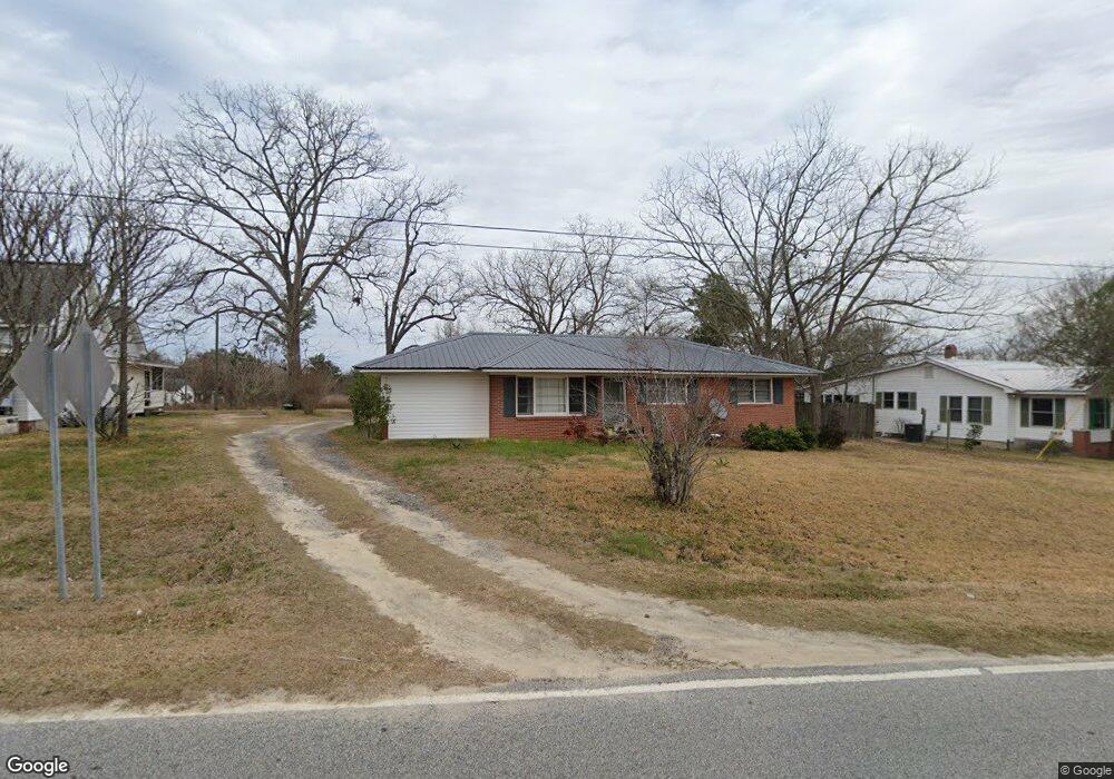
615 Wommack Ave Soperton, GA 30457
Estimated Value: $100,000 - $115,988
--
Bed
1
Bath
1,380
Sq Ft
$77/Sq Ft
Est. Value
About This Home
This home is located at 615 Wommack Ave, Soperton, GA 30457 and is currently estimated at $106,247, approximately $76 per square foot. 615 Wommack Ave is a home with nearby schools including Treutlen Elementary School, Treutlen Middle/High School, and Faith Tabernacle Christian Academy.
Ownership History
Date
Name
Owned For
Owner Type
Purchase Details
Closed on
Mar 28, 2017
Bought by
Bgm Rentals Llc
Current Estimated Value
Purchase Details
Closed on
Aug 3, 2010
Sold by
Sumner Marie B
Bought by
Rail Hill Properties
Purchase Details
Closed on
Feb 23, 1988
Bought by
Beasley Kenneth and Beasley J
Purchase Details
Closed on
Oct 3, 1968
Bought by
Beasley Mrs and Beasley Myrtic
Purchase Details
Closed on
Oct 30, 1951
Bought by
Beasley Sam J
Purchase Details
Closed on
Dec 13, 1947
Bought by
Sarabest Corporation
Create a Home Valuation Report for This Property
The Home Valuation Report is an in-depth analysis detailing your home's value as well as a comparison with similar homes in the area
Home Values in the Area
Average Home Value in this Area
Purchase History
| Date | Buyer | Sale Price | Title Company |
|---|---|---|---|
| Bgm Rentals Llc | $50,000 | -- | |
| Rail Hill Properties | $4,226 | -- | |
| Beasley Kenneth | -- | -- | |
| Beasley Mrs | -- | -- | |
| Beasley Sam J | $6,200 | -- | |
| Sarabest Corporation | $22,500 | -- |
Source: Public Records
Tax History Compared to Growth
Tax History
| Year | Tax Paid | Tax Assessment Tax Assessment Total Assessment is a certain percentage of the fair market value that is determined by local assessors to be the total taxable value of land and additions on the property. | Land | Improvement |
|---|---|---|---|---|
| 2024 | $659 | $21,240 | $1,080 | $20,160 |
| 2023 | $594 | $21,240 | $1,080 | $20,160 |
| 2022 | $533 | $19,760 | $1,080 | $18,680 |
| 2021 | $533 | $19,760 | $1,080 | $18,680 |
| 2020 | $516 | $19,160 | $1,080 | $18,080 |
| 2019 | $516 | $19,160 | $1,080 | $18,080 |
| 2018 | $563 | $19,160 | $1,080 | $18,080 |
| 2017 | $450 | $17,000 | $1,040 | $15,960 |
| 2016 | $437 | $16,840 | $1,040 | $15,800 |
| 2015 | -- | $16,840 | $1,040 | $15,800 |
| 2014 | -- | $16,840 | $1,040 | $15,800 |
| 2013 | -- | $16,840 | $1,040 | $15,800 |
Source: Public Records
Map
Nearby Homes
- 4687 W Main St
- 46 Georgia 46
- 1785 Martin Luther King jr Dr
- 7586 Eastman Rd
- 4004 E Louisiana Ave
- 0 Cedar Grove Rd
- 0 Rivoli Clay Rd
- 00 Rivoli Clay Rd
- 1936 Cedar Grove Rd
- 0 Beasley Hill Place Unit 10640367
- 0 Knox Mill Rd Unit 10640244
- 4281 Ga Highway 46
- 4281 Sr-46
- 481 Windmill Way
- 0 County Line Rd Unit n/a 113727
- 95 Railroad Ave
- 0 Muskogee Trail Unit 25917
- 0 Muskogee Trail Unit LOT 78 20128125
- 0 Lake Helen Loop Unit 10640271
- 2166 Ga Highway 199
- 16 Wommack Ave
- 613 Wommack Ave
- 619 Norman WomMacK
- 28 Wommack Ave
- 202 Norman St
- 202 Norman St
- 214 Norman & 720
- 0 W Main St
- W W Main St
- 1237 Sarabelle Ave
- 142 Wommack Ave
- 302 Glenn St
- 4631 W Main St
- 4523 W Main St
- 0 Norman St Unit 7548976
- 0 Norman St
- 4583 W Main St
- 4559 W Main St
- 1255 Sarabelle Ave
- 4651 W Main St